Dorna Cândrenilor elevation
Dorna Cândrenilor (Suceava, Comuna Dorna Cândrenilor), Romania elevation is 839 meters and Dorna Cândrenilor elevation in feet is 2753 ft above sea level [src 1]. Dorna Cândrenilor is a seat of a second-order administrative division (feature code) with elevation that is 587 meters (1926 ft) bigger than average city elevation in Romania.
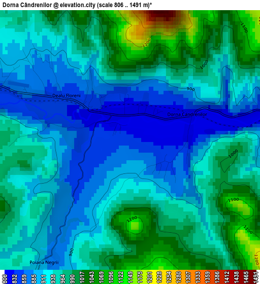
Below is the Elevation map of Dorna Cândrenilor, which displays elevation range with different colors. Scale of the first map is from 806 to 1491 m (2644 to 4892 ft) with average elevation of 946.1 meters (=3104 ft) [note 1]
These maps also provides idea of topography and contour of this city, they are displayed at different zoom levels. More info about maps, scale and edge coordinates you can find below images.
| \ | Map #1 | Map #2 | Topo.Map |
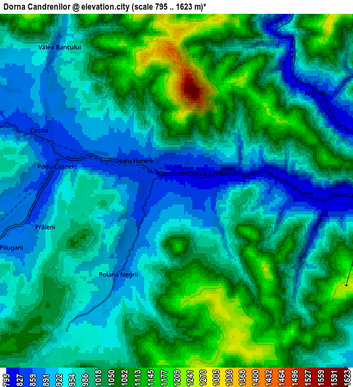
| Scale [m] | 806..1491 m | 795..1623 m | × |
| Scale [ft] | 2644..4892 ft | 2608..5325 ft | × |
| Average | 946.1 m = 3104 ft | 1000 m = 3281 ft | × |
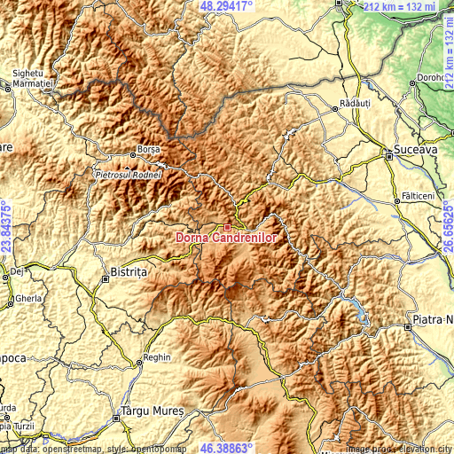
| Width | 6.62 km = 4.1 mi | 13.24 km = 8.2 mi | 211.9 km = 131.7 mi |
| Height | 6.62 km = 4.1 mi | 13.24 km = 8.2 mi | 211.9 km = 131.7 mi |
| ↑Max Latitude | 47.379765° | 47.409514° | 48.29417° |
| Latitude at center | 47.35° | 47.35° | 47.35° |
| ↓Min Latitude | 47.320218° | 47.290419° | 46.38863° |
| ← Min Longitude | 25.206055° | 25.162109° | 23.84375° |
| Longitude center | 25.25° | 25.25° | 25.25° |
| →Max Longitude | 25.293945° | 25.337891° | 26.65625° |
Nearby cities:
Cities around Dorna Cândrenilor sort by population:
• Vatra Dornei elevation 814 m
8.8 km,  90°
90°
• Şaru Dornei 864 m
10.6 km,  134°
134°
• Fundu Moldovei 850 m
23.3 km,  28°
28°
• Iacobeni 1117 m
10.5 km, 28°
• Lunca Ilvei 751 m
20.2 km,  275°
275°
• Poiana Stampei 906 m
9.5 km,  247°
247°
• Panaci 914 m
13.7 km, 132°
• Neagra Șarului 940 m
13.7 km,  154°
154°
• Dorna-Arini 807 m
11.9 km,  96°
96°
• Ciocănești 853 m
14.7 km,  8°
8°
• Colacu 757 m
22.9 km,  23°
23°
• Coșna 856 m
5.7 km,  294°
294°
Multilingual:
 En español:
Dorna Cândrenilor elevación 839 m.
 En France:
Dorna Cândrenilor élévation 839 m.
 Auf Deutsch:
Dorna Cândrenilor höhe über dem Meeresspiegel ist 839 m.

Sources and notes:
- [note 1] Map square and city borders are not equal. Map elevation data is calculated only from area inside that square.
- [src 1] Elevation data from geonames database provided with same terms of usage.
- [src 2] The elevation map of Dorna Cândrenilor is generated using elevation data from NASA's 3 arcsec (90m) resolution SRTM data.
- [src 3] Base (background) map © OpenStreetMap contributors tiles are generated by Geofabrik and OpenTopoMap.
Copyright & License:
This Dorna Cândrenilor Elevation Map is licensed under CC BY-SA. You may reuse any part from this page, if you give a proper credit by linking to this URL:
 More info on terms of use page.