Cârna elevation
Cârna (Dolj, Comuna Cârna), Romania elevation is 33 meters and Cârna elevation in feet is 108 ft above sea level [src 1]. Cârna is a populated place (feature code) with elevation that is 219 meters (719 ft) smaller than average city elevation in Romania.
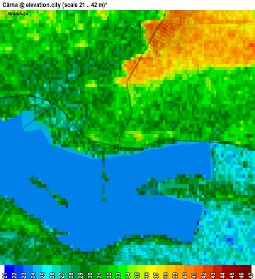
Below is the Elevation map of Cârna, which displays elevation range with different colors. Scale of the first map is from 21 to 42 m (69 to 138 ft) with average elevation of 29.1 meters (=95 ft) [note 1]
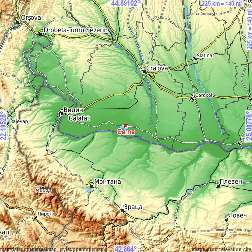
These maps also provides idea of topography and contour of this city, they are displayed at different zoom levels. More info about maps, scale and edge coordinates you can find below images.
| \ | Map #1 | Topo.Map |
| Scale [m] | 21..42 m | × |
| Scale [ft] | 69..138 ft | × |
| Average | 29.1 m = 95 ft | × |
| Width | 7.04 km = 4.4 mi | 225.4 km = 140.1 mi |
| Height | 7.04 km = 4.4 mi | 225.4 km = 140.1 mi |
| ↑Max Latitude | 43.917794° | 44.89102° |
| Latitude at center | 43.88613° | 43.88613° |
| ↓Min Latitude | 43.854449° | 42.864° |
| ← Min Longitude | 23.557585° | 22.19528° |
| Longitude center | 23.60153° | 23.60153° |
| →Max Longitude | 23.645475° | 25.00778° |
Nearby cities:
Cities around Cârna sort by population:
• Goicea elevation 40 m
3.6 km,  19°
19°
• Bârca 50 m
9 km,  7°
7°
• Gighera 36 m
16.4 km,  104°
104°
• Afumaţi 52 m
16.6 km,  319°
319°
• Giurgiţa 63 m
14.7 km, 9°
• Urzicuţa 54 m
15.1 km,  344°
344°
• Bistreț 35 m
8.3 km,  280°
280°
• Negoi 36 m
18.6 km, 279°
• Măceşu de Sus 56 m
8.6 km,  66°
66°
• Măceşu de Jos 32 m
9.2 km,  91°
91°
• Nedeia 39 m
14.6 km,  106°
106°
• Catane 38 m
15.9 km,  286°
286°
Multilingual:
 En español:
Cârna elevación 33 m.
 En France:
Cârna élévation 33 m.


Sources and notes:
- [note 1] Map square and city borders are not equal. Map elevation data is calculated only from area inside that square.
- [src 1] Elevation data from geonames database provided with same terms of usage.
- [src 2] The elevation map of Cârna is generated using elevation data from NASA's 3 arcsec (90m) resolution SRTM data.
- [src 3] Base (background) map © OpenStreetMap contributors tiles are generated by Geofabrik and OpenTopoMap.
Copyright & License:
This Cârna Elevation Map is licensed under CC BY-SA. You may reuse any part from this page, if you give a proper credit by linking to this URL:
 More info on terms of use page.