Fărcaşa elevation
Fărcaşa (Maramureş, Comuna Fărcaşa), Romania elevation is 160 meters and Fărcaşa elevation in feet is 525 ft above sea level [src 1]. Fărcaşa is a seat of a second-order administrative division (feature code) with elevation that is 92 meters (302 ft) smaller than average city elevation in Romania.
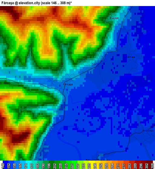
Below is the Elevation map of Fărcaşa, which displays elevation range with different colors. Scale of the first map is from 146 to 308 m (479 to 1010 ft) with average elevation of 189.2 meters (=621 ft) [note 1]
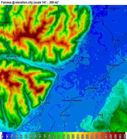
These maps also provides idea of topography and contour of this city, they are displayed at different zoom levels. More info about maps, scale and edge coordinates you can find below images.
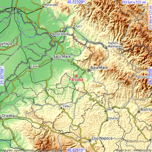
| \ | Map #1 | Map #2 | Topo.Map |
| Scale [m] | 146..308 m | 141..309 m | × |
| Scale [ft] | 479..1010 ft | 463..1014 ft | × |
| Average | 189.2 m = 621 ft | 193.1 m = 634 ft | × |
| Width | 6.59 km = 4.1 mi | 13.18 km = 8.2 mi | 210.9 km = 131 mi |
| Height | 6.59 km = 4.1 mi | 13.18 km = 8.2 mi | 210.9 km = 131 mi |
| ↑Max Latitude | 47.612963° | 47.64258° | 48.52329° |
| Latitude at center | 47.58333° | 47.58333° | 47.58333° |
| ↓Min Latitude | 47.55368° | 47.524013° | 46.62619° |
| ← Min Longitude | 23.289385° | 23.245439° | 21.92708° |
| Longitude center | 23.33333° | 23.33333° | 23.33333° |
| →Max Longitude | 23.377275° | 23.421221° | 24.73958° |
Nearby cities:
Cities around Fărcaşa sort by population:
• Şomcuta Mare elevation 190 m
12.5 km,  126°
126°
• Satulung 164 m
7.7 km,  103°
103°
• Mireşu Mare 166 m
9.3 km,  180°
180°
• Sălsig 160 m
6.1 km,  204°
204°
• Ardusat 154 m
7.8 km,  18°
18°
• Bârsău de Sus 194 m
8.9 km,  281°
281°
• Gârdani 159 m
4 km,  207°
207°
• Asuaju de Sus 200 m
11.4 km,  260°
260°
• Poiana Codrului 204 m
7.9 km,  307°
307°
• Lăpușel 164 m
11.6 km,  70°
70°
• Ariniş 166 m
11.9 km,  219°
219°
• Mânău 192 m
12.5 km, 205°
Multilingual:
 En español:
Fărcaşa elevación 160 m.
 En France:
Fărcaşa élévation 160 m.


Sources and notes:
- [note 1] Map square and city borders are not equal. Map elevation data is calculated only from area inside that square.
- [src 1] Elevation data from geonames database provided with same terms of usage.
- [src 2] The elevation map of Fărcaşa is generated using elevation data from NASA's 3 arcsec (90m) resolution SRTM data.
- [src 3] Base (background) map © OpenStreetMap contributors tiles are generated by Geofabrik and OpenTopoMap.
Copyright & License:
This Fărcaşa Elevation Map is licensed under CC BY-SA. You may reuse any part from this page, if you give a proper credit by linking to this URL:
 More info on terms of use page.