Frătăuţii Vechi elevation
Frătăuţii Vechi (Suceava, Comuna Frătăuţii Vechi), Romania elevation is 379 meters and Frătăuţii Vechi elevation in feet is 1243 ft above sea level [src 1]. Frătăuţii Vechi is a seat of a second-order administrative division (feature code) with elevation that is 127 meters (417 ft) bigger than average city elevation in Romania.
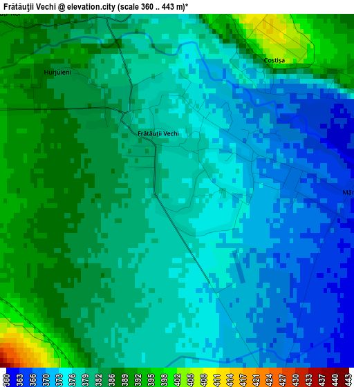
Below is the Elevation map of Frătăuţii Vechi, which displays elevation range with different colors. Scale of the first map is from 360 to 443 m (1181 to 1453 ft) with average elevation of 379.3 meters (=1244 ft) [note 1]
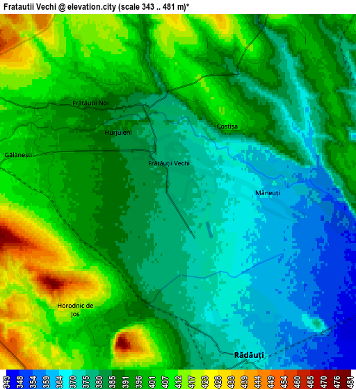
These maps also provides idea of topography and contour of this city, they are displayed at different zoom levels. More info about maps, scale and edge coordinates you can find below images.
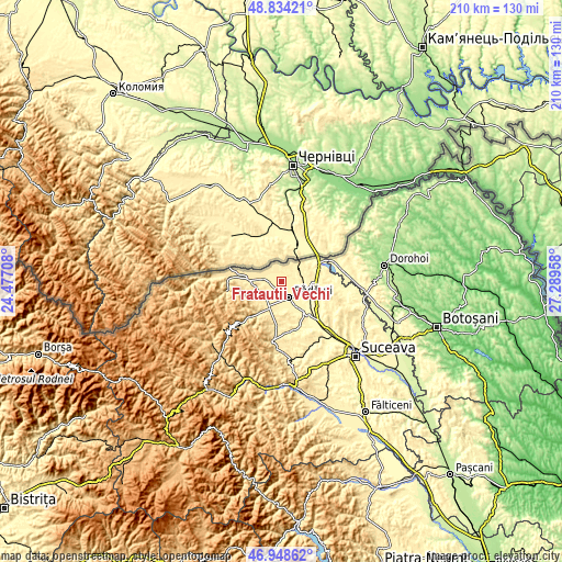
| \ | Map #1 | Map #2 | Topo.Map |
| Scale [m] | 360..443 m | 343..481 m | × |
| Scale [ft] | 1181..1453 ft | 1125..1578 ft | × |
| Average | 379.3 m = 1244 ft | 389.8 m = 1279 ft | × |
| Width | 6.55 km = 4.1 mi | 13.1 km = 8.1 mi | 209.7 km = 130.3 mi |
| Height | 6.55 km = 4.1 mi | 13.1 km = 8.1 mi | 209.6 km = 130.2 mi |
| ↑Max Latitude | 47.929454° | 47.958891° | 48.83421° |
| Latitude at center | 47.9° | 47.9° | 47.9° |
| ↓Min Latitude | 47.87053° | 47.841042° | 46.94862° |
| ← Min Longitude | 25.839385° | 25.795439° | 24.47708° |
| Longitude center | 25.88333° | 25.88333° | 25.88333° |
| →Max Longitude | 25.927275° | 25.971221° | 27.28958° |
Nearby cities:
Cities around Frătăuţii Vechi sort by population:
• Rădăuți elevation 368 m
6.1 km,  155°
155°
• Marginea 437 m
10.5 km,  208°
208°
• Volovăţ 383 m
9.3 km,  172°
172°
• Gălăneşti 405 m
6.5 km,  286°
286°
• Vicovu de Jos 438 m
11.2 km,  270°
270°
• Frătăuţii Noi 408 m
5.5 km,  328°
328°
• Horodnic de Sus 423 m
8 km, 213°
• Dorneşti 346 m
9.6 km,  109°
109°
• Bilca 422 m
10.1 km,  280°
280°
• Voitinel 454 m
9.6 km,  259°
259°
• Horodnic de Jos 425 m
6.2 km,  231°
231°
• Hurjuieni 399 m
5.3 km, 290°
Multilingual:
 En español:
Frătăuţii Vechi elevación 379 m.
 En France:
Frătăuţii Vechi élévation 379 m.
 Auf Deutsch:
Deutsch Alftratautz, Alftratautz, Rumänisch Altfratautz höhe über dem Meeresspiegel ist 379 m.

Sources and notes:
- [note 1] Map square and city borders are not equal. Map elevation data is calculated only from area inside that square.
- [src 1] Elevation data from geonames database provided with same terms of usage.
- [src 2] The elevation map of Frătăuţii Vechi is generated using elevation data from NASA's 3 arcsec (90m) resolution SRTM data.
- [src 3] Base (background) map © OpenStreetMap contributors tiles are generated by Geofabrik and OpenTopoMap.
Copyright & License:
This Frătăuţii Vechi Elevation Map is licensed under CC BY-SA. You may reuse any part from this page, if you give a proper credit by linking to this URL:
 More info on terms of use page.