Frunzi elevation
Frunzi (Bistriţa-Năsăud, Comuna Sânmihaiu de Câmpie), Romania elevation is 351 meters and Frunzi elevation in feet is 1152 ft above sea level [src 1]. Frunzi is a populated place (feature code) with elevation that is 99 meters (325 ft) bigger than average city elevation in Romania.
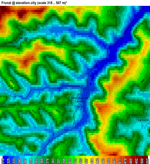
Below is the Elevation map of Frunzi, which displays elevation range with different colors. Scale of the first map is from 318 to 507 m (1043 to 1663 ft) with average elevation of 381.5 meters (=1252 ft) [note 1]
These maps also provides idea of topography and contour of this city, they are displayed at different zoom levels. More info about maps, scale and edge coordinates you can find below images.
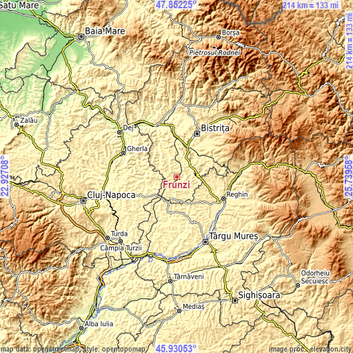
| \ | Map #1 | Topo.Map |
| Scale [m] | 318..507 m | × |
| Scale [ft] | 1043..1663 ft | × |
| Average | 381.5 m = 1252 ft | × |
| Width | 6.68 km = 4.2 mi | 213.7 km = 132.8 mi |
| Height | 6.68 km = 4.2 mi | 213.7 km = 132.8 mi |
| ↑Max Latitude | 46.930018° | 47.85225° |
| Latitude at center | 46.9° | 46.9° |
| ↓Min Latitude | 46.869965° | 45.93053° |
| ← Min Longitude | 24.289385° | 22.92708° |
| Longitude center | 24.33333° | 24.33333° |
| →Max Longitude | 24.377275° | 25.73958° |
Nearby cities:
Cities around Frunzi sort by population:
• Lechinţa elevation 344 m
13 km,  5°
5°
• Matei 326 m
10.6 km,  331°
331°
• Galaţii Bistriţei 360 m
10.6 km,  28°
28°
• Cătina 337 m
12.7 km,  244°
244°
• Budeşti 477 m
6.6 km,  253°
253°
• Milaş 379 m
12 km,  140°
140°
• Buza 452 m
13.9 km,  270°
270°
• Ocnița 369 m
12.4 km,  109°
109°
• Miceştii de Câmpie 384 m
3.9 km,  198°
198°
• Viile Tecii 370 m
12 km,  71°
71°
• Silivașu de Câmpie 376 m
13.2 km,  191°
191°
• Sânmihaiu de Câmpie 334 m
0.8 km,  166°
166°
Multilingual:
 En español:
Frunzi elevación 351 m.
 En France:
Frunzi élévation 351 m.


Sources and notes:
- [note 1] Map square and city borders are not equal. Map elevation data is calculated only from area inside that square.
- [src 1] Elevation data from geonames database provided with same terms of usage.
- [src 2] The elevation map of Frunzi is generated using elevation data from NASA's 3 arcsec (90m) resolution SRTM data.
- [src 3] Base (background) map © OpenStreetMap contributors tiles are generated by Geofabrik and OpenTopoMap.
Copyright & License:
This Frunzi Elevation Map is licensed under CC BY-SA. You may reuse any part from this page, if you give a proper credit by linking to this URL:
 More info on terms of use page.