Găneşti elevation
Găneşti (Mureş, Comuna Găneşti), Romania elevation is 307 meters and Găneşti elevation in feet is 1007 ft above sea level [src 1]. Găneşti is a seat of a second-order administrative division (feature code) with elevation that is 55 meters (180 ft) bigger than average city elevation in Romania.
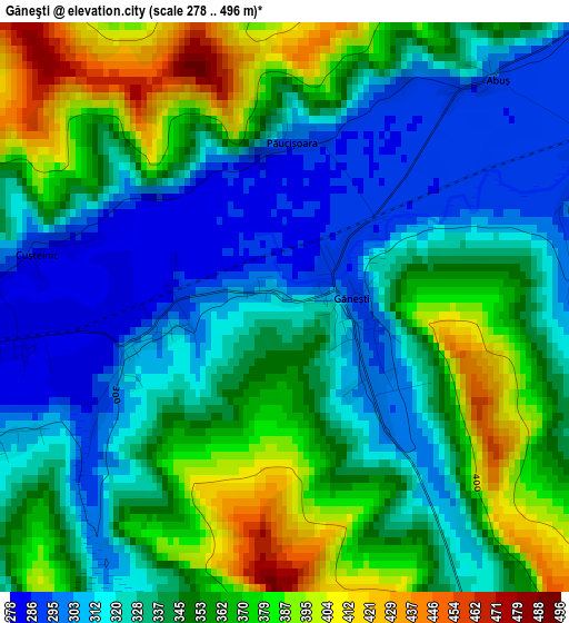
Below is the Elevation map of Găneşti, which displays elevation range with different colors. Scale of the first map is from 278 to 496 m (912 to 1627 ft) with average elevation of 343.3 meters (=1126 ft) [note 1]
These maps also provides idea of topography and contour of this city, they are displayed at different zoom levels. More info about maps, scale and edge coordinates you can find below images.
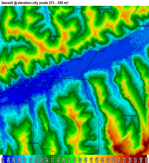
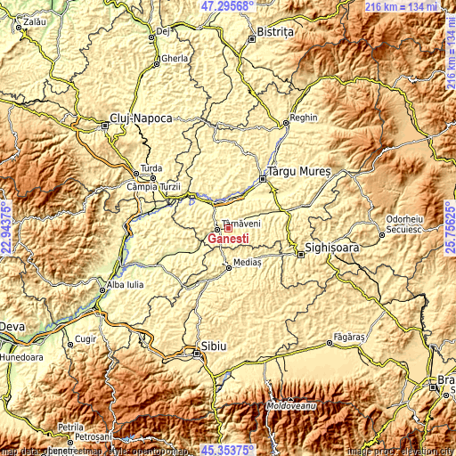
| \ | Map #1 | Map #2 | Topo.Map |
| Scale [m] | 278..496 m | 273..559 m | × |
| Scale [ft] | 912..1627 ft | 896..1834 ft | × |
| Average | 343.3 m = 1126 ft | 367 m = 1204 ft | × |
| Width | 6.75 km = 4.2 mi | 13.5 km = 8.4 mi | 215.9 km = 134.2 mi |
| Height | 6.75 km = 4.2 mi | 13.5 km = 8.4 mi | 215.9 km = 134.2 mi |
| ↑Max Latitude | 46.363664° | 46.393981° | 47.29568° |
| Latitude at center | 46.33333° | 46.33333° | 46.33333° |
| ↓Min Latitude | 46.302979° | 46.272611° | 45.35375° |
| ← Min Longitude | 24.306055° | 24.262109° | 22.94375° |
| Longitude center | 24.35° | 24.35° | 24.35° |
| →Max Longitude | 24.393945° | 24.437891° | 25.75625° |
Nearby cities:
Cities around Găneşti sort by population:
• Târnăveni elevation 284 m
4.1 km,  267°
267°
• Adămuş 310 m
9.7 km,  247°
247°
• Mica 295 m
6.3 km,  54°
54°
• Bahnea 332 m
10.9 km,  70°
70°
• Băgaciu 379 m
7.5 km,  170°
170°
• Ogra 292 m
11.4 km,  347°
347°
• Cucerdea 330 m
9.8 km,  319°
319°
• Bobohalma 362 m
9.3 km,  282°
282°
• Deaj 305 m
4.3 km, 69°
• Cornești 296 m
11.5 km, 246°
• Dâmbău 310 m
9 km,  260°
260°
• Deleni 363 m
7.8 km,  184°
184°
Multilingual:
 En español:
Găneşti elevación 307 m.
 En France:
Găneşti élévation 307 m.


Sources and notes:
- [note 1] Map square and city borders are not equal. Map elevation data is calculated only from area inside that square.
- [src 1] Elevation data from geonames database provided with same terms of usage.
- [src 2] The elevation map of Găneşti is generated using elevation data from NASA's 3 arcsec (90m) resolution SRTM data.
- [src 3] Base (background) map © OpenStreetMap contributors tiles are generated by Geofabrik and OpenTopoMap.
Copyright & License:
This Găneşti Elevation Map is licensed under CC BY-SA. You may reuse any part from this page, if you give a proper credit by linking to this URL:
 More info on terms of use page.