Ghiroda elevation
Ghiroda (Timiş, Comuna Ghiroda), Romania elevation is 89 meters and Ghiroda elevation in feet is 292 ft above sea level [src 1]. Ghiroda is a seat of a second-order administrative division (feature code) with elevation that is 163 meters (535 ft) smaller than average city elevation in Romania.
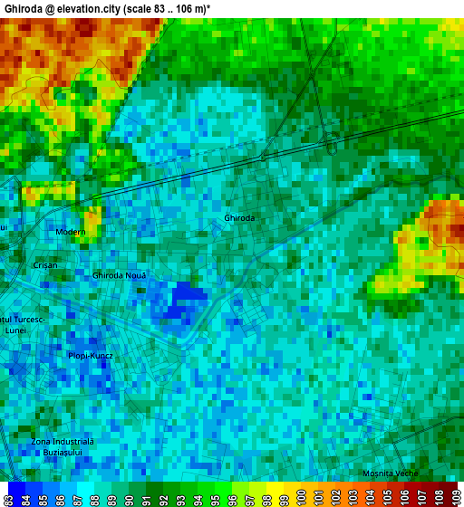
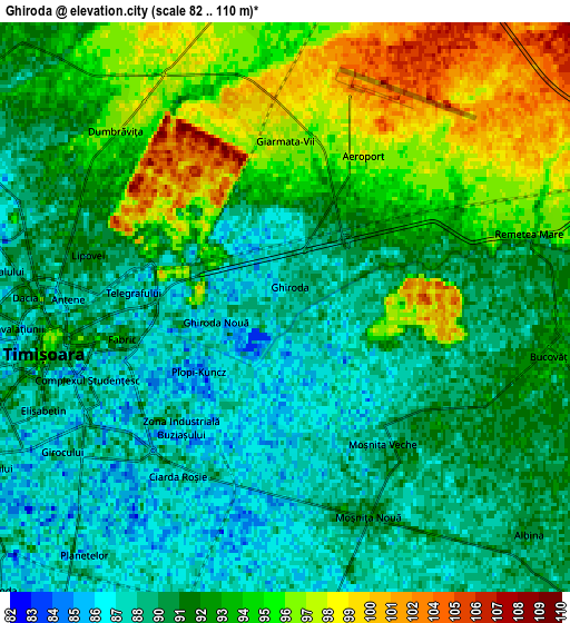
Below is the Elevation map of Ghiroda, which displays elevation range with different colors. Scale of the first map is from 83 to 106 m (272 to 348 ft) with average elevation of 89.9 meters (=295 ft) [note 1]
These maps also provides idea of topography and contour of this city, they are displayed at different zoom levels. More info about maps, scale and edge coordinates you can find below images.
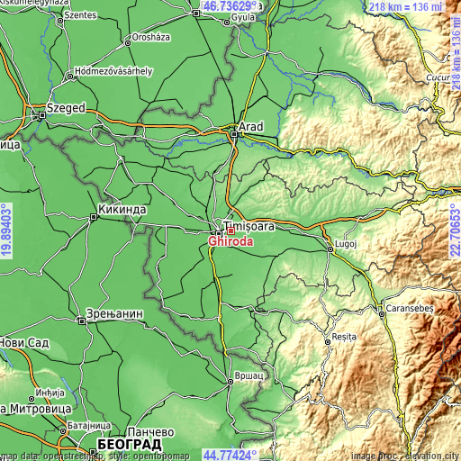
| \ | Map #1 | Map #2 | Topo.Map |
| Scale [m] | 83..106 m | 82..110 m | × |
| Scale [ft] | 272..348 ft | 269..361 ft | × |
| Average | 89.9 m = 295 ft | 91.9 m = 302 ft | × |
| Width | 6.82 km = 4.2 mi | 13.64 km = 8.5 mi | 218.2 km = 135.6 mi |
| Height | 6.82 km = 4.2 mi | 13.63 km = 8.5 mi | 218.1 km = 135.5 mi |
| ↑Max Latitude | 45.794539° | 45.82517° | 46.73629° |
| Latitude at center | 45.76389° | 45.76389° | 45.76389° |
| ↓Min Latitude | 45.733225° | 45.702542° | 44.77424° |
| ← Min Longitude | 21.256335° | 21.212389° | 19.89403° |
| Longitude center | 21.30028° | 21.30028° | 21.30028° |
| →Max Longitude | 21.344225° | 21.388171° | 22.70653° |
Nearby cities:
Cities around Ghiroda sort by population:
• Timişoara elevation 96 m
5.9 km,  258°
258°
• Giarmata 110 m
8.3 km,  5°
5°
• Moşniţa Nouă 90 m
5.5 km,  159°
159°
• Giroc 87 m
9.2 km,  212°
212°
• Remetea Mare 96 m
6.1 km,  73°
73°
• Dumbrăviţa 94 m
5.8 km,  309°
309°
• Chișoda 88 m
9.4 km,  224°
224°
• Izvin 97 m
13.1 km, 71°
• Giarmata-Vii 97 m
4 km,  359°
359°
• Moșnița Veche 89 m
4.1 km,  140°
140°
• Urseni 89 m
8 km,  174°
174°
• Bucovăț 92 m
6.5 km,  98°
98°
Multilingual:
 En español:
Ghiroda elevación 89 m.
 En France:
Ghiroda élévation 89 m.


Sources and notes:
- [note 1] Map square and city borders are not equal. Map elevation data is calculated only from area inside that square.
- [src 1] Elevation data from geonames database provided with same terms of usage.
- [src 2] The elevation map of Ghiroda is generated using elevation data from NASA's 3 arcsec (90m) resolution SRTM data.
- [src 3] Base (background) map © OpenStreetMap contributors tiles are generated by Geofabrik and OpenTopoMap.
Copyright & License:
This Ghiroda Elevation Map is licensed under CC BY-SA. You may reuse any part from this page, if you give a proper credit by linking to this URL:
 More info on terms of use page.