Grinţieş elevation
Grinţieş (Neamţ, Comuna Grinţieş), Romania elevation is 723 meters and Grinţieş elevation in feet is 2372 ft above sea level [src 1]. Grinţieş is a seat of a second-order administrative division (feature code) with elevation that is 471 meters (1545 ft) bigger than average city elevation in Romania.
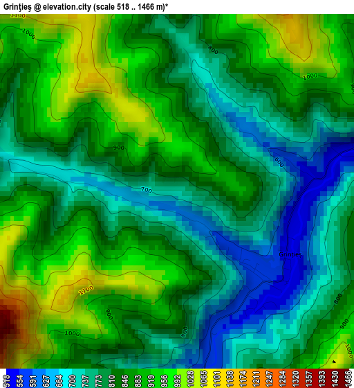
Below is the Elevation map of Grinţieş, which displays elevation range with different colors. Scale of the first map is from 518 to 1466 m (1699 to 4810 ft) with average elevation of 835.2 meters (=2740 ft) [note 1]
These maps also provides idea of topography and contour of this city, they are displayed at different zoom levels. More info about maps, scale and edge coordinates you can find below images.
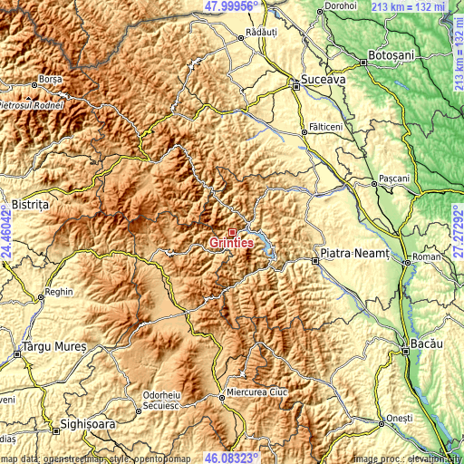
| \ | Map #1 | Topo.Map |
| Scale [m] | 518..1466 m | × |
| Scale [ft] | 1699..4810 ft | × |
| Average | 835.2 m = 2740 ft | × |
| Width | 6.66 km = 4.1 mi | 213.1 km = 132.4 mi |
| Height | 6.66 km = 4.1 mi | 213.1 km = 132.4 mi |
| ↑Max Latitude | 47.079934° | 47.99956° |
| Latitude at center | 47.05° | 47.05° |
| ↓Min Latitude | 47.020049° | 46.08323° |
| ← Min Longitude | 25.822725° | 24.46042° |
| Longitude center | 25.86667° | 25.86667° |
| →Max Longitude | 25.910615° | 27.27292° |
Nearby cities:
Cities around Grinţieş sort by population:
• Bicaz elevation 744 m
21.2 km,  134°
134°
• Borca 856 m
16.6 km,  332°
332°
• Poiana Teiului 664 m
9.4 km,  53°
53°
• Hangu 487 m
12.6 km,  90°
90°
• Tulgheş 920 m
13.5 km,  214°
214°
• Fărcaşa 770 m
13.2 km,  348°
348°
• Taşca 555 m
20.2 km,  145°
145°
• Ceahlău 487 m
7.6 km, 90°
• Sabasa 644 m
17.3 km, 347°
• Telec 681 m
18.9 km,  177°
177°
• Dodeni 425 m
22 km, 128°
• Corbu 693 m
14.6 km,  239°
239°
Multilingual:
 En español:
Grinţieş elevación 723 m.
 En France:
Grinţieş élévation 723 m.
 Auf Deutsch:
Grinţieş höhe über dem Meeresspiegel ist 723 m.

Sources and notes:
- [note 1] Map square and city borders are not equal. Map elevation data is calculated only from area inside that square.
- [src 1] Elevation data from geonames database provided with same terms of usage.
- [src 2] The elevation map of Grinţieş is generated using elevation data from NASA's 3 arcsec (90m) resolution SRTM data.
- [src 3] Base (background) map © OpenStreetMap contributors tiles are generated by Geofabrik and OpenTopoMap.
Copyright & License:
This Grinţieş Elevation Map is licensed under CC BY-SA. You may reuse any part from this page, if you give a proper credit by linking to this URL:
 More info on terms of use page.