Griviţa elevation
Griviţa (Ialomiţa, Comuna Griviţa), Romania elevation is 42 meters and Griviţa elevation in feet is 138 ft above sea level [src 1]. Griviţa is a seat of a second-order administrative division (feature code) with elevation that is 210 meters (689 ft) smaller than average city elevation in Romania.
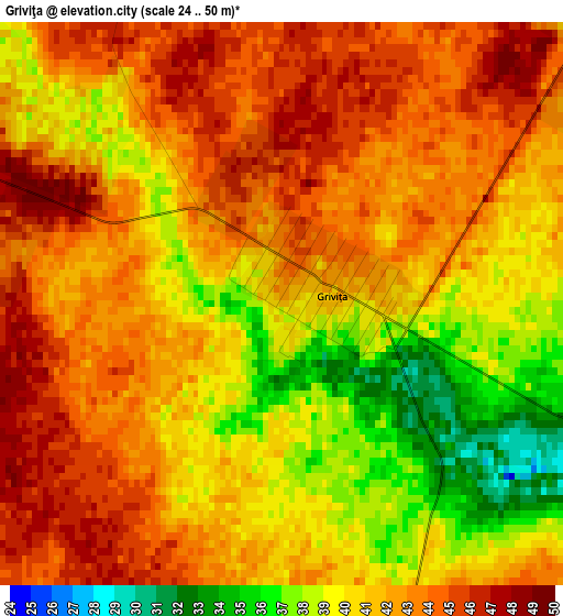
Below is the Elevation map of Griviţa, which displays elevation range with different colors. Scale of the first map is from 24 to 50 m (79 to 164 ft) with average elevation of 41.3 meters (=135 ft) [note 1]
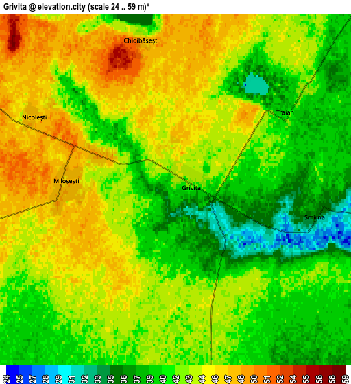
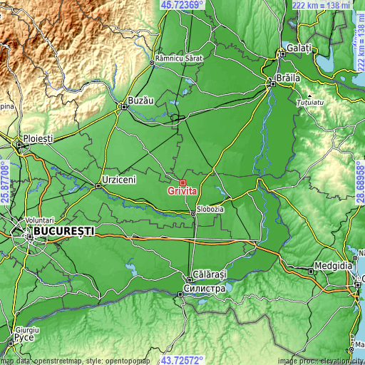
These maps also provides idea of topography and contour of this city, they are displayed at different zoom levels. More info about maps, scale and edge coordinates you can find below images.
| \ | Map #1 | Map #2 | Topo.Map |
| Scale [m] | 24..50 m | 24..59 m | × |
| Scale [ft] | 79..164 ft | 79..194 ft | × |
| Average | 41.3 m = 135 ft | 42.3 m = 139 ft | × |
| Width | 6.94 km = 4.3 mi | 13.88 km = 8.6 mi | 222.2 km = 138.1 mi |
| Height | 6.94 km = 4.3 mi | 13.88 km = 8.6 mi | 222.1 km = 138 mi |
| ↑Max Latitude | 44.76454° | 44.795733° | 45.72369° |
| Latitude at center | 44.73333° | 44.73333° | 44.73333° |
| ↓Min Latitude | 44.702103° | 44.67086° | 43.72572° |
| ← Min Longitude | 27.239385° | 27.195439° | 25.87708° |
| Longitude center | 27.28333° | 27.28333° | 27.28333° |
| →Max Longitude | 27.327275° | 27.371221° | 28.68958° |
Nearby cities:
Cities around Griviţa sort by population:
• Amara elevation 28 m
13.2 km,  168°
168°
• Reviga 48 m
14.6 km,  262°
262°
• Traian 42 m
5.8 km,  54°
54°
• Ciocile 50 m
10.1 km,  336°
336°
• Roşiori 40 m
10.8 km, 46°
• Scânteia 33 m
14.4 km,  89°
89°
• Miloşeşti 48 m
3.9 km,  270°
270°
• Gheorghe Doja 37 m
15.1 km,  210°
210°
• Tătaru 41 m
17.2 km,  43°
43°
• Iazu 29 m
10.9 km, 91°
• Smirna 36 m
5.7 km,  100°
100°
• Rovine 46 m
15.6 km,  254°
254°
Multilingual:
 En español:
Griviţa elevación 42 m.
 En France:
Griviţa élévation 42 m.


Sources and notes:
- [note 1] Map square and city borders are not equal. Map elevation data is calculated only from area inside that square.
- [src 1] Elevation data from geonames database provided with same terms of usage.
- [src 2] The elevation map of Griviţa is generated using elevation data from NASA's 3 arcsec (90m) resolution SRTM data.
- [src 3] Base (background) map © OpenStreetMap contributors tiles are generated by Geofabrik and OpenTopoMap.
Copyright & License:
This Griviţa Elevation Map is licensed under CC BY-SA. You may reuse any part from this page, if you give a proper credit by linking to this URL:
 More info on terms of use page.