Hinova elevation
Hinova (Mehedinţi, Comuna Hinova), Romania elevation is 61 meters and Hinova elevation in feet is 200 ft above sea level [src 1]. Hinova is a seat of a second-order administrative division (feature code) with elevation that is 191 meters (627 ft) smaller than average city elevation in Romania.
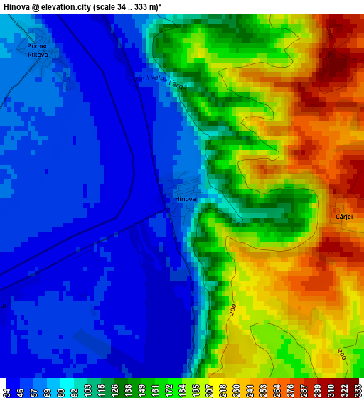
Below is the Elevation map of Hinova, which displays elevation range with different colors. Scale of the first map is from 34 to 333 m (112 to 1093 ft) with average elevation of 125.1 meters (=410 ft) [note 1]
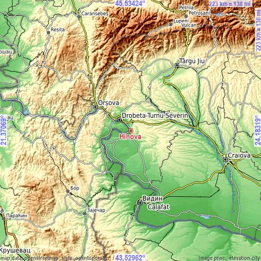
These maps also provides idea of topography and contour of this city, they are displayed at different zoom levels. More info about maps, scale and edge coordinates you can find below images.
| \ | Map #1 | Topo.Map |
| Scale [m] | 34..333 m | × |
| Scale [ft] | 112..1093 ft | × |
| Average | 125.1 m = 410 ft | × |
| Width | 6.97 km = 4.3 mi | 222.9 km = 138.5 mi |
| Height | 6.97 km = 4.3 mi | 222.9 km = 138.5 mi |
| ↑Max Latitude | 44.571874° | 45.53424° |
| Latitude at center | 44.54056° | 44.54056° |
| ↓Min Latitude | 44.509229° | 43.52962° |
| ← Min Longitude | 22.732995° | 21.37069° |
| Longitude center | 22.77694° | 22.77694° |
| →Max Longitude | 22.820885° | 24.18319° |
Nearby cities:
Cities around Hinova sort by population:
• Drobeta-Turnu Severin elevation 61 m
13.7 km,  314°
314°
• Şimian 55 m
9.9 km,  325°
325°
• Devesel 103 m
11.8 km,  227°
227°
• Cerneți 58 m
11.8 km, 332°
• Prunişor 216 m
13.4 km,  55°
55°
• Livezile 180 m
7.5 km,  114°
114°
• Vânjuleţ 91 m
11.1 km,  173°
173°
• Rogova 110 m
8 km,  162°
162°
• Poroina Mare 245 m
13.6 km, 111°
• Bistrița 100 m
5 km,  9°
9°
• Orevița Mare 164 m
14.2 km,  130°
130°
• Dudașu 68 m
14 km, 333°
Multilingual:
 En español:
Hinova elevación 61 m.
 En France:
Hinova élévation 61 m.


Sources and notes:
- [note 1] Map square and city borders are not equal. Map elevation data is calculated only from area inside that square.
- [src 1] Elevation data from geonames database provided with same terms of usage.
- [src 2] The elevation map of Hinova is generated using elevation data from NASA's 3 arcsec (90m) resolution SRTM data.
- [src 3] Base (background) map © OpenStreetMap contributors tiles are generated by Geofabrik and OpenTopoMap.
Copyright & License:
This Hinova Elevation Map is licensed under CC BY-SA. You may reuse any part from this page, if you give a proper credit by linking to this URL:
 More info on terms of use page.