Hudeşti elevation
Hudeşti (Botoşani, Comuna Hudeşti), Romania elevation is 191 meters and Hudeşti elevation in feet is 627 ft above sea level [src 1]. Hudeşti is a seat of a second-order administrative division (feature code) with elevation that is 61 meters (200 ft) smaller than average city elevation in Romania.
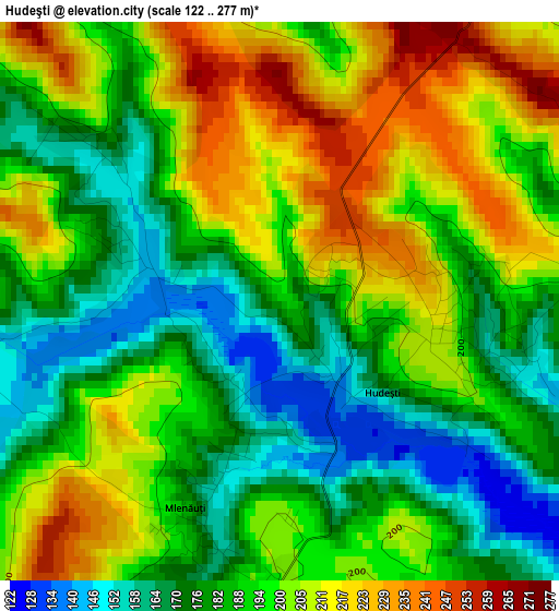
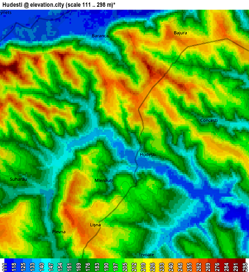
Below is the Elevation map of Hudeşti, which displays elevation range with different colors. Scale of the first map is from 122 to 277 m (400 to 909 ft) with average elevation of 192.6 meters (=632 ft) [note 1]
These maps also provides idea of topography and contour of this city, they are displayed at different zoom levels. More info about maps, scale and edge coordinates you can find below images.
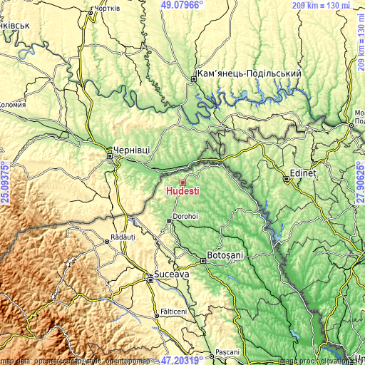
| \ | Map #1 | Map #2 | Topo.Map |
| Scale [m] | 122..277 m | 111..298 m | × |
| Scale [ft] | 400..909 ft | 364..978 ft | × |
| Average | 192.6 m = 632 ft | 188.9 m = 620 ft | × |
| Width | 6.52 km = 4.1 mi | 13.04 km = 8.1 mi | 208.6 km = 129.6 mi |
| Height | 6.52 km = 4.1 mi | 13.04 km = 8.1 mi | 208.6 km = 129.6 mi |
| ↑Max Latitude | 48.179311° | 48.208606° | 49.07966° |
| Latitude at center | 48.15° | 48.15° | 48.15° |
| ↓Min Latitude | 48.120672° | 48.091327° | 47.20319° |
| ← Min Longitude | 26.456055° | 26.412109° | 25.09375° |
| Longitude center | 26.5° | 26.5° | 26.5° |
| →Max Longitude | 26.543945° | 26.587891° | 27.90625° |
Nearby cities:
Cities around Hudeşti sort by population:
• Darabani elevation 222 m
7.2 km,  59°
59°
• Suharău 193 m
6.5 km,  253°
253°
• Ibăneşti 291 m
13.6 km,  226°
226°
• Cristineşti 239 m
10.3 km,  237°
237°
• George Enescu 175 m
13 km,  185°
185°
• Păltiniş 231 m
13.4 km, 56°
• Conceşti 232 m
4.1 km, 63°
• Bajura 197 m
6.4 km,  27°
27°
• Alba 145 m
1.9 km,  299°
299°
• Mlenăuți 154 m
2.7 km,  196°
196°
• Oroftiana 175 m
11.6 km,  285°
285°
• Baranca 126 m
5.4 km,  343°
343°
Multilingual:
 En español:
Hudeşti elevación 191 m.
 En France:
Hudeşti élévation 191 m.


Sources and notes:
- [note 1] Map square and city borders are not equal. Map elevation data is calculated only from area inside that square.
- [src 1] Elevation data from geonames database provided with same terms of usage.
- [src 2] The elevation map of Hudeşti is generated using elevation data from NASA's 3 arcsec (90m) resolution SRTM data.
- [src 3] Base (background) map © OpenStreetMap contributors tiles are generated by Geofabrik and OpenTopoMap.
Copyright & License:
This Hudeşti Elevation Map is licensed under CC BY-SA. You may reuse any part from this page, if you give a proper credit by linking to this URL:
 More info on terms of use page.