Izbiceni elevation
Izbiceni (Olt, Comuna Izbiceni), Romania elevation is 40 meters and Izbiceni elevation in feet is 131 ft above sea level [src 1]. Izbiceni is a populated place (feature code) with elevation that is 212 meters (696 ft) smaller than average city elevation in Romania.
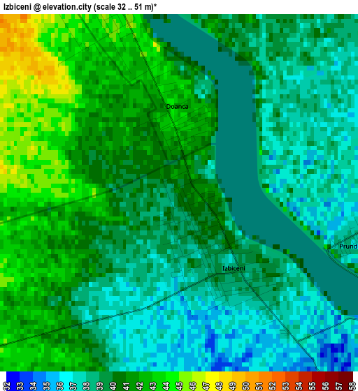
Below is the Elevation map of Izbiceni, which displays elevation range with different colors. Scale of the first map is from 32 to 51 m (105 to 167 ft) with average elevation of 39.6 meters (=130 ft) [note 1]
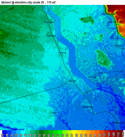
These maps also provides idea of topography and contour of this city, they are displayed at different zoom levels. More info about maps, scale and edge coordinates you can find below images.
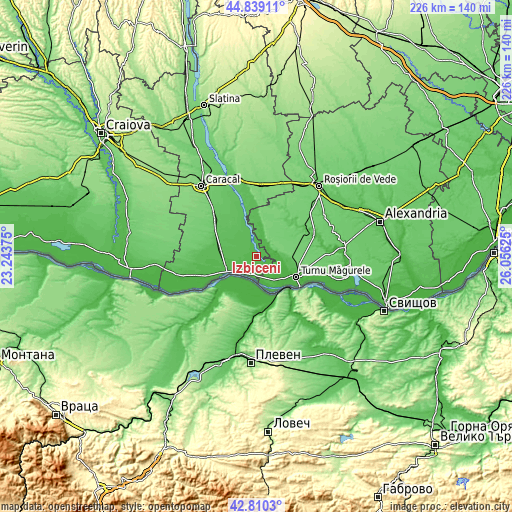
| \ | Map #1 | Map #2 | Topo.Map |
| Scale [m] | 32..51 m | 25..115 m | × |
| Scale [ft] | 105..167 ft | 82..377 ft | × |
| Average | 39.6 m = 130 ft | 41.6 m = 136 ft | × |
| Width | 7.05 km = 4.4 mi | 14.1 km = 8.8 mi | 225.6 km = 140.2 mi |
| Height | 7.05 km = 4.4 mi | 14.1 km = 8.8 mi | 225.6 km = 140.2 mi |
| ↑Max Latitude | 43.865022° | 43.896697° | 44.83911° |
| Latitude at center | 43.83333° | 43.83333° | 43.83333° |
| ↓Min Latitude | 43.801621° | 43.769896° | 42.8103° |
| ← Min Longitude | 24.606055° | 24.562109° | 23.24375° |
| Longitude center | 24.65° | 24.65° | 24.65° |
| →Max Longitude | 24.693945° | 24.737891° | 26.05625° |
Nearby cities:
Cities around Izbiceni sort by population:
• Tia Mare elevation 46 m
3.9 km,  340°
340°
• Cilieni 49 m
7.9 km, 340°
• Gârcov 33 m
8.7 km,  198°
198°
• Giuvărăşti 34 m
5.5 km,  132°
132°
• Saelele 38 m
6.7 km,  68°
68°
• Potlogeni 46 m
5.4 km, 343°
• Doanca 41 m
1.7 km,  358°
358°
• Uda-Paciurea 57 m
7.9 km,  48°
48°
• Pleașov 36 m
8.1 km,  77°
77°
• Uda-Clocociov 64 m
8 km,  40°
40°
• Ursa 38 m
5.2 km,  190°
190°
• Prundu 36 m
3.5 km,  107°
107°
Multilingual:
 En español:
Izbiceni elevación 40 m.
 En France:
Izbiceni élévation 40 m.


Sources and notes:
- [note 1] Map square and city borders are not equal. Map elevation data is calculated only from area inside that square.
- [src 1] Elevation data from geonames database provided with same terms of usage.
- [src 2] The elevation map of Izbiceni is generated using elevation data from NASA's 3 arcsec (90m) resolution SRTM data.
- [src 3] Base (background) map © OpenStreetMap contributors tiles are generated by Geofabrik and OpenTopoMap.
Copyright & License:
This Izbiceni Elevation Map is licensed under CC BY-SA. You may reuse any part from this page, if you give a proper credit by linking to this URL:
 More info on terms of use page.