Laza elevation
Laza (Vaslui, Comuna Laza), Romania elevation is 219 meters and Laza elevation in feet is 719 ft above sea level [src 1]. Laza is a seat of a second-order administrative division (feature code) with elevation that is 33 meters (108 ft) smaller than average city elevation in Romania.
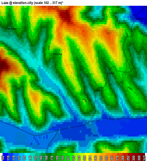
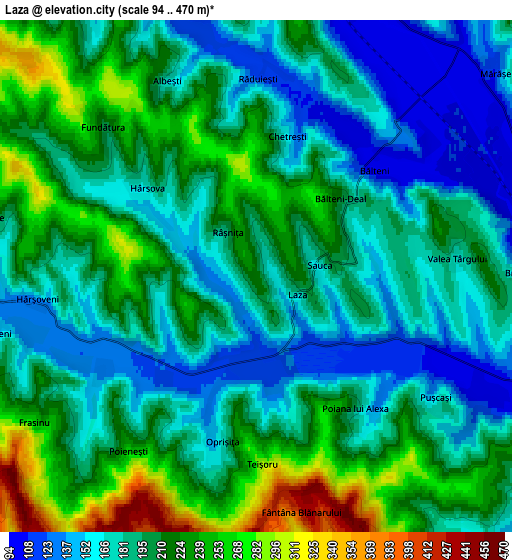
Below is the Elevation map of Laza, which displays elevation range with different colors. Scale of the first map is from 102 to 317 m (335 to 1040 ft) with average elevation of 178.5 meters (=586 ft) [note 1]
These maps also provides idea of topography and contour of this city, they are displayed at different zoom levels. More info about maps, scale and edge coordinates you can find below images.
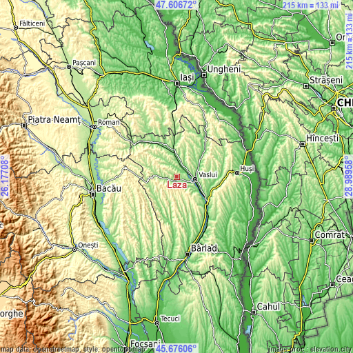
| \ | Map #1 | Map #2 | Topo.Map |
| Scale [m] | 102..317 m | 94..470 m | × |
| Scale [ft] | 335..1040 ft | 308..1542 ft | × |
| Average | 178.5 m = 586 ft | 197.6 m = 648 ft | × |
| Width | 6.71 km = 4.2 mi | 13.42 km = 8.3 mi | 214.7 km = 133.4 mi |
| Height | 6.71 km = 4.2 mi | 13.42 km = 8.3 mi | 214.7 km = 133.4 mi |
| ↑Max Latitude | 46.680158° | 46.710299° | 47.60672° |
| Latitude at center | 46.65° | 46.65° | 46.65° |
| ↓Min Latitude | 46.619825° | 46.589634° | 45.67606° |
| ← Min Longitude | 27.539385° | 27.495439° | 26.17708° |
| Longitude center | 27.58333° | 27.58333° | 27.58333° |
| →Max Longitude | 27.627275° | 27.671221° | 28.98958° |
Nearby cities:
Cities around Laza sort by population:
• Deleşti elevation 216 m
6.1 km,  335°
335°
• Ştefan cel Mare 106 m
8.2 km,  25°
25°
• Poieneşti 201 m
5.3 km,  225°
225°
• Brodoc 100 m
7.1 km,  89°
89°
• Pușcași 148 m
5.7 km,  123°
123°
• Bălteni 188 m
3.1 km,  53°
53°
• Ivănești 177 m
9.5 km,  259°
259°
• Chițoc 157 m
9.2 km,  131°
131°
• Rediu 100 m
8.7 km,  102°
102°
• Bârzești 190 m
11.4 km,  347°
347°
• Sauca 171 m
1.7 km,  79°
79°
• Cozmești 134 m
11.2 km,  326°
326°
Multilingual:
 En español:
Laza elevación 219 m.
 En France:
Laza élévation 219 m.


Sources and notes:
- [note 1] Map square and city borders are not equal. Map elevation data is calculated only from area inside that square.
- [src 1] Elevation data from geonames database provided with same terms of usage.
- [src 2] The elevation map of Laza is generated using elevation data from NASA's 3 arcsec (90m) resolution SRTM data.
- [src 3] Base (background) map © OpenStreetMap contributors tiles are generated by Geofabrik and OpenTopoMap.
Copyright & License:
This Laza Elevation Map is licensed under CC BY-SA. You may reuse any part from this page, if you give a proper credit by linking to this URL:
 More info on terms of use page.