Mavrodin elevation
Mavrodin (Teleorman, Comuna Mavrodin), Romania elevation is 66 meters and Mavrodin elevation in feet is 217 ft above sea level [src 1]. Mavrodin is a seat of a second-order administrative division (feature code) with elevation that is 186 meters (610 ft) smaller than average city elevation in Romania.
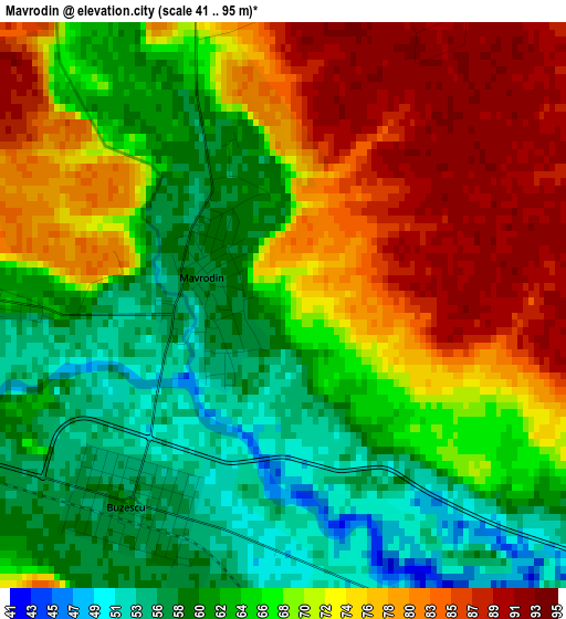
Below is the Elevation map of Mavrodin, which displays elevation range with different colors. Scale of the first map is from 41 to 95 m (135 to 312 ft) with average elevation of 68.9 meters (=226 ft) [note 1]
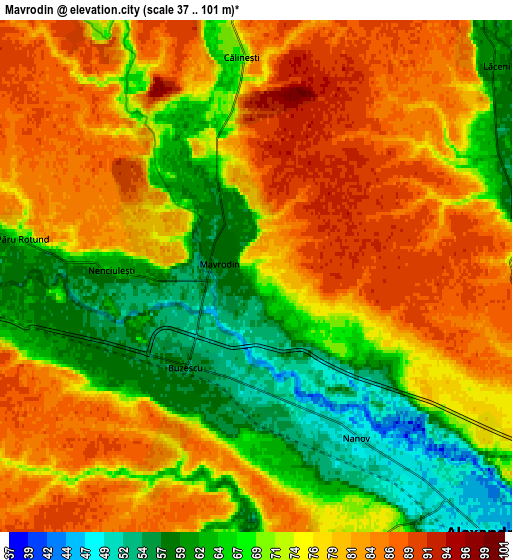
These maps also provides idea of topography and contour of this city, they are displayed at different zoom levels. More info about maps, scale and edge coordinates you can find below images.
| \ | Map #1 | Map #2 | Topo.Map |
| Scale [m] | 41..95 m | 37..101 m | × |
| Scale [ft] | 135..312 ft | 121..331 ft | × |
| Average | 68.9 m = 226 ft | 74.5 m = 244 ft | × |
| Width | 7.03 km = 4.4 mi | 14.05 km = 8.7 mi | 224.8 km = 139.7 mi |
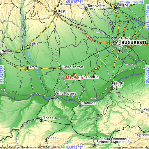
| Height | 7.03 km = 4.4 mi | 14.05 km = 8.7 mi | 224.8 km = 139.7 mi |
| ↑Max Latitude | 44.064915° | 44.096484° | 45.03571° |
| Latitude at center | 44.03333° | 44.03333° | 44.03333° |
| ↓Min Latitude | 44.001728° | 43.970109° | 43.01371° |
| ← Min Longitude | 25.206055° | 25.162109° | 23.84375° |
| Longitude center | 25.25° | 25.25° | 25.25° |
| →Max Longitude | 25.293945° | 25.337891° | 26.65625° |
Nearby cities:
Cities around Mavrodin sort by population:
• Alexandria elevation 48 m
8.7 km,  129°
129°
• Peretu 70 m
13.4 km,  277°
277°
• Plosca 65 m
9.3 km,  270°
270°
• Buzescu 51 m
2.3 km,  215°
215°
• Călineşti 83 m
5.7 km,  346°
346°
• Nanov 45 m
5.5 km, 132°
• Vităneşti 45 m
13.8 km,  105°
105°
• Măgura 65 m
12 km,  90°
90°
• Orbeasca de Jos 65 m
11.7 km,  32°
32°
• Lăceni 60 m
8.7 km,  49°
49°
• Nenciulești 64 m
4 km, 272°
• Guruieni 62 m
12 km,  76°
76°
Multilingual:
 En español:
Mavrodin elevación 66 m.
 En France:
Mavrodin élévation 66 m.


Sources and notes:
- [note 1] Map square and city borders are not equal. Map elevation data is calculated only from area inside that square.
- [src 1] Elevation data from geonames database provided with same terms of usage.
- [src 2] The elevation map of Mavrodin is generated using elevation data from NASA's 3 arcsec (90m) resolution SRTM data.
- [src 3] Base (background) map © OpenStreetMap contributors tiles are generated by Geofabrik and OpenTopoMap.
Copyright & License:
This Mavrodin Elevation Map is licensed under CC BY-SA. You may reuse any part from this page, if you give a proper credit by linking to this URL:
 More info on terms of use page.