Mugeni elevation
Mugeni (Harghita, Comuna Mugeni), Romania elevation is 448 meters and Mugeni elevation in feet is 1470 ft above sea level [src 1]. Mugeni is a seat of a second-order administrative division (feature code) with elevation that is 196 meters (643 ft) bigger than average city elevation in Romania.
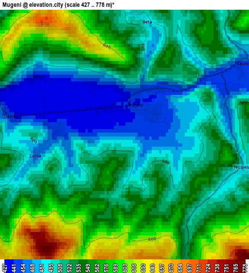
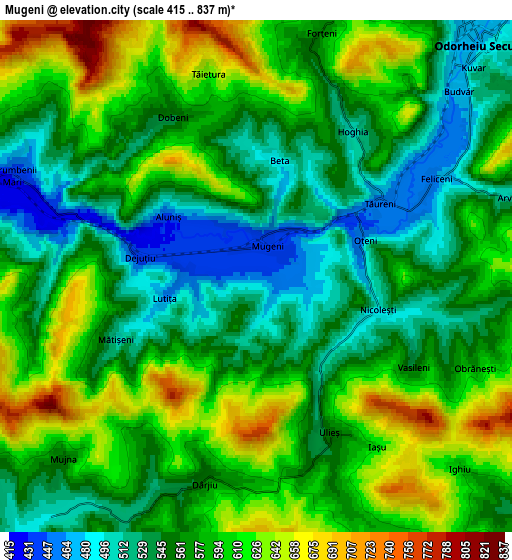
Below is the Elevation map of Mugeni, which displays elevation range with different colors. Scale of the first map is from 427 to 778 m (1401 to 2552 ft) with average elevation of 528 meters (=1732 ft) [note 1]
These maps also provides idea of topography and contour of this city, they are displayed at different zoom levels. More info about maps, scale and edge coordinates you can find below images.
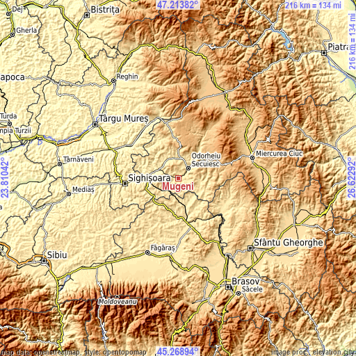
| \ | Map #1 | Map #2 | Topo.Map |
| Scale [m] | 427..778 m | 415..837 m | × |
| Scale [ft] | 1401..2552 ft | 1362..2746 ft | × |
| Average | 528 m = 1732 ft | 575.8 m = 1889 ft | × |
| Width | 6.76 km = 4.2 mi | 13.52 km = 8.4 mi | 216.3 km = 134.4 mi |
| Height | 6.76 km = 4.2 mi | 13.52 km = 8.4 mi | 216.2 km = 134.3 mi |
| ↑Max Latitude | 46.28038° | 46.310744° | 47.21382° |
| Latitude at center | 46.25° | 46.25° | 46.25° |
| ↓Min Latitude | 46.219603° | 46.189189° | 45.26894° |
| ← Min Longitude | 25.172725° | 25.128779° | 23.81042° |
| Longitude center | 25.21667° | 25.21667° | 25.21667° |
| →Max Longitude | 25.260615° | 25.304561° | 26.62292° |
Nearby cities:
Cities around Mugeni sort by population:
• Odorheiu Secuiesc elevation 495 m
8.5 km,  49°
49°
• Cristuru Secuiesc 387 m
14.6 km,  284°
284°
• Lupeni 598 m
14.8 km,  0°
0°
• Simoneşti 440 m
12.9 km,  315°
315°
• Brădeşti 539 m
15.1 km,  42°
42°
• Feliceni 452 m
4.3 km,  64°
64°
• Mărtiniş 507 m
12.9 km,  98°
98°
• Porumbenii Mari 444 m
6.8 km,  294°
294°
• Dârjiu 569 m
5.7 km,  192°
192°
• Filiaș 389 m
15.2 km, 278°
• Sâncrai 587 m
15.1 km,  30°
30°
• Tăureni 481 m
3.2 km, 54°
Multilingual:
 En español:
Mugeni elevación 448 m.
 En France:
Mugeni élévation 448 m.


Sources and notes:
- [note 1] Map square and city borders are not equal. Map elevation data is calculated only from area inside that square.
- [src 1] Elevation data from geonames database provided with same terms of usage.
- [src 2] The elevation map of Mugeni is generated using elevation data from NASA's 3 arcsec (90m) resolution SRTM data.
- [src 3] Base (background) map © OpenStreetMap contributors tiles are generated by Geofabrik and OpenTopoMap.
Copyright & License:
This Mugeni Elevation Map is licensed under CC BY-SA. You may reuse any part from this page, if you give a proper credit by linking to this URL:
 More info on terms of use page.