Nistoreşti elevation
Nistoreşti (Vrancea, Comuna Nistoreşti), Romania elevation is 503 meters and Nistoreşti elevation in feet is 1650 ft above sea level [src 1]. Nistoreşti is a seat of a second-order administrative division (feature code) with elevation that is 251 meters (823 ft) bigger than average city elevation in Romania.
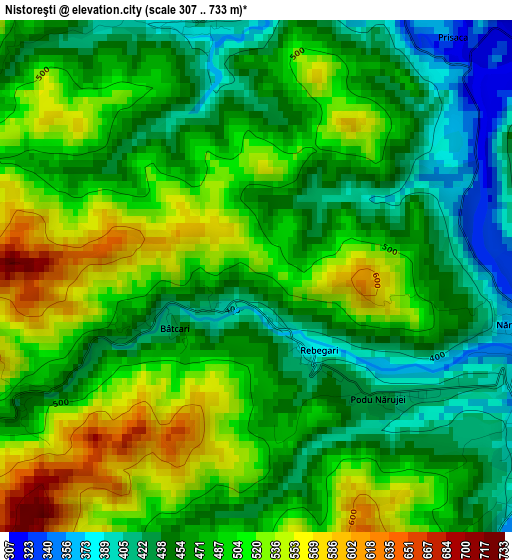
Below is the Elevation map of Nistoreşti, which displays elevation range with different colors. Scale of the first map is from 307 to 733 m (1007 to 2405 ft) with average elevation of 482 meters (=1581 ft) [note 1]
These maps also provides idea of topography and contour of this city, they are displayed at different zoom levels. More info about maps, scale and edge coordinates you can find below images.
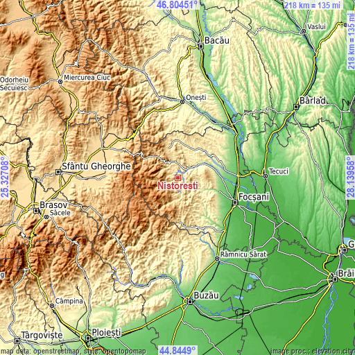
| \ | Map #1 | Topo.Map |
| Scale [m] | 307..733 m | × |
| Scale [ft] | 1007..2405 ft | × |
| Average | 482 m = 1581 ft | × |
| Width | 6.81 km = 4.2 mi | 217.9 km = 135.4 mi |
| Height | 6.81 km = 4.2 mi | 217.9 km = 135.4 mi |
| ↑Max Latitude | 45.86394° | 46.80451° |
| Latitude at center | 45.83333° | 45.83333° |
| ↓Min Latitude | 45.802703° | 44.8449° |
| ← Min Longitude | 26.689385° | 25.32708° |
| Longitude center | 26.73333° | 26.73333° |
| →Max Longitude | 26.777275° | 28.13958° |
Nearby cities:
Cities around Nistoreşti sort by population:
• Tulnici elevation 546 m
10.6 km,  330°
330°
• Paltin 493 m
5.7 km,  193°
193°
• Vrâncioaia 488 m
1.9 km,  0°
0°
• Reghiu 584 m
9.5 km,  125°
125°
• Negrilești 491 m
11.7 km,  349°
349°
• Mătăcina 378 m
7.6 km,  42°
42°
• Andreiaşu de Jos 454 m
12.1 km,  140°
140°
• Năruja 410 m
3.9 km,  90°
90°
• Păulești 463 m
7.3 km, 332°
• Valea Sării 353 m
7 km,  46°
46°
• Spulber 476 m
9.3 km,  166°
166°
• Bârseşti 423 m
9.3 km, 0°
Multilingual:
 En español:
Nistoreşti elevación 503 m.
 En France:
Nistoreşti élévation 503 m.
 Auf Deutsch:
Nistoreşti höhe über dem Meeresspiegel ist 503 m.

Sources and notes:
- [note 1] Map square and city borders are not equal. Map elevation data is calculated only from area inside that square.
- [src 1] Elevation data from geonames database provided with same terms of usage.
- [src 2] The elevation map of Nistoreşti is generated using elevation data from NASA's 3 arcsec (90m) resolution SRTM data.
- [src 3] Base (background) map © OpenStreetMap contributors tiles are generated by Geofabrik and OpenTopoMap.
Copyright & License:
This Nistoreşti Elevation Map is licensed under CC BY-SA. You may reuse any part from this page, if you give a proper credit by linking to this URL:
 More info on terms of use page.