Ogrezeni elevation
Ogrezeni (Giurgiu, Comuna Ogrezeni), Romania elevation is 103 meters and Ogrezeni elevation in feet is 338 ft above sea level [src 1]. Ogrezeni is a seat of a second-order administrative division (feature code) with elevation that is 149 meters (489 ft) smaller than average city elevation in Romania.
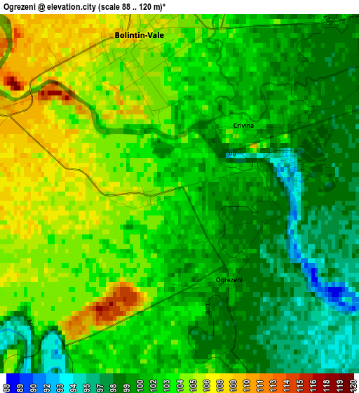
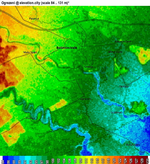
Below is the Elevation map of Ogrezeni, which displays elevation range with different colors. Scale of the first map is from 88 to 120 m (289 to 394 ft) with average elevation of 102.1 meters (=335 ft) [note 1]
These maps also provides idea of topography and contour of this city, they are displayed at different zoom levels. More info about maps, scale and edge coordinates you can find below images.
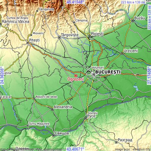
| \ | Map #1 | Map #2 | Topo.Map |
| Scale [m] | 88..120 m | 84..131 m | × |
| Scale [ft] | 289..394 ft | 276..430 ft | × |
| Average | 102.1 m = 335 ft | 103 m = 338 ft | × |
| Width | 6.98 km = 4.3 mi | 13.96 km = 8.7 mi | 223.4 km = 138.8 mi |
| Height | 6.98 km = 4.3 mi | 13.96 km = 8.7 mi | 223.3 km = 138.8 mi |
| ↑Max Latitude | 44.451099° | 44.482461° | 45.41548° |
| Latitude at center | 44.41972° | 44.41972° | 44.41972° |
| ↓Min Latitude | 44.388324° | 44.356912° | 43.40671° |
| ← Min Longitude | 25.724385° | 25.680439° | 24.36208° |
| Longitude center | 25.76833° | 25.76833° | 25.76833° |
| →Max Longitude | 25.812275° | 25.856221° | 27.17458° |
Nearby cities:
Cities around Ogrezeni sort by population:
• Bolintin Vale elevation 106 m
3.3 km,  345°
345°
• Ulmi 111 m
7.5 km,  7°
7°
• Bolintin Deal 101 m
6.1 km,  43°
43°
• Buturugeni 96 m
8.1 km,  138°
138°
• Grădinari 96 m
4.8 km,  129°
129°
• Malu Spart 111 m
4.8 km,  303°
303°
• Palanca 112 m
7.1 km,  331°
331°
• Mihai Vodă 99 m
4.6 km,  62°
62°
• Stoenești 116 m
8.6 km, 328°
• Tântava 95 m
4.5 km,  96°
96°
• Zorile 96 m
5.5 km,  146°
146°
• Icoana 111 m
8.3 km, 347°
Multilingual:
 En español:
Ogrezeni elevación 103 m.
 En France:
Ogrezeni élévation 103 m.
 Auf Deutsch:
Ogrezeni höhe über dem Meeresspiegel ist 103 m.

Sources and notes:
- [note 1] Map square and city borders are not equal. Map elevation data is calculated only from area inside that square.
- [src 1] Elevation data from geonames database provided with same terms of usage.
- [src 2] The elevation map of Ogrezeni is generated using elevation data from NASA's 3 arcsec (90m) resolution SRTM data.
- [src 3] Base (background) map © OpenStreetMap contributors tiles are generated by Geofabrik and OpenTopoMap.
Copyright & License:
This Ogrezeni Elevation Map is licensed under CC BY-SA. You may reuse any part from this page, if you give a proper credit by linking to this URL:
 More info on terms of use page.