Perieţi elevation
Perieţi (Ialomiţa, Comuna Perieţi), Romania elevation is 27 meters and Perieţi elevation in feet is 89 ft above sea level [src 1]. Perieţi is a seat of a second-order administrative division (feature code) with elevation that is 225 meters (738 ft) smaller than average city elevation in Romania.
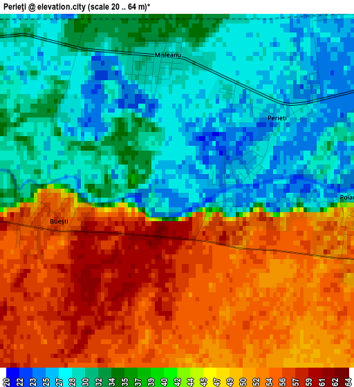
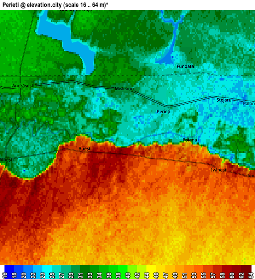
Below is the Elevation map of Perieţi, which displays elevation range with different colors. Scale of the first map is from 20 to 64 m (66 to 210 ft) with average elevation of 40.3 meters (=132 ft) [note 1]
These maps also provides idea of topography and contour of this city, they are displayed at different zoom levels. More info about maps, scale and edge coordinates you can find below images.
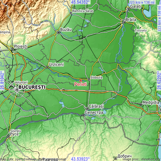
| \ | Map #1 | Map #2 | Topo.Map |
| Scale [m] | 20..64 m | 16..64 m | × |
| Scale [ft] | 66..210 ft | 52..210 ft | × |
| Average | 40.3 m = 132 ft | 39.6 m = 130 ft | × |
| Width | 6.96 km = 4.3 mi | 13.93 km = 8.7 mi | 222.9 km = 138.5 mi |
| Height | 6.96 km = 4.3 mi | 13.93 km = 8.7 mi | 222.8 km = 138.4 mi |
| ↑Max Latitude | 44.581309° | 44.612601° | 45.54352° |
| Latitude at center | 44.55° | 44.55° | 44.55° |
| ↓Min Latitude | 44.518674° | 44.487332° | 43.53923° |
| ← Min Longitude | 27.172725° | 27.128779° | 25.81042° |
| Longitude center | 27.21667° | 27.21667° | 27.21667° |
| →Max Longitude | 27.260615° | 27.304561° | 28.62292° |
Nearby cities:
Cities around Perieţi sort by population:
• Slobozia elevation 24 m
11.7 km,  81°
81°
• Dragalina 39 m
15.2 km,  148°
148°
• Amara 28 m
10.8 km,  46°
46°
• Ciochina 34 m
12.4 km,  287°
287°
• Albeşti 56 m
6.9 km,  254°
254°
• Gheorghe Doja 37 m
7.7 km,  342°
342°
• Ciulniţa 52 m
10.7 km,  99°
99°
• Dragoș Vodă 44 m
14 km,  202°
202°
• Andrăşeşti 31 m
6.9 km, 285°
• Buești 56 m
2.4 km,  255°
255°
• Constantin Brâncoveanu 39 m
17.5 km,  117°
117°
• Cosâmbeşti 23 m
17.3 km,  86°
86°
Multilingual:
 En español:
Perieţi elevación 27 m.
 En France:
Perieţi élévation 27 m.


Sources and notes:
- [note 1] Map square and city borders are not equal. Map elevation data is calculated only from area inside that square.
- [src 1] Elevation data from geonames database provided with same terms of usage.
- [src 2] The elevation map of Perieţi is generated using elevation data from NASA's 3 arcsec (90m) resolution SRTM data.
- [src 3] Base (background) map © OpenStreetMap contributors tiles are generated by Geofabrik and OpenTopoMap.
Copyright & License:
This Perieţi Elevation Map is licensed under CC BY-SA. You may reuse any part from this page, if you give a proper credit by linking to this URL:
 More info on terms of use page.