Răcăşdia elevation
Răcăşdia (Caraş-Severin, Comuna Răcăşdia), Romania elevation is 142 meters and Răcăşdia elevation in feet is 466 ft above sea level [src 1]. Răcăşdia is a seat of a second-order administrative division (feature code) with elevation that is 110 meters (361 ft) smaller than average city elevation in Romania.
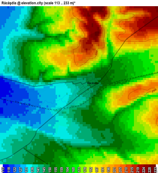
Below is the Elevation map of Răcăşdia, which displays elevation range with different colors. Scale of the first map is from 113 to 233 m (371 to 764 ft) with average elevation of 163 meters (=535 ft) [note 1]
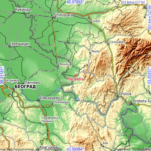
These maps also provides idea of topography and contour of this city, they are displayed at different zoom levels. More info about maps, scale and edge coordinates you can find below images.
| \ | Map #1 | Topo.Map |
| Scale [m] | 113..233 m | × |
| Scale [ft] | 371..764 ft | × |
| Average | 163 m = 535 ft | × |
| Width | 6.91 km = 4.3 mi | 221.2 km = 137.4 mi |
| Height | 6.91 km = 4.3 mi | 221.1 km = 137.4 mi |
| ↑Max Latitude | 45.024129° | 45.97892° |
| Latitude at center | 44.99306° | 44.99306° |
| ↓Min Latitude | 44.961974° | 43.98994° |
| ← Min Longitude | 21.574115° | 20.21181° |
| Longitude center | 21.61806° | 21.61806° |
| →Max Longitude | 21.662005° | 23.02431° |
Nearby cities:
Cities around Răcăşdia sort by population:
• Oraviţa elevation 213 m
7.1 km,  51°
51°
• Steierdorf 631 m
20 km,  66°
66°
• Grădinari 104 m
14 km,  353°
353°
• Ticvaniu Mare 112 m
15.9 km,  5°
5°
• Ciclova-Română 297 m
8.3 km, 73°
• Vărădia 96 m
11 km,  329°
329°
• Berlişte 100 m
12.2 km,  266°
266°
• Ciuchici 131 m
5.8 km,  186°
186°
• Vrani 93 m
11.1 km,  297°
297°
• Greoni 119 m
10.7 km,  359°
359°
• Naidăș 129 m
12.6 km, 189°
• Sasca Montană 147 m
13.9 km,  149°
149°
Multilingual:
 En español:
Răcăşdia elevación 142 m.
 En France:
Răcăşdia élévation 142 m.
 Auf Deutsch:
Răcăşdia höhe über dem Meeresspiegel ist 142 m.

Sources and notes:
- [note 1] Map square and city borders are not equal. Map elevation data is calculated only from area inside that square.
- [src 1] Elevation data from geonames database provided with same terms of usage.
- [src 2] The elevation map of Răcăşdia is generated using elevation data from NASA's 3 arcsec (90m) resolution SRTM data.
- [src 3] Base (background) map © OpenStreetMap contributors tiles are generated by Geofabrik and OpenTopoMap.
Copyright & License:
This Răcăşdia Elevation Map is licensed under CC BY-SA. You may reuse any part from this page, if you give a proper credit by linking to this URL:
 More info on terms of use page.