Roşia elevation
Roşia (Sibiu, Comuna Roşia), Romania elevation is 426 meters and Roşia elevation in feet is 1398 ft above sea level [src 1]. Roşia is a seat of a second-order administrative division (feature code) with elevation that is 174 meters (571 ft) bigger than average city elevation in Romania.
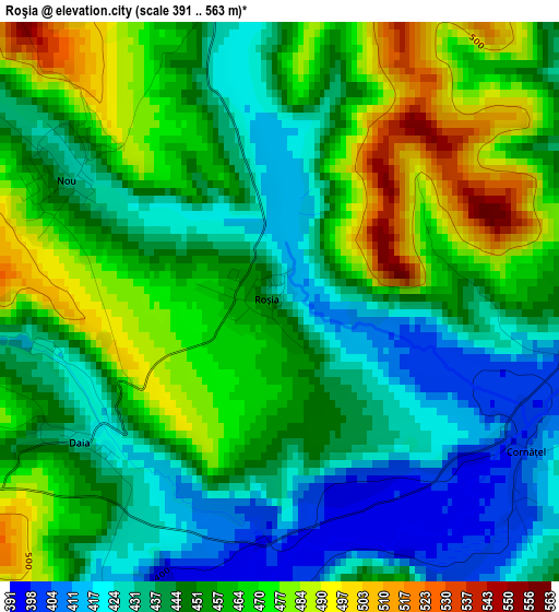
Below is the Elevation map of Roşia, which displays elevation range with different colors. Scale of the first map is from 391 to 563 m (1283 to 1847 ft) with average elevation of 451.9 meters (=1483 ft) [note 1]
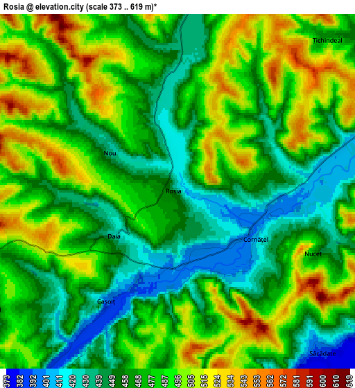
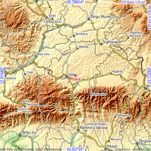
These maps also provides idea of topography and contour of this city, they are displayed at different zoom levels. More info about maps, scale and edge coordinates you can find below images.
| \ | Map #1 | Map #2 | Topo.Map |
| Scale [m] | 391..563 m | 373..619 m | × |
| Scale [ft] | 1283..1847 ft | 1224..2031 ft | × |
| Average | 451.9 m = 1483 ft | 474.6 m = 1557 ft | × |
| Width | 6.81 km = 4.2 mi | 13.62 km = 8.5 mi | 218 km = 135.5 mi |
| Height | 6.81 km = 4.2 mi | 13.62 km = 8.5 mi | 217.9 km = 135.4 mi |
| ↑Max Latitude | 45.84729° | 45.877892° | 46.78814° |
| Latitude at center | 45.81667° | 45.81667° | 45.81667° |
| ↓Min Latitude | 45.786034° | 45.75538° | 44.82795° |
| ← Min Longitude | 24.272725° | 24.228779° | 22.91042° |
| Longitude center | 24.31667° | 24.31667° | 24.31667° |
| →Max Longitude | 24.360615° | 24.404561° | 25.72292° |
Nearby cities:
Cities around Roşia sort by population:
• Sibiu elevation 410 m
13.1 km,  261°
261°
• Avrig 385 m
12.3 km,  155°
155°
• Şelimbăr 403 m
10.6 km,  238°
238°
• Şura Mare 448 m
12.2 km,  287°
287°
• Mârșa 382 m
13.6 km, 162°
• Porumbacu de Jos 407 m
12.7 km,  125°
125°
• Racoviţa 384 m
15 km,  170°
170°
• Nocrich 451 m
13.9 km,  48°
48°
• Vurpăr 478 m
9.6 km,  15°
15°
• Veștem 383 m
12.5 km,  208°
208°
• Nou 432 m
3.2 km,  305°
305°
• Bradu 382 m
10.6 km, 173°
Multilingual:
 En español:
Roşia elevación 426 m.
 En France:
Roşia élévation 426 m.


Sources and notes:
- [note 1] Map square and city borders are not equal. Map elevation data is calculated only from area inside that square.
- [src 1] Elevation data from geonames database provided with same terms of usage.
- [src 2] The elevation map of Roşia is generated using elevation data from NASA's 3 arcsec (90m) resolution SRTM data.
- [src 3] Base (background) map © OpenStreetMap contributors tiles are generated by Geofabrik and OpenTopoMap.
Copyright & License:
This Roşia Elevation Map is licensed under CC BY-SA. You may reuse any part from this page, if you give a proper credit by linking to this URL:
 More info on terms of use page.