Săbăreni elevation
Săbăreni (Giurgiu, Comuna Săbăreni), Romania elevation is 100 meters and Săbăreni elevation in feet is 328 ft above sea level [src 1]. Săbăreni is a seat of a second-order administrative division (feature code) with elevation that is 152 meters (499 ft) smaller than average city elevation in Romania.
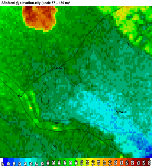
Below is the Elevation map of Săbăreni, which displays elevation range with different colors. Scale of the first map is from 87 to 130 m (285 to 427 ft) with average elevation of 101.3 meters (=332 ft) [note 1]
These maps also provides idea of topography and contour of this city, they are displayed at different zoom levels. More info about maps, scale and edge coordinates you can find below images.
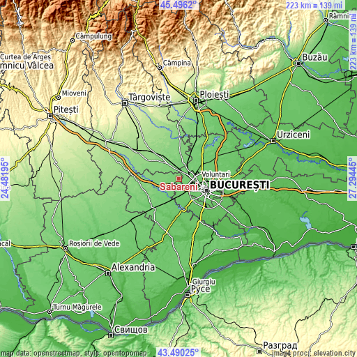
| \ | Map #1 | Topo.Map |
| Scale [m] | 87..130 m | × |
| Scale [ft] | 285..427 ft | × |
| Average | 101.3 m = 332 ft | × |
| Width | 6.97 km = 4.3 mi | 223 km = 138.6 mi |
| Height | 6.97 km = 4.3 mi | 223 km = 138.6 mi |
| ↑Max Latitude | 44.533185° | 45.4962° |
| Latitude at center | 44.50185° | 44.50185° |
| ↓Min Latitude | 44.470499° | 43.49025° |
| ← Min Longitude | 25.844255° | 24.48195° |
| Longitude center | 25.8882° | 25.8882° |
| →Max Longitude | 25.932145° | 27.29445° |
Nearby cities:
Cities around Săbăreni sort by population:
• Buftea elevation 107 m
8.2 km,  36°
36°
• Chitila 93 m
7.5 km,  84°
84°
• Joiţa 104 m
2.9 km,  252°
252°
• Bolintin Deal 101 m
7.1 km,  228°
228°
• Ciorogârla 96 m
6.6 km,  183°
183°
• Dragomireşti-Vale 95 m
4.8 km,  128°
128°
• Cosoba 111 m
6 km,  292°
292°
• Dragomirești-Deal 92 m
6.3 km, 134°
• Buciumeni 100 m
8 km,  48°
48°
• Bâcu 102 m
2.1 km, 178°
• Rudeni 87 m
7.5 km,  115°
115°
• Gulia 108 m
5.1 km,  346°
346°
Multilingual:
 En español:
Săbăreni elevación 100 m.
 En France:
Săbăreni élévation 100 m.
 Auf Deutsch:
Săbăreni höhe über dem Meeresspiegel ist 100 m.

Sources and notes:
- [note 1] Map square and city borders are not equal. Map elevation data is calculated only from area inside that square.
- [src 1] Elevation data from geonames database provided with same terms of usage.
- [src 2] The elevation map of Săbăreni is generated using elevation data from NASA's 3 arcsec (90m) resolution SRTM data.
- [src 3] Base (background) map © OpenStreetMap contributors tiles are generated by Geofabrik and OpenTopoMap.
Copyright & License:
This Săbăreni Elevation Map is licensed under CC BY-SA. You may reuse any part from this page, if you give a proper credit by linking to this URL:
 More info on terms of use page.