Someş-Odorhei elevation
Someş-Odorhei (Sălaj, Comuna Someş-Odorhei), Romania elevation is 178 meters and Someş-Odorhei elevation in feet is 584 ft above sea level [src 1]. Someş-Odorhei is a seat of a second-order administrative division (feature code) with elevation that is 74 meters (243 ft) smaller than average city elevation in Romania.
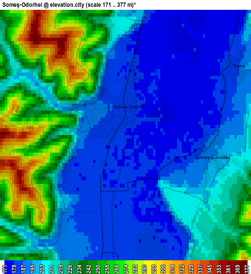
Below is the Elevation map of Someş-Odorhei, which displays elevation range with different colors. Scale of the first map is from 171 to 377 m (561 to 1237 ft) with average elevation of 213 meters (=699 ft) [note 1]
These maps also provides idea of topography and contour of this city, they are displayed at different zoom levels. More info about maps, scale and edge coordinates you can find below images.
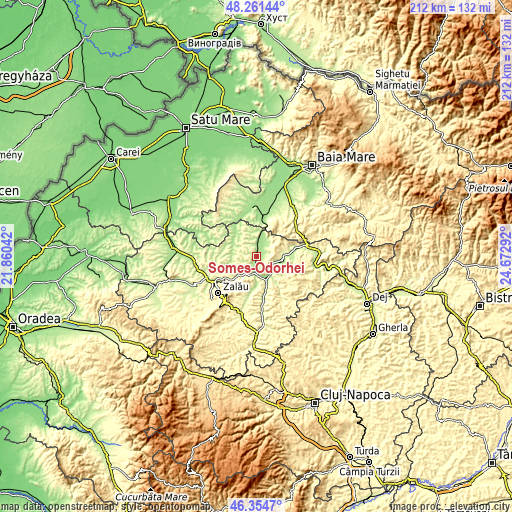
| \ | Map #1 | Topo.Map |
| Scale [m] | 171..377 m | × |
| Scale [ft] | 561..1237 ft | × |
| Average | 213 m = 699 ft | × |
| Width | 6.63 km = 4.1 mi | 212 km = 131.7 mi |
| Height | 6.63 km = 4.1 mi | 212 km = 131.7 mi |
| ↑Max Latitude | 47.346454° | 48.26144° |
| Latitude at center | 47.31667° | 47.31667° |
| ↓Min Latitude | 47.286869° | 46.3547° |
| ← Min Longitude | 23.222725° | 21.86042° |
| Longitude center | 23.26667° | 23.26667° |
| →Max Longitude | 23.310615° | 24.67292° |
Nearby cities:
Cities around Someş-Odorhei sort by population:
• Jibou elevation 191 m
6.5 km,  186°
186°
• Surduc 223 m
9.7 km,  139°
139°
• Sălăţig 182 m
11.5 km,  298°
298°
• Creaca 209 m
13 km, 185°
• Năpradea 190 m
6.7 km,  34°
34°
• Mirşid 323 m
13.7 km,  227°
227°
• Băbeni 199 m
10.2 km,  100°
100°
• Benesat 175 m
10.6 km,  9°
9°
• Dobrin 289 m
10.7 km,  249°
249°
• Deja 233 m
7.6 km, 304°
• Tihău 198 m
11 km,  154°
154°
• Cehu Silvaniei 218 m
12.6 km,  326°
326°
Multilingual:
 En español:
Someş-Odorhei elevación 178 m.
 En France:
Someş-Odorhei élévation 178 m.
 Auf Deutsch:
Someş-Odorhei höhe über dem Meeresspiegel ist 178 m.

Sources and notes:
- [note 1] Map square and city borders are not equal. Map elevation data is calculated only from area inside that square.
- [src 1] Elevation data from geonames database provided with same terms of usage.
- [src 2] The elevation map of Someş-Odorhei is generated using elevation data from NASA's 3 arcsec (90m) resolution SRTM data.
- [src 3] Base (background) map © OpenStreetMap contributors tiles are generated by Geofabrik and OpenTopoMap.
Copyright & License:
This Someş-Odorhei Elevation Map is licensed under CC BY-SA. You may reuse any part from this page, if you give a proper credit by linking to this URL:
 More info on terms of use page.