Tătărani elevation
Tătărani (Dâmboviţa, Comuna Tătărani), Romania elevation is 408 meters and Tătărani elevation in feet is 1339 ft above sea level [src 1]. Tătărani is a seat of a second-order administrative division (feature code) with elevation that is 156 meters (512 ft) bigger than average city elevation in Romania.
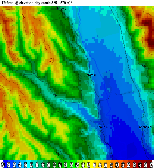
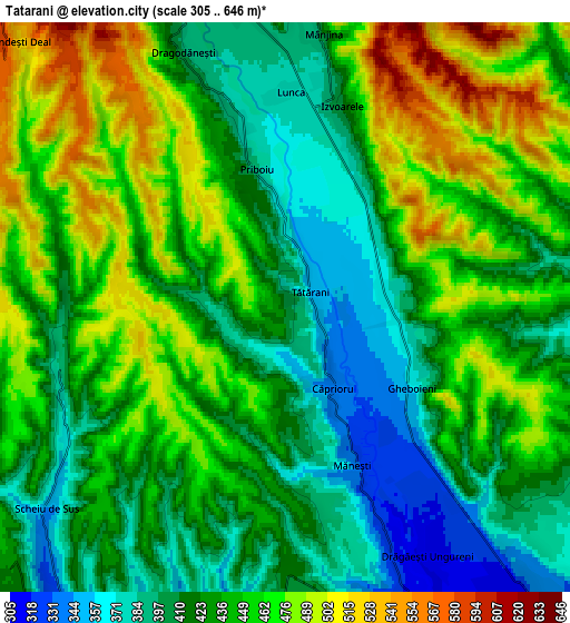
Below is the Elevation map of Tătărani, which displays elevation range with different colors. Scale of the first map is from 325 to 579 m (1066 to 1900 ft) with average elevation of 413.8 meters (=1358 ft) [note 1]
These maps also provides idea of topography and contour of this city, they are displayed at different zoom levels. More info about maps, scale and edge coordinates you can find below images.
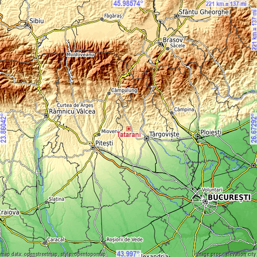
| \ | Map #1 | Map #2 | Topo.Map |
| Scale [m] | 325..579 m | 305..646 m | × |
| Scale [ft] | 1066..1900 ft | 1001..2119 ft | × |
| Average | 413.8 m = 1358 ft | 437.4 m = 1435 ft | × |
| Width | 6.91 km = 4.3 mi | 13.82 km = 8.6 mi | 221.1 km = 137.4 mi |
| Height | 6.91 km = 4.3 mi | 13.82 km = 8.6 mi | 221.1 km = 137.4 mi |
| ↑Max Latitude | 45.031066° | 45.062114° | 45.98574° |
| Latitude at center | 45° | 45° | 45° |
| ↓Min Latitude | 44.968918° | 44.937818° | 43.997° |
| ← Min Longitude | 25.222725° | 25.178779° | 23.86042° |
| Longitude center | 25.26667° | 25.26667° | 25.26667° |
| →Max Longitude | 25.310615° | 25.354561° | 26.67292° |
Nearby cities:
Cities around Tătărani sort by population:
• Izvoarele elevation 363 m
3.7 km,  0°
0°
• Voineşti 396 m
7.5 km,  349°
349°
• Măneşti 351 m
3.9 km,  160°
160°
• Vulcana-Pandele 349 m
10.1 km,  80°
80°
• Căprioru 341 m
2.3 km,  149°
149°
• Gheboieni 371 m
3.5 km,  114°
114°
• Dragodănești 393 m
6.6 km,  338°
338°
• Scheiu de Jos 334 m
9 km,  215°
215°
• Drăgăești Ungureni 314 m
7 km, 150°
• Priboiu 388 m
3.4 km, 348°
• Scheiu de Sus 344 m
7.6 km,  229°
229°
• Şotânga 362 m
8.1 km,  103°
103°
Multilingual:
 En español:
Tătărani elevación 408 m.
 En France:
Tătărani élévation 408 m.
 Auf Deutsch:
Tătărani höhe über dem Meeresspiegel ist 408 m.

Sources and notes:
- [note 1] Map square and city borders are not equal. Map elevation data is calculated only from area inside that square.
- [src 1] Elevation data from geonames database provided with same terms of usage.
- [src 2] The elevation map of Tătărani is generated using elevation data from NASA's 3 arcsec (90m) resolution SRTM data.
- [src 3] Base (background) map © OpenStreetMap contributors tiles are generated by Geofabrik and OpenTopoMap.
Copyright & License:
This Tătărani Elevation Map is licensed under CC BY-SA. You may reuse any part from this page, if you give a proper credit by linking to this URL:
 More info on terms of use page.