Ulmeni elevation
Ulmeni (Călăraşi, Comuna Ulmeni), Romania elevation is 34 meters and Ulmeni elevation in feet is 112 ft above sea level [src 1]. Ulmeni is a seat of a second-order administrative division (feature code) with elevation that is 218 meters (715 ft) smaller than average city elevation in Romania.
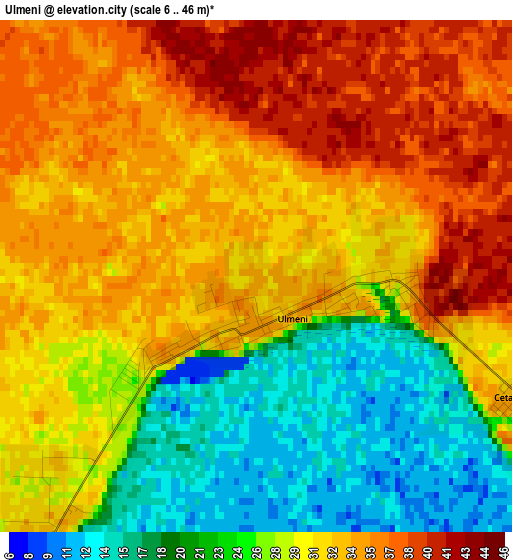
Below is the Elevation map of Ulmeni, which displays elevation range with different colors. Scale of the first map is from 6 to 46 m (20 to 151 ft) with average elevation of 29.3 meters (=96 ft) [note 1]
These maps also provides idea of topography and contour of this city, they are displayed at different zoom levels. More info about maps, scale and edge coordinates you can find below images.
| \ | Map #1 | Map #2 | Topo.Map |
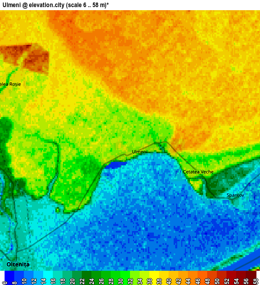
| Scale [m] | 6..46 m | 6..58 m | × |
| Scale [ft] | 20..151 ft | 20..190 ft | × |
| Average | 29.3 m = 96 ft | 28.5 m = 94 ft | × |
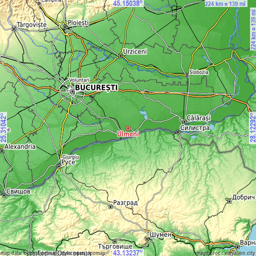
| Width | 7.01 km = 4.4 mi | 14.02 km = 8.7 mi | 224.4 km = 139.4 mi |
| Height | 7.01 km = 4.4 mi | 14.02 km = 8.7 mi | 224.4 km = 139.4 mi |
| ↑Max Latitude | 44.181523° | 44.213029° | 45.15038° |
| Latitude at center | 44.15° | 44.15° | 44.15° |
| ↓Min Latitude | 44.11846° | 44.086903° | 43.13237° |
| ← Min Longitude | 26.672725° | 26.628779° | 25.31042° |
| Longitude center | 26.71667° | 26.71667° | 26.71667° |
| →Max Longitude | 26.760615° | 26.804561° | 28.12292° |
Nearby cities:
Cities around Ulmeni sort by population:
• Olteniţa elevation 14 m
10 km,  221°
221°
• Chirnogi 27 m
12.5 km,  252°
252°
• Mânăstirea 17 m
16.4 km,  63°
63°
• Curcani 31 m
12 km,  297°
297°
• Mitreni 22 m
9.5 km,  281°
281°
• Spanţov 11 m
6.5 km,  124°
124°
• Chiselet 24 m
11.3 km,  70°
70°
• Nana 41 m
16.8 km,  320°
320°
• Valea Roșie 31 m
7.2 km, 295°
• Stancea 13 m
7.8 km,  100°
100°
• Luica 34 m
14.1 km,  311°
311°
• Sultana 46 m
16.5 km,  41°
41°
Multilingual:
 En español:
Ulmeni elevación 34 m.
 En France:
Ulmeni élévation 34 m.


Sources and notes:
- [note 1] Map square and city borders are not equal. Map elevation data is calculated only from area inside that square.
- [src 1] Elevation data from geonames database provided with same terms of usage.
- [src 2] The elevation map of Ulmeni is generated using elevation data from NASA's 3 arcsec (90m) resolution SRTM data.
- [src 3] Base (background) map © OpenStreetMap contributors tiles are generated by Geofabrik and OpenTopoMap.
Copyright & License:
This Ulmeni Elevation Map is licensed under CC BY-SA. You may reuse any part from this page, if you give a proper credit by linking to this URL:
 More info on terms of use page.