Vădastra elevation
Vădastra (Olt, Comuna Vădastra), Romania elevation is 67 meters and Vădastra elevation in feet is 220 ft above sea level [src 1]. Vădastra is a seat of a second-order administrative division (feature code) with elevation that is 185 meters (607 ft) smaller than average city elevation in Romania.
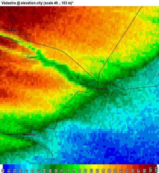
Below is the Elevation map of Vădastra, which displays elevation range with different colors. Scale of the first map is from 49 to 103 m (161 to 338 ft) with average elevation of 74.4 meters (=244 ft) [note 1]
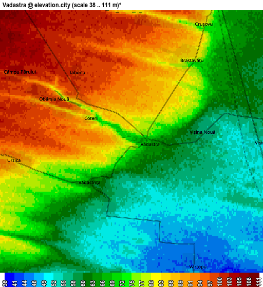
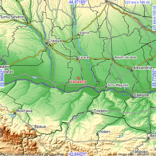
These maps also provides idea of topography and contour of this city, they are displayed at different zoom levels. More info about maps, scale and edge coordinates you can find below images.
| \ | Map #1 | Map #2 | Topo.Map |
| Scale [m] | 49..103 m | 38..111 m | × |
| Scale [ft] | 161..338 ft | 125..364 ft | × |
| Average | 74.4 m = 244 ft | 72.8 m = 239 ft | × |
| Width | 7.05 km = 4.4 mi | 14.09 km = 8.8 mi | 225.5 km = 140.1 mi |
| Height | 7.05 km = 4.4 mi | 14.09 km = 8.8 mi | 225.4 km = 140.1 mi |
| ↑Max Latitude | 43.898344° | 43.930001° | 44.87189° |
| Latitude at center | 43.86667° | 43.86667° | 43.86667° |
| ↓Min Latitude | 43.834979° | 43.803271° | 42.84421° |
| ← Min Longitude | 24.322725° | 24.278779° | 22.96042° |
| Longitude center | 24.36667° | 24.36667° | 24.36667° |
| →Max Longitude | 24.410615° | 24.454561° | 25.77292° |
Nearby cities:
Cities around Vădastra sort by population:
• Studina elevation 89 m
11.8 km,  19°
19°
• Orlea 27 m
13 km,  174°
174°
• Brastavățu 82 m
5.5 km,  36°
36°
• Vădăstriţa 72 m
3.3 km,  235°
235°
• Vişina 53 m
6.7 km,  90°
90°
• Vișina Nouă 55 m
4.2 km,  78°
78°
• Gura Padinii 35 m
12.8 km,  198°
198°
• Crușovu 86 m
7.5 km,  30°
30°
• Urzica 86 m
6.3 km,  259°
259°
• Orlea Nouă 43 m
12.4 km,  183°
183°
• Stăvaru 95 m
8.6 km,  268°
268°
• Obârşia 78 m
3.3 km,  304°
304°
Multilingual:
 En español:
Vădastra elevación 67 m.
 En France:
Vădastra élévation 67 m.


Sources and notes:
- [note 1] Map square and city borders are not equal. Map elevation data is calculated only from area inside that square.
- [src 1] Elevation data from geonames database provided with same terms of usage.
- [src 2] The elevation map of Vădastra is generated using elevation data from NASA's 3 arcsec (90m) resolution SRTM data.
- [src 3] Base (background) map © OpenStreetMap contributors tiles are generated by Geofabrik and OpenTopoMap.
Copyright & License:
This Vădastra Elevation Map is licensed under CC BY-SA. You may reuse any part from this page, if you give a proper credit by linking to this URL:
 More info on terms of use page.