Vama elevation
Vama (Satu Mare, Comuna Vama), Romania elevation is 236 meters and Vama elevation in feet is 774 ft above sea level [src 1]. Vama is a seat of a second-order administrative division (feature code) with elevation that is 16 meters (52 ft) smaller than average city elevation in Romania.
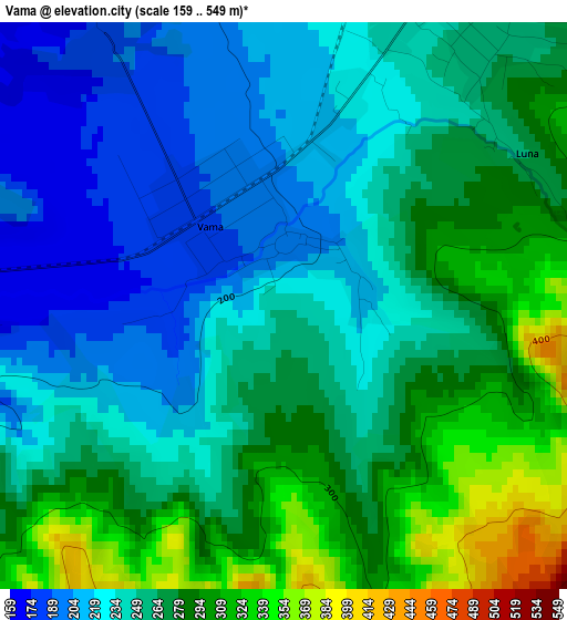
Below is the Elevation map of Vama, which displays elevation range with different colors. Scale of the first map is from 159 to 549 m (522 to 1801 ft) with average elevation of 256.1 meters (=840 ft) [note 1]
These maps also provides idea of topography and contour of this city, they are displayed at different zoom levels. More info about maps, scale and edge coordinates you can find below images.
| \ | Map #1 | Map #2 | Topo.Map |
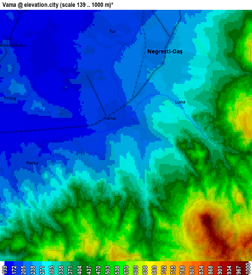
| Scale [m] | 159..549 m | 139..1000 m | × |
| Scale [ft] | 522..1801 ft | 456..3281 ft | × |
| Average | 256.1 m = 840 ft | 339 m = 1112 ft | × |
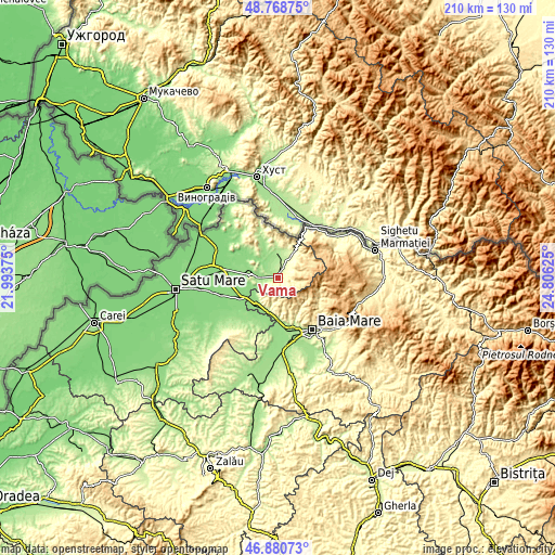
| Width | 6.56 km = 4.1 mi | 13.12 km = 8.2 mi | 209.9 km = 130.4 mi |
| Height | 6.56 km = 4.1 mi | 13.12 km = 8.2 mi | 209.9 km = 130.4 mi |
| ↑Max Latitude | 47.862822° | 47.892297° | 48.76875° |
| Latitude at center | 47.83333° | 47.83333° | 47.83333° |
| ↓Min Latitude | 47.803822° | 47.774296° | 46.88073° |
| ← Min Longitude | 23.356055° | 23.312109° | 21.99375° |
| Longitude center | 23.4° | 23.4° | 23.4° |
| →Max Longitude | 23.443945° | 23.487891° | 24.80625° |
Nearby cities:
Cities around Vama sort by population:
• Negreşti-Oaş elevation 253 m
4.5 km,  33°
33°
• Seini 140 m
12.7 km,  223°
223°
• Bixad 192 m
11.1 km,  0°
0°
• Oraşu Nou 186 m
8.7 km,  270°
270°
• Certeze 272 m
8.9 km, 33°
• Călineşti-Oaş 143 m
10.5 km,  314°
314°
• Tur 186 m
5.5 km,  352°
352°
• Boinești 171 m
9.9 km,  338°
338°
• Trip 172 m
10.3 km, 350°
• Moișeni 264 m
11.7 km, 25°
• Huta Certeze 287 m
12.2 km, 32°
• Racşa 184 m
5.2 km,  254°
254°
Multilingual:
 En español:
Vama elevación 236 m.
 En France:
Vama élévation 236 m.


Sources and notes:
- [note 1] Map square and city borders are not equal. Map elevation data is calculated only from area inside that square.
- [src 1] Elevation data from geonames database provided with same terms of usage.
- [src 2] The elevation map of Vama is generated using elevation data from NASA's 3 arcsec (90m) resolution SRTM data.
- [src 3] Base (background) map © OpenStreetMap contributors tiles are generated by Geofabrik and OpenTopoMap.
Copyright & License:
This Vama Elevation Map is licensed under CC BY-SA. You may reuse any part from this page, if you give a proper credit by linking to this URL:
 More info on terms of use page.