Voila elevation
Voila (Braşov, Comuna Voila), Romania elevation is 421 meters and Voila elevation in feet is 1381 ft above sea level [src 1]. Voila is a seat of a second-order administrative division (feature code) with elevation that is 169 meters (554 ft) bigger than average city elevation in Romania.
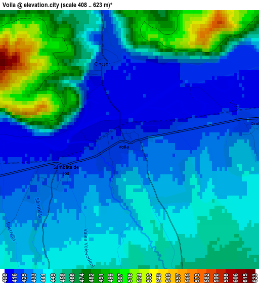
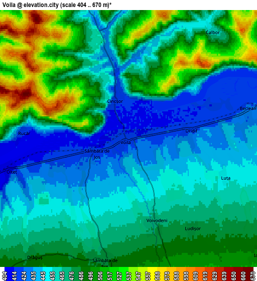
Below is the Elevation map of Voila, which displays elevation range with different colors. Scale of the first map is from 408 to 623 m (1339 to 2044 ft) with average elevation of 448.1 meters (=1470 ft) [note 1]
These maps also provides idea of topography and contour of this city, they are displayed at different zoom levels. More info about maps, scale and edge coordinates you can find below images.
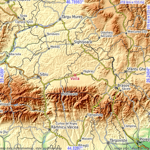
| \ | Map #1 | Map #2 | Topo.Map |
| Scale [m] | 408..623 m | 404..670 m | × |
| Scale [ft] | 1339..2044 ft | 1325..2198 ft | × |
| Average | 448.1 m = 1470 ft | 474.8 m = 1558 ft | × |
| Width | 6.81 km = 4.2 mi | 13.62 km = 8.5 mi | 217.9 km = 135.4 mi |
| Height | 6.81 km = 4.2 mi | 13.62 km = 8.5 mi | 217.9 km = 135.4 mi |
| ↑Max Latitude | 45.849009° | 45.87961° | 46.78983° |
| Latitude at center | 45.81839° | 45.81839° | 45.81839° |
| ↓Min Latitude | 45.787755° | 45.757102° | 44.8297° |
| ← Min Longitude | 24.798205° | 24.754259° | 23.4359° |
| Longitude center | 24.84215° | 24.84215° | 24.84215° |
| →Max Longitude | 24.886095° | 24.930041° | 26.2484° |
Nearby cities:
Cities around Voila sort by population:
• Făgăraș elevation 420 m
10.3 km,  69°
69°
• Recea 592 m
13.6 km,  149°
149°
• Ucea de Sus 492 m
14.5 km,  238°
238°
• Şoarş 481 m
14 km,  28°
28°
• Cincu 474 m
11.4 km,  343°
343°
• Lisa 566 m
11.3 km,  176°
176°
• Beclean 426 m
6.3 km,  77°
77°
• Sâmbăta de Sus 481 m
6.5 km,  194°
194°
• Drăguș 488 m
8 km,  217°
217°
• Ucea de Jos 428 m
13.8 km,  253°
253°
• Bruiu 469 m
12.2 km,  295°
295°
• Viștea de Jos 421 m
9.5 km, 254°
Multilingual:
 En español:
Voila elevación 421 m.
 En France:
Voila élévation 421 m.


Sources and notes:
- [note 1] Map square and city borders are not equal. Map elevation data is calculated only from area inside that square.
- [src 1] Elevation data from geonames database provided with same terms of usage.
- [src 2] The elevation map of Voila is generated using elevation data from NASA's 3 arcsec (90m) resolution SRTM data.
- [src 3] Base (background) map © OpenStreetMap contributors tiles are generated by Geofabrik and OpenTopoMap.
Copyright & License:
This Voila Elevation Map is licensed under CC BY-SA. You may reuse any part from this page, if you give a proper credit by linking to this URL:
 More info on terms of use page.