Fram elevation
Fram (Itapúa, La Paz), Paraguay elevation is 226 meters and Fram elevation in feet is 741 ft above sea level [src 1]. Fram is a populated place (feature code) with elevation that is 52 meters (171 ft) bigger than average city elevation in Paraguay.
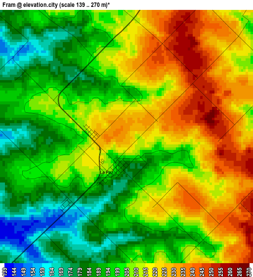
Below is the Elevation map of Fram, which displays elevation range with different colors. Scale of the first map is from 139 to 270 m (456 to 886 ft) with average elevation of 206 meters (=676 ft) [note 1]
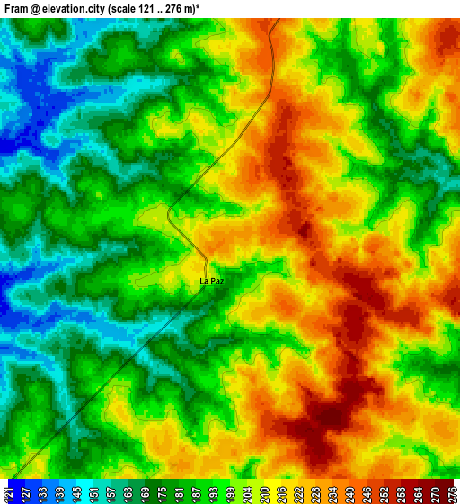
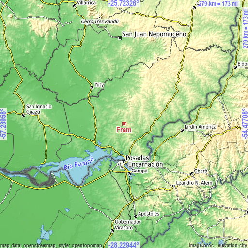
These maps also provides idea of topography and contour of this city, they are displayed at different zoom levels. More info about maps, scale and edge coordinates you can find below images.
| \ | Map #1 | Map #2 | Topo.Map |
| Scale [m] | 139..270 m | 121..276 m | × |
| Scale [ft] | 456..886 ft | 397..906 ft | × |
| Average | 206 m = 676 ft | 197.9 m = 649 ft | × |
| Width | 8.71 km = 5.4 mi | 17.42 km = 10.8 mi | 278.7 km = 173.2 mi |
| Height | 8.71 km = 5.4 mi | 17.42 km = 10.8 mi | 278.7 km = 173.2 mi |
| ↑Max Latitude | -26.944162° | -26.90498° | -25.72326° |
| Latitude at center | -26.98333° | -26.98333° | -26.98333° |
| ↓Min Latitude | -27.022485° | -27.061625° | -28.22944° |
| ← Min Longitude | -55.927275° | -55.971221° | -57.28958° |
| Longitude center | -55.88333° | -55.88333° | -55.88333° |
| →Max Longitude | -55.839385° | -55.795439° | -54.47708° |
Nearby cities:
Cities around Fram sort by population:
• Encarnación elevation 119 m
38.6 km,  177°
177°
• Obligado 188 m
25.4 km,  102°
102°
• San Pedro del Paraná 147 m
36.1 km,  297°
297°
• Hohenau 202 m
25.9 km,  112°
112°
• Carmen del Paraná 100 m
37.6 km,  225°
225°
• General Artigas 139 m
34 km,  279°
279°
• Trinidad 184 m
17.8 km,  146°
146°
• Jesús 217 m
16.2 km,  119°
119°
• Capitán Miranda 203 m
25.5 km,  161°
161°
• Bella Vista 145 m
33.8 km, 102°
• Pirapó 153 m
36.4 km,  67°
67°
• San Juan del Paraná 116 m
36.3 km,  192°
192°
Multilingual:
 En español:
Fram elevación 226 m.
 En France:
Fram élévation 226 m.


Sources and notes:
- [note 1] Map square and city borders are not equal. Map elevation data is calculated only from area inside that square.
- [src 1] Elevation data from geonames database provided with same terms of usage.
- [src 2] The elevation map of Fram is generated using elevation data from NASA's 3 arcsec (90m) resolution SRTM data.
- [src 3] Base (background) map © OpenStreetMap contributors tiles are generated by Geofabrik and OpenTopoMap.
Copyright & License:
This Fram Elevation Map is licensed under CC BY-SA. You may reuse any part from this page, if you give a proper credit by linking to this URL:
 More info on terms of use page.