Lagoa elevation
Lagoa (Azores), Portugal elevation is 41 meters and Lagoa elevation in feet is 135 ft above sea level [src 1]. Lagoa is a populated place (feature code) with elevation that is 127 meters (417 ft) smaller than average city elevation in Portugal.
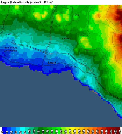
Below is the Elevation map of Lagoa, which displays elevation range with different colors. Scale of the first map is from -5 to 471 m (-16 to 1545 ft) with average elevation of 157.8 meters (=518 ft) [note 1]
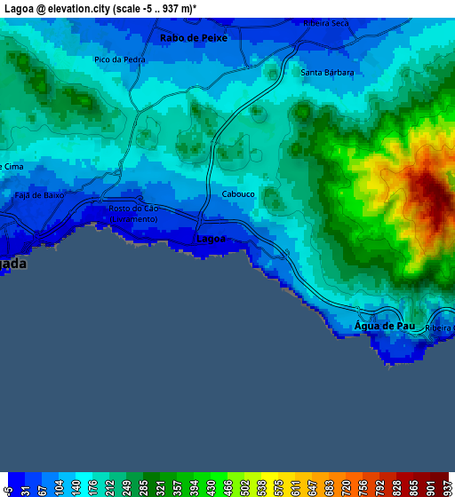
These maps also provides idea of topography and contour of this city, they are displayed at different zoom levels. More info about maps, scale and edge coordinates you can find below images.
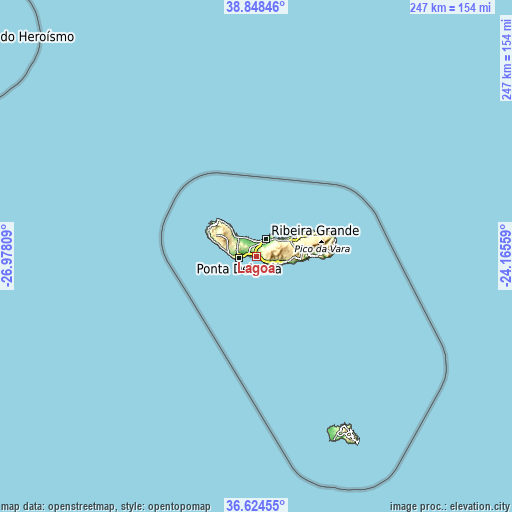
| \ | Map #1 | Map #2 | Topo.Map |
| Scale [m] | -5..471 m | -5..937 m | × |
| Scale [ft] | -16..1545 ft | -16..3074 ft | × |
| Average | 157.8 m = 518 ft | 204.4 m = 671 ft | × |
| Width | 7.73 km = 4.8 mi | 15.46 km = 9.6 mi | 247.3 km = 153.7 mi |
| Height | 7.73 km = 4.8 mi | 15.46 km = 9.6 mi | 247.3 km = 153.7 mi |
| ↑Max Latitude | 37.779601° | 37.814326° | 38.84846° |
| Latitude at center | 37.74486° | 37.74486° | 37.74486° |
| ↓Min Latitude | 37.710102° | 37.675328° | 36.62455° |
| ← Min Longitude | -25.615785° | -25.659731° | -26.97809° |
| Longitude center | -25.57184° | -25.57184° | -25.57184° |
| →Max Longitude | -25.527895° | -25.483949° | -24.16559° |
Nearby cities:
Cities around Lagoa sort by population:
• Ponta Delgada elevation 1 m
8.5 km,  266°
266°
• Rosto de Cão 37 m
6.9 km, 274°
• Rabo de Peixe 1 m
7.3 km,  352°
352°
• Arrifes 193 m
11.5 km,  282°
282°
• São Roque 1 m
6.2 km, 279°
• Fajã de Baixo 37 m
6.9 km, 274°
• Ribeira Grande 4 m
9.6 km,  27°
27°
• Água de Pau 132 m
5.9 km,  116°
116°
• Ribeira Seca 27 m
8.7 km,  22°
22°
• São Vicente 9 m
11.6 km,  314°
314°
• Fenais da Luz 2 m
10.8 km,  325°
325°
• Cabouco 184 m
2.5 km,  10°
10°
Multilingual:
 En español:
Lagoa elevación 41 m.
 En France:
Lagoa élévation 41 m.


Sources and notes:
- [note 1] Map square and city borders are not equal. Map elevation data is calculated only from area inside that square.
- [src 1] Elevation data from geonames database provided with same terms of usage.
- [src 2] The elevation map of Lagoa is generated using elevation data from NASA's 3 arcsec (90m) resolution SRTM data.
- [src 3] Base (background) map © OpenStreetMap contributors tiles are generated by Geofabrik and OpenTopoMap.
Copyright & License:
This Lagoa Elevation Map is licensed under CC BY-SA. You may reuse any part from this page, if you give a proper credit by linking to this URL:
 More info on terms of use page.