Aveleda elevation
Aveleda (Braga), Portugal elevation is 152 meters and Aveleda elevation in feet is 499 ft above sea level [src 1]. Aveleda is a populated place (feature code) with elevation that is 16 meters (52 ft) smaller than average city elevation in Portugal.
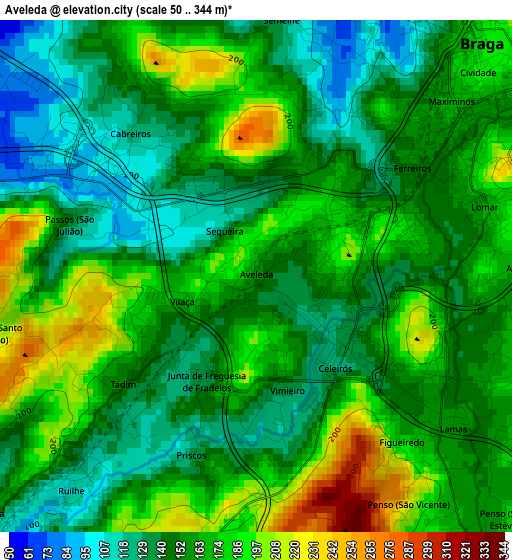
Below is the Elevation map of Aveleda, which displays elevation range with different colors. Scale of the first map is from 50 to 344 m (164 to 1129 ft) with average elevation of 159.6 meters (=524 ft) [note 1]
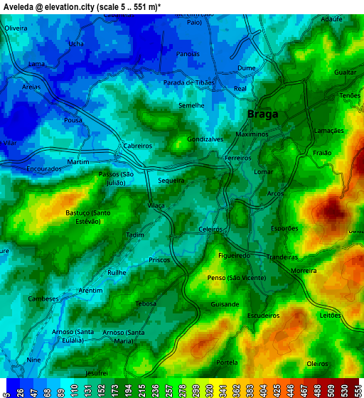
These maps also provides idea of topography and contour of this city, they are displayed at different zoom levels. More info about maps, scale and edge coordinates you can find below images.
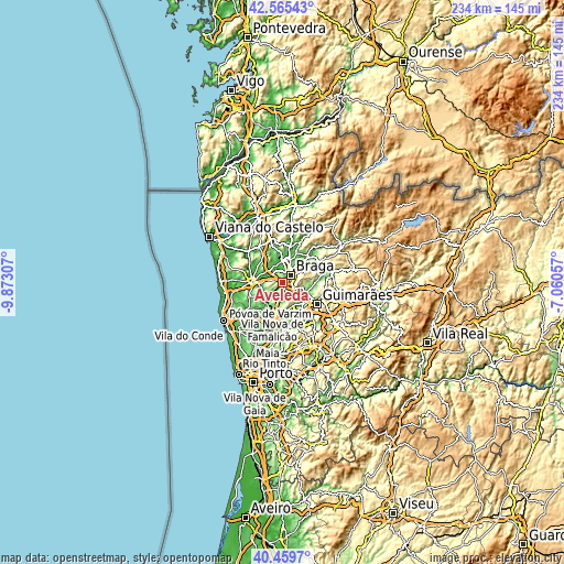
| \ | Map #1 | Map #2 | Topo.Map |
| Scale [m] | 50..344 m | 5..551 m | × |
| Scale [ft] | 164..1129 ft | 16..1808 ft | × |
| Average | 159.6 m = 524 ft | 176.8 m = 580 ft | × |
| Width | 7.32 km = 4.5 mi | 14.63 km = 9.1 mi | 234.1 km = 145.5 mi |
| Height | 7.32 km = 4.5 mi | 14.63 km = 9.1 mi | 234.1 km = 145.5 mi |
| ↑Max Latitude | 41.554024° | 41.586901° | 42.56543° |
| Latitude at center | 41.52113° | 41.52113° | 41.52113° |
| ↓Min Latitude | 41.488219° | 41.455292° | 40.4597° |
| ← Min Longitude | -8.510765° | -8.554711° | -9.87307° |
| Longitude center | -8.46682° | -8.46682° | -8.46682° |
| →Max Longitude | -8.422875° | -8.378929° | -7.06057° |
Nearby cities:
Cities around Aveleda sort by population:
• Braga elevation 188 m
5.1 km,  50°
50°
• Real 74 m
4.6 km,  25°
25°
• Semelhe 126 m
3.7 km,  5°
5°
• Gondizalves 109 m
2.5 km,  22°
22°
• Arcos 167 m
3.8 km,  88°
88°
• Oliveira 184 m
4.8 km,  182°
182°
• Merelim 57 m
7.2 km,  0°
0°
• Frossos 56 m
5.1 km, 14°
• Esporões 221 m
4.3 km,  106°
106°
• Vilaça 168 m
1.4 km,  255°
255°
• Tebosa 173 m
4.5 km,  198°
198°
• Guisande 238 m
4.6 km,  157°
157°
Multilingual:
 En español:
Aveleda elevación 152 m.
 En France:
Aveleda élévation 152 m.


Sources and notes:
- [note 1] Map square and city borders are not equal. Map elevation data is calculated only from area inside that square.
- [src 1] Elevation data from geonames database provided with same terms of usage.
- [src 2] The elevation map of Aveleda is generated using elevation data from NASA's 3 arcsec (90m) resolution SRTM data.
- [src 3] Base (background) map © OpenStreetMap contributors tiles are generated by Geofabrik and OpenTopoMap.
Copyright & License:
This Aveleda Elevation Map is licensed under CC BY-SA. You may reuse any part from this page, if you give a proper credit by linking to this URL:
 More info on terms of use page.