Azenha elevation
Azenha (Porto, Vila Nova de Gaia), Portugal elevation is 74 meters and Azenha elevation in feet is 243 ft above sea level [src 1]. Azenha is a populated place (feature code) with elevation that is 94 meters (308 ft) smaller than average city elevation in Portugal.
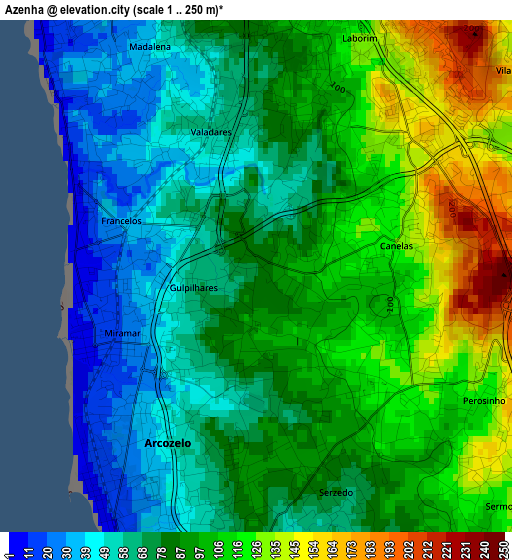
Below is the Elevation map of Azenha, which displays elevation range with different colors. Scale of the first map is from 1 to 250 m (3 to 820 ft) with average elevation of 87.6 meters (=287 ft) [note 1]
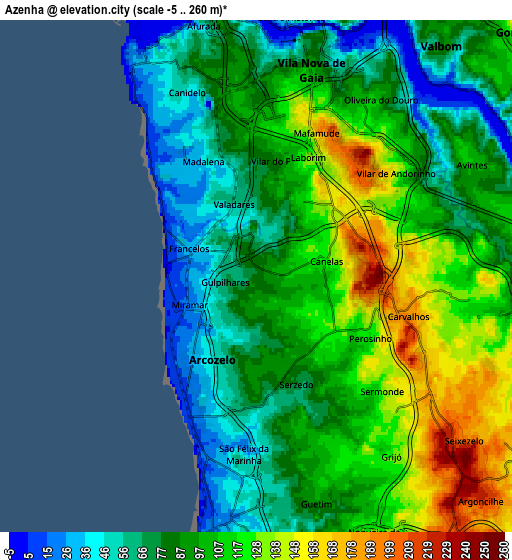
These maps also provides idea of topography and contour of this city, they are displayed at different zoom levels. More info about maps, scale and edge coordinates you can find below images.
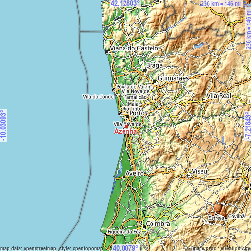
| \ | Map #1 | Map #2 | Topo.Map |
| Scale [m] | 1..250 m | -5..260 m | × |
| Scale [ft] | 3..820 ft | -16..853 ft | × |
| Average | 87.6 m = 287 ft | 95.5 m = 313 ft | × |
| Width | 7.37 km = 4.6 mi | 14.73 km = 9.2 mi | 235.7 km = 146.5 mi |
| Height | 7.37 km = 4.6 mi | 14.73 km = 9.2 mi | 235.7 km = 146.5 mi |
| ↑Max Latitude | 41.109629° | 41.142731° | 42.12803° |
| Latitude at center | 41.07651° | 41.07651° | 41.07651° |
| ↓Min Latitude | 41.043374° | 41.010222° | 40.0079° |
| ← Min Longitude | -8.668625° | -8.712571° | -10.03093° |
| Longitude center | -8.62468° | -8.62468° | -8.62468° |
| →Max Longitude | -8.580735° | -8.536789° | -7.21843° |
Nearby cities:
Cities around Azenha sort by population:
• Vila Nova de Gaia elevation 122 m
5.4 km,  11°
11°
• Canidelo 83 m
5.5 km,  340°
340°
• Vilar de Andorinho 145 m
4.6 km,  44°
44°
• Vilar do Paraíso 67 m
1.5 km, 11°
• Arcozelo 54 m
1.7 km,  200°
200°
• Canelas 128 m
2.2 km,  69°
69°
• São Félix da Marinha 62 m
4.6 km,  177°
177°
• Gulpilhares 83 m
0.7 km,  346°
346°
• Serzedo 89 m
2.9 km,  165°
165°
• Perozinho 137 m
3.5 km,  110°
110°
• Vila Nova da Telha 41 m
1.5 km,  249°
249°
• Sermonde 117 m
4.7 km,  134°
134°
Multilingual:
 En español:
Azenha elevación 74 m.
 En France:
Azenha élévation 74 m.


Sources and notes:
- [note 1] Map square and city borders are not equal. Map elevation data is calculated only from area inside that square.
- [src 1] Elevation data from geonames database provided with same terms of usage.
- [src 2] The elevation map of Azenha is generated using elevation data from NASA's 3 arcsec (90m) resolution SRTM data.
- [src 3] Base (background) map © OpenStreetMap contributors tiles are generated by Geofabrik and OpenTopoMap.
Copyright & License:
This Azenha Elevation Map is licensed under CC BY-SA. You may reuse any part from this page, if you give a proper credit by linking to this URL:
 More info on terms of use page.