Lavra elevation
Lavra (Porto, Matosinhos), Portugal elevation is 15 meters and Lavra elevation in feet is 49 ft above sea level [src 1]. Lavra is a populated place (feature code) with elevation that is 153 meters (502 ft) smaller than average city elevation in Portugal.
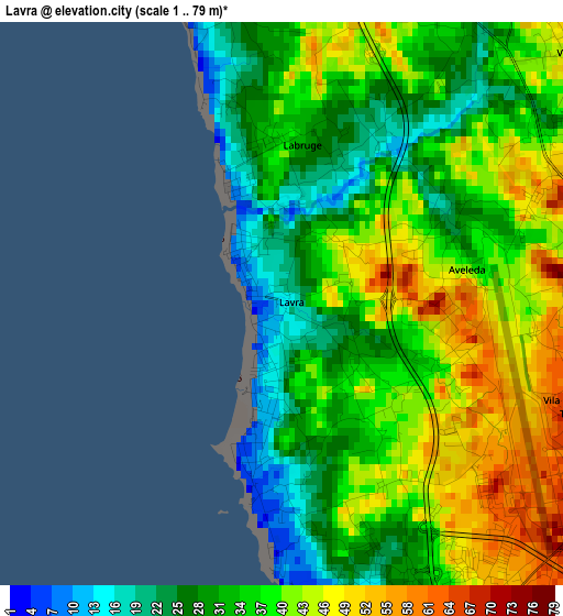
Below is the Elevation map of Lavra, which displays elevation range with different colors. Scale of the first map is from 1 to 79 m (3 to 259 ft) with average elevation of 36 meters (=118 ft) [note 1]
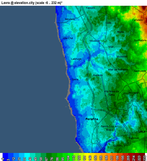
These maps also provides idea of topography and contour of this city, they are displayed at different zoom levels. More info about maps, scale and edge coordinates you can find below images.
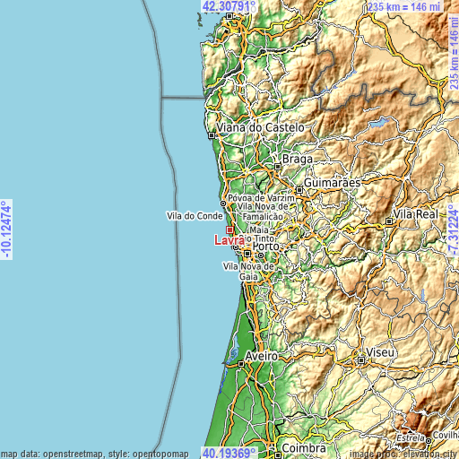
| \ | Map #1 | Map #2 | Topo.Map |
| Scale [m] | 1..79 m | -6..232 m | × |
| Scale [ft] | 3..259 ft | -20..761 ft | × |
| Average | 36 m = 118 ft | 56.9 m = 187 ft | × |
| Width | 7.35 km = 4.6 mi | 14.69 km = 9.1 mi | 235.1 km = 146.1 mi |
| Height | 7.35 km = 4.6 mi | 14.69 km = 9.1 mi | 235.1 km = 146.1 mi |
| ↑Max Latitude | 41.292377° | 41.325387° | 42.30791° |
| Latitude at center | 41.25935° | 41.25935° | 41.25935° |
| ↓Min Latitude | 41.226307° | 41.193246° | 40.19369° |
| ← Min Longitude | -8.762435° | -8.806381° | -10.12474° |
| Longitude center | -8.71849° | -8.71849° | -8.71849° |
| →Max Longitude | -8.674545° | -8.630599° | -7.31224° |
Nearby cities:
Cities around Lavra sort by population:
• Maia elevation 93 m
8.7 km,  107°
107°
• Matosinhos 17 m
8.9 km,  164°
164°
• Leça da Palmeira 18 m
7.8 km,  168°
168°
• Leça do Bailio 84 m
8.8 km,  126°
126°
• Moreira 82 m
6 km,  102°
102°
• Anta 121 m
7.6 km,  84°
84°
• Guifões 80 m
8 km,  148°
148°
• Santa Cruz do Bispo 58 m
6.2 km,  143°
143°
• Gemunde 92 m
6.2 km, 81°
• Árvore 36 m
8.9 km,  0°
0°
• Mindelo 30 m
6.2 km,  357°
357°
• Vairão 69 m
9.3 km,  27°
27°
Multilingual:
 En español:
Lavra elevación 15 m.
 En France:
Lavra élévation 15 m.


Sources and notes:
- [note 1] Map square and city borders are not equal. Map elevation data is calculated only from area inside that square.
- [src 1] Elevation data from geonames database provided with same terms of usage.
- [src 2] The elevation map of Lavra is generated using elevation data from NASA's 3 arcsec (90m) resolution SRTM data.
- [src 3] Base (background) map © OpenStreetMap contributors tiles are generated by Geofabrik and OpenTopoMap.
Copyright & License:
This Lavra Elevation Map is licensed under CC BY-SA. You may reuse any part from this page, if you give a proper credit by linking to this URL:
 More info on terms of use page.