Póvoa de Lanhoso elevation
Póvoa de Lanhoso (Braga), Portugal elevation is 209 meters and Póvoa de Lanhoso elevation in feet is 686 ft above sea level [src 1]. Póvoa de Lanhoso is a populated place (feature code) with elevation that is 41 meters (135 ft) bigger than average city elevation in Portugal.
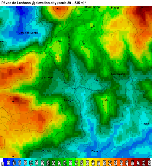
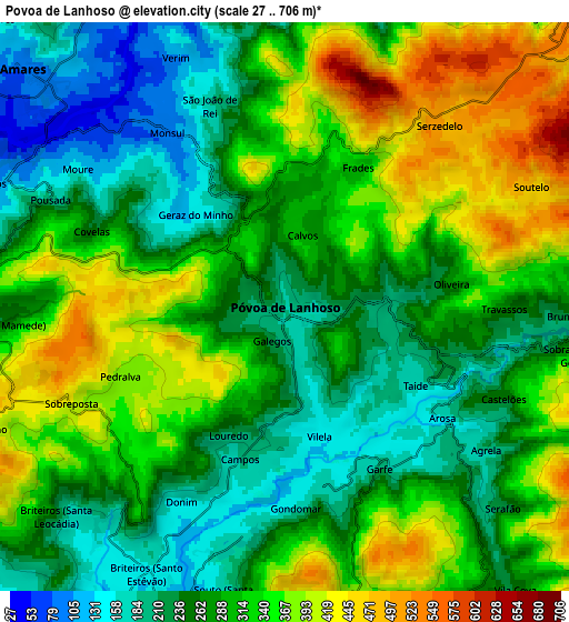
Below is the Elevation map of Póvoa de Lanhoso, which displays elevation range with different colors. Scale of the first map is from 89 to 535 m (292 to 1755 ft) with average elevation of 270.9 meters (=889 ft) [note 1]
These maps also provides idea of topography and contour of this city, they are displayed at different zoom levels. More info about maps, scale and edge coordinates you can find below images.
| \ | Map #1 | Map #2 | Topo.Map |
| Scale [m] | 89..535 m | 27..706 m | × |
| Scale [ft] | 292..1755 ft | 89..2316 ft | × |
| Average | 270.9 m = 889 ft | 299.2 m = 982 ft | × |
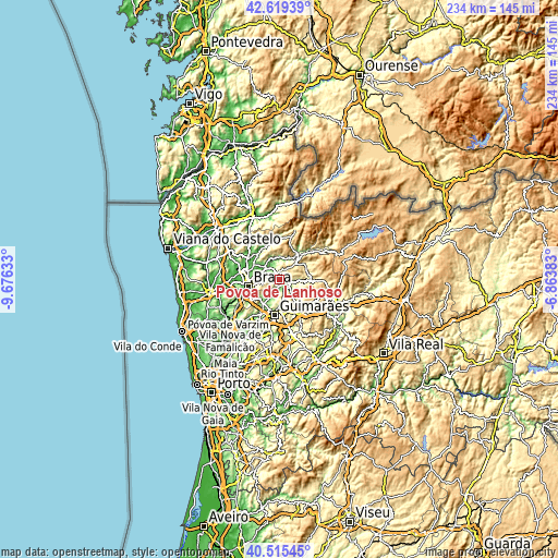
| Width | 7.31 km = 4.5 mi | 14.62 km = 9.1 mi | 233.9 km = 145.3 mi |
| Height | 7.31 km = 4.5 mi | 14.62 km = 9.1 mi | 233.9 km = 145.3 mi |
| ↑Max Latitude | 41.608856° | 41.641705° | 42.61939° |
| Latitude at center | 41.57599° | 41.57599° | 41.57599° |
| ↓Min Latitude | 41.543107° | 41.510208° | 40.51545° |
| ← Min Longitude | -8.314025° | -8.357971° | -9.67633° |
| Longitude center | -8.27008° | -8.27008° | -8.27008° |
| →Max Longitude | -8.226135° | -8.182189° | -6.86383° |
Nearby cities:
Cities around Póvoa de Lanhoso sort by population:
• Braga elevation 188 m
12.8 km,  257°
257°
• Ponte 133 m
12.7 km,  203°
203°
• Arcos 167 m
14 km,  244°
244°
• Caldelas 78 m
14 km,  318°
318°
• Caldas das Taipas 131 m
12.1 km,  212°
212°
• Arões 367 m
14.2 km,  160°
160°
• Adaúfe 115 m
10.7 km,  276°
276°
• Ferreiros 110 m
9.9 km,  308°
308°
• Lago 72 m
12.9 km,  293°
293°
• Vieira do Minho 396 m
12.4 km,  59°
59°
• Rendufe 87 m
12.9 km,  297°
297°
• Amares 92 m
9.1 km, 312°
Multilingual:
 En español:
Póvoa de Lanhoso elevación 209 m.
 En France:
Póvoa de Lanhoso élévation 209 m.
 Auf Deutsch:
Póvoa de Lanhoso höhe über dem Meeresspiegel ist 209 m.

Sources and notes:
- [note 1] Map square and city borders are not equal. Map elevation data is calculated only from area inside that square.
- [src 1] Elevation data from geonames database provided with same terms of usage.
- [src 2] The elevation map of Póvoa de Lanhoso is generated using elevation data from NASA's 3 arcsec (90m) resolution SRTM data.
- [src 3] Base (background) map © OpenStreetMap contributors tiles are generated by Geofabrik and OpenTopoMap.
Copyright & License:
This Póvoa de Lanhoso Elevation Map is licensed under CC BY-SA. You may reuse any part from this page, if you give a proper credit by linking to this URL:
 More info on terms of use page.