Tábua elevation
Tábua (Coimbra), Portugal elevation is 239 meters and Tábua elevation in feet is 784 ft above sea level [src 1]. Tábua is a seat of a second-order administrative division (feature code) with elevation that is 71 meters (233 ft) bigger than average city elevation in Portugal.
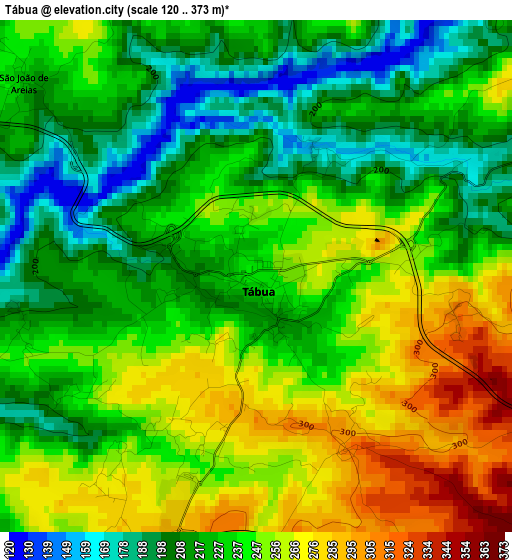
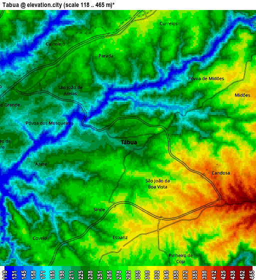
Below is the Elevation map of Tábua, which displays elevation range with different colors. Scale of the first map is from 120 to 373 m (394 to 1224 ft) with average elevation of 235.5 meters (=773 ft) [note 1]
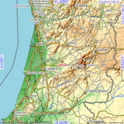
These maps also provides idea of topography and contour of this city, they are displayed at different zoom levels. More info about maps, scale and edge coordinates you can find below images.
| \ | Map #1 | Map #2 | Topo.Map |
| Scale [m] | 120..373 m | 118..465 m | × |
| Scale [ft] | 394..1224 ft | 387..1526 ft | × |
| Average | 235.5 m = 773 ft | 254.3 m = 834 ft | × |
| Width | 7.45 km = 4.6 mi | 14.89 km = 9.3 mi | 238.3 km = 148.1 mi |
| Height | 7.45 km = 4.6 mi | 14.89 km = 9.3 mi | 238.3 km = 148.1 mi |
| ↑Max Latitude | 40.395547° | 40.429007° | 41.42505° |
| Latitude at center | 40.36207° | 40.36207° | 40.36207° |
| ↓Min Latitude | 40.328577° | 40.295067° | 39.28206° |
| ← Min Longitude | -8.073305° | -8.117251° | -9.43561° |
| Longitude center | -8.02936° | -8.02936° | -8.02936° |
| →Max Longitude | -7.985415° | -7.941469° | -6.62311° |
Nearby cities:
Cities around Tábua sort by population:
• Santa Comba Dão elevation 192 m
9.6 km,  295°
295°
• Tondela 305 m
17.8 km,  345°
345°
• Carregal do Sal 307 m
8.3 km,  17°
17°
• Oliveira do Hospital 508 m
14.3 km,  90°
90°
• Arganil 175 m
16.1 km,  187°
187°
• São João de Areias 214 m
4.3 km,  310°
310°
• São Pedro de Alva 198 m
13.5 km,  239°
239°
• Cabanas de Viriato 294 m
13.6 km, 20°
• Treixedo 255 m
9.6 km,  324°
324°
• Oliveira do Mondego 101 m
17 km,  255°
255°
• Travanca 194 m
14 km,  252°
252°
• Mortágua 100 m
17.6 km,  282°
282°
Multilingual:
 En español:
Tábua elevación 239 m.
 En France:
Tábua élévation 239 m.


Sources and notes:
- [note 1] Map square and city borders are not equal. Map elevation data is calculated only from area inside that square.
- [src 1] Elevation data from geonames database provided with same terms of usage.
- [src 2] The elevation map of Tábua is generated using elevation data from NASA's 3 arcsec (90m) resolution SRTM data.
- [src 3] Base (background) map © OpenStreetMap contributors tiles are generated by Geofabrik and OpenTopoMap.
Copyright & License:
This Tábua Elevation Map is licensed under CC BY-SA. You may reuse any part from this page, if you give a proper credit by linking to this URL:
 More info on terms of use page.