Valbom elevation
Valbom (Porto, Gondomar), Portugal elevation is 45 meters and Valbom elevation in feet is 148 ft above sea level [src 1]. Valbom is a populated place (feature code) with elevation that is 123 meters (404 ft) smaller than average city elevation in Portugal.
Below is the Elevation map of Valbom, which displays elevation range with different colors. Scale of the first map is from -4 to 235 m (-13 to 771 ft) with average elevation of 85.5 meters (=281 ft) [note 1]
These maps also provides idea of topography and contour of this city, they are displayed at different zoom levels. More info about maps, scale and edge coordinates you can find below images.
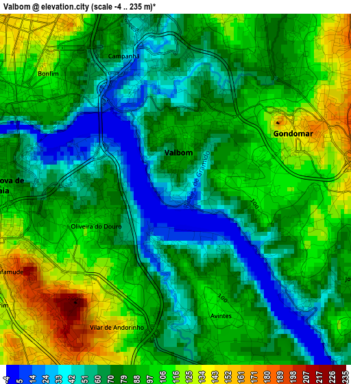
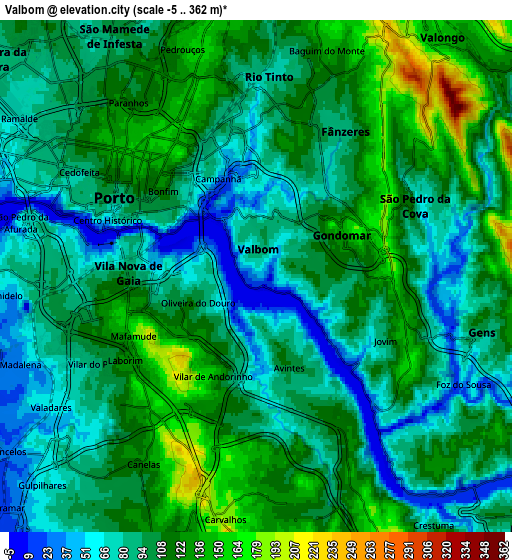
| \ | Map #1 | Map #2 | Topo.Map |
| Scale [m] | -4..235 m | -5..362 m | × |
| Scale [ft] | -13..771 ft | -16..1188 ft | × |
| Average | 85.5 m = 281 ft | 100.2 m = 329 ft | × |
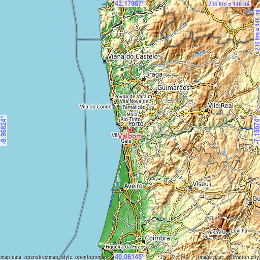
| Width | 7.36 km = 4.6 mi | 14.72 km = 9.1 mi | 235.5 km = 146.3 mi |
| Height | 7.36 km = 4.6 mi | 14.72 km = 9.1 mi | 235.5 km = 146.3 mi |
| ↑Max Latitude | 41.162302° | 41.195378° | 42.17987° |
| Latitude at center | 41.12921° | 41.12921° | 41.12921° |
| ↓Min Latitude | 41.096101° | 41.062975° | 40.06145° |
| ← Min Longitude | -8.605935° | -8.649881° | -9.96824° |
| Longitude center | -8.56199° | -8.56199° | -8.56199° |
| →Max Longitude | -8.518045° | -8.474099° | -7.15574° |
Nearby cities:
Cities around Valbom sort by population:
• Porto elevation 97 m
4.7 km,  298°
298°
• Vila Nova de Gaia 122 m
4.3 km,  262°
262°
• Rio Tinto 88 m
5.5 km,  2°
2°
• Gondomar 116 m
3 km,  55°
55°
• Oliveira do Douro 87 m
2 km, 255°
• Fânzeres 166 m
5 km,  32°
32°
• Vilar de Andorinho 145 m
3.3 km,  217°
217°
• São Pedro da Cova 73 m
5.4 km,  73°
73°
• Canelas 128 m
6 km,  211°
211°
• Avintes 86 m
2.6 km,  159°
159°
• Jovim 87 m
4.1 km,  119°
119°
• Foz do Sousa 48 m
6.2 km,  125°
125°
Multilingual:
 En español:
Valbom elevación 45 m.
 En France:
Valbom élévation 45 m.


Sources and notes:
- [note 1] Map square and city borders are not equal. Map elevation data is calculated only from area inside that square.
- [src 1] Elevation data from geonames database provided with same terms of usage.
- [src 2] The elevation map of Valbom is generated using elevation data from NASA's 3 arcsec (90m) resolution SRTM data.
- [src 3] Base (background) map © OpenStreetMap contributors tiles are generated by Geofabrik and OpenTopoMap.
Copyright & License:
This Valbom Elevation Map is licensed under CC BY-SA. You may reuse any part from this page, if you give a proper credit by linking to this URL:
 More info on terms of use page.