Loulé elevation
Loulé (Faro), Portugal elevation is 186 meters and Loulé elevation in feet is 610 ft above sea level [src 1]. Loulé is a seat of a second-order administrative division (feature code) with elevation that is 18 meters (59 ft) bigger than average city elevation in Portugal.
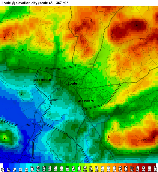
Below is the Elevation map of Loulé, which displays elevation range with different colors. Scale of the first map is from 45 to 367 m (148 to 1204 ft) with average elevation of 190.7 meters (=626 ft) [note 1]
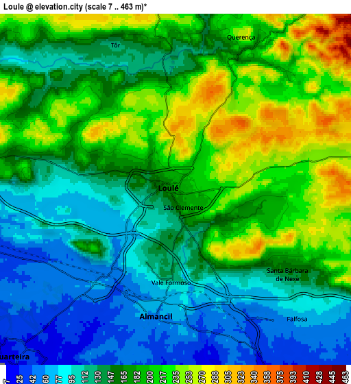
These maps also provides idea of topography and contour of this city, they are displayed at different zoom levels. More info about maps, scale and edge coordinates you can find below images.
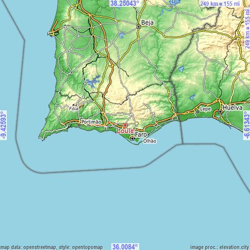
| \ | Map #1 | Map #2 | Topo.Map |
| Scale [m] | 45..367 m | 7..463 m | × |
| Scale [ft] | 148..1204 ft | 23..1519 ft | × |
| Average | 190.7 m = 626 ft | 161.5 m = 530 ft | × |
| Width | 7.79 km = 4.8 mi | 15.58 km = 9.7 mi | 249.3 km = 154.9 mi |
| Height | 7.79 km = 4.8 mi | 15.58 km = 9.7 mi | 249.3 km = 154.9 mi |
| ↑Max Latitude | 37.172745° | 37.207753° | 38.25043° |
| Latitude at center | 37.13772° | 37.13772° | 37.13772° |
| ↓Min Latitude | 37.102679° | 37.067622° | 36.0084° |
| ← Min Longitude | -8.063625° | -8.107571° | -9.42593° |
| Longitude center | -8.01968° | -8.01968° | -8.01968° |
| →Max Longitude | -7.975735° | -7.931789° | -6.61343° |
Nearby cities:
Cities around Loulé sort by population:
• Faro elevation 12 m
15.6 km,  148°
148°
• Olhão 11 m
20 km,  127°
127°
• Quarteira 23 m
10.4 km,  223°
223°
• São Brás de Alportel 254 m
11.8 km,  81°
81°
• Almancil 55 m
5.7 km,  189°
189°
• Ferreiras 80 m
19.3 km,  267°
267°
• Boliqueime 120 m
12.3 km, 269°
• Santa Bárbara de Nexe 162 m
5.9 km, 126°
• Estói 115 m
12.1 km,  113°
113°
• Paderne 57 m
16.8 km,  286°
286°
• Olhos de Água 20 m
16.1 km,  250°
250°
• Vilamoura 16 m
10.3 km,  236°
236°
Multilingual:
 En español:
Loulé elevación 186 m.
 En France:
Loulé élévation 186 m.


Sources and notes:
- [note 1] Map square and city borders are not equal. Map elevation data is calculated only from area inside that square.
- [src 1] Elevation data from geonames database provided with same terms of usage.
- [src 2] The elevation map of Loulé is generated using elevation data from NASA's 3 arcsec (90m) resolution SRTM data.
- [src 3] Base (background) map © OpenStreetMap contributors tiles are generated by Geofabrik and OpenTopoMap.
Copyright & License:
This Loulé Elevation Map is licensed under CC BY-SA. You may reuse any part from this page, if you give a proper credit by linking to this URL:
 More info on terms of use page.