Borzęcin elevation
Borzęcin (Lesser Poland, Powiat brzeski), Poland elevation is 190 meters and Borzęcin elevation in feet is 623 ft above sea level [src 1]. Borzęcin is a seat of a third-order administrative division (feature code) with elevation that is 1 meters (3 ft) smaller than average city elevation in Poland.
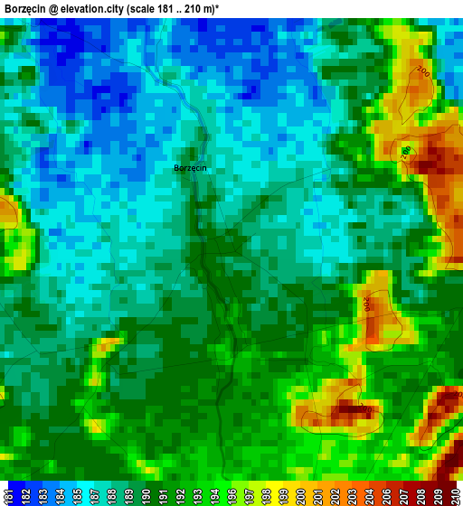
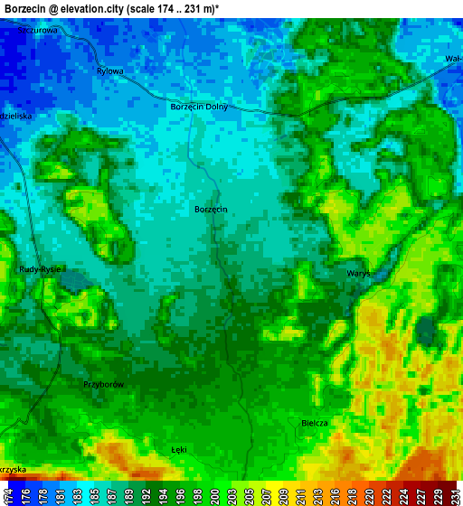
Below is the Elevation map of Borzęcin, which displays elevation range with different colors. Scale of the first map is from 181 to 210 m (594 to 689 ft) with average elevation of 190.1 meters (=624 ft) [note 1]
These maps also provides idea of topography and contour of this city, they are displayed at different zoom levels. More info about maps, scale and edge coordinates you can find below images.
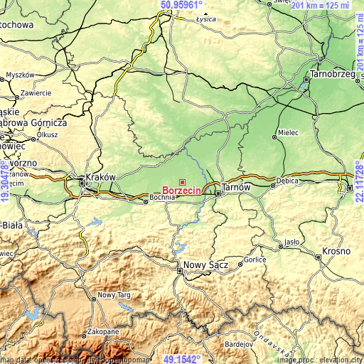
| \ | Map #1 | Map #2 | Topo.Map |
| Scale [m] | 181..210 m | 174..231 m | × |
| Scale [ft] | 594..689 ft | 571..758 ft | × |
| Average | 190.1 m = 624 ft | 192.9 m = 633 ft | × |
| Width | 6.27 km = 3.9 mi | 12.55 km = 7.8 mi | 200.7 km = 124.7 mi |
| Height | 6.27 km = 3.9 mi | 12.55 km = 7.8 mi | 200.7 km = 124.7 mi |
| ↑Max Latitude | 50.093601° | 50.121785° | 50.95961° |
| Latitude at center | 50.0654° | 50.0654° | 50.0654° |
| ↓Min Latitude | 50.037183° | 50.008949° | 49.1542° |
| ← Min Longitude | 20.667085° | 20.623139° | 19.30478° |
| Longitude center | 20.71103° | 20.71103° | 20.71103° |
| →Max Longitude | 20.754975° | 20.798921° | 22.11728° |
Nearby cities:
Cities around Borzęcin sort by population:
• Brzesko elevation 225 m
13.1 km,  215°
215°
• Jadowniki 231 m
12.8 km,  201°
201°
• Wierzchosławice 193 m
11.3 km,  113°
113°
• Radłów 187 m
10.1 km,  78°
78°
• Przyborów 193 m
5.2 km, 221°
• Szczurowa 180 m
8 km,  318°
318°
• Wola Dębińska 210 m
9.4 km,  190°
190°
• Dębno 221 m
11 km,  176°
176°
• Maszkienice 205 m
8.7 km, 191°
• Porąbka Uszewska 231 m
13.7 km, 186°
• Biskupice Radłowskie 181 m
12.2 km,  59°
59°
• Jadowniki Mokre 176 m
11.2 km,  6°
6°
Multilingual:
 En español:
Borzęcin elevación 190 m.
 En France:
Borzęcin élévation 190 m.
 Auf Deutsch:
Borzęcin höhe über dem Meeresspiegel ist 190 m.

Sources and notes:
- [note 1] Map square and city borders are not equal. Map elevation data is calculated only from area inside that square.
- [src 1] Elevation data from geonames database provided with same terms of usage.
- [src 2] The elevation map of Borzęcin is generated using elevation data from NASA's 3 arcsec (90m) resolution SRTM data.
- [src 3] Base (background) map © OpenStreetMap contributors tiles are generated by Geofabrik and OpenTopoMap.
Copyright & License:
This Borzęcin Elevation Map is licensed under CC BY-SA. You may reuse any part from this page, if you give a proper credit by linking to this URL:
 More info on terms of use page.