Długie elevation
Długie (Subcarpathian, Powiat sanocki), Poland elevation is 292 meters and Długie elevation in feet is 958 ft above sea level [src 1]. Długie is a populated place (feature code) with elevation that is 101 meters (331 ft) bigger than average city elevation in Poland.
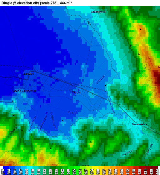
Below is the Elevation map of Długie, which displays elevation range with different colors. Scale of the first map is from 278 to 444 m (912 to 1457 ft) with average elevation of 313.5 meters (=1029 ft) [note 1]
These maps also provides idea of topography and contour of this city, they are displayed at different zoom levels. More info about maps, scale and edge coordinates you can find below images.
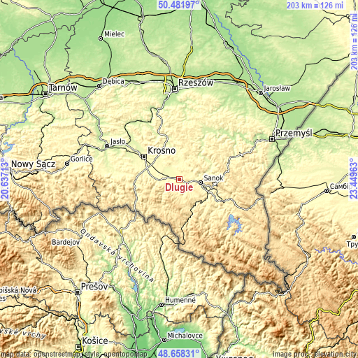
| \ | Map #1 | Topo.Map |
| Scale [m] | 278..444 m | × |
| Scale [ft] | 912..1457 ft | × |
| Average | 313.5 m = 1029 ft | × |
| Width | 6.34 km = 3.9 mi | 202.8 km = 126 mi |
| Height | 6.34 km = 3.9 mi | 202.8 km = 126 mi |
| ↑Max Latitude | 49.607146° | 50.48197° |
| Latitude at center | 49.57866° | 49.57866° |
| ↓Min Latitude | 49.550157° | 48.65831° |
| ← Min Longitude | 21.999435° | 20.63713° |
| Longitude center | 22.04338° | 22.04338° |
| →Max Longitude | 22.087325° | 23.44963° |
Nearby cities:
Cities around Długie sort by population:
• Humniska elevation 282 m
10.7 km,  3°
3°
• Besko 292 m
6.6 km,  278°
278°
• Grabownica Starzeńska 287 m
9.3 km,  15°
15°
• Niebieszczany 360 m
11.7 km,  135°
135°
• Górki 317 m
7.2 km,  359°
359°
• Bukowsko 392 m
11 km,  172°
172°
• Jasionów 323 m
10.1 km,  331°
331°
• Nowosielce-Gniewosz 305 m
2.2 km,  121°
121°
• Zarszyn 285 m
2.2 km, 278°
• Strachocina 315 m
4.6 km,  44°
44°
• Sieniawa 341 m
8.5 km,  259°
259°
• Turze Pole 312 m
9.8 km,  343°
343°
Multilingual:
 En español:
Długie elevación 292 m.
 En France:
Długie élévation 292 m.


Sources and notes:
- [note 1] Map square and city borders are not equal. Map elevation data is calculated only from area inside that square.
- [src 1] Elevation data from geonames database provided with same terms of usage.
- [src 2] The elevation map of Długie is generated using elevation data from NASA's 3 arcsec (90m) resolution SRTM data.
- [src 3] Base (background) map © OpenStreetMap contributors tiles are generated by Geofabrik and OpenTopoMap.
Copyright & License:
This Długie Elevation Map is licensed under CC BY-SA. You may reuse any part from this page, if you give a proper credit by linking to this URL:
 More info on terms of use page.