Kozienice elevation
Kozienice (Mazovia, Powiat kozienicki), Poland elevation is 113 meters and Kozienice elevation in feet is 371 ft above sea level [src 1]. Kozienice is a populated place (feature code) with elevation that is 78 meters (256 ft) smaller than average city elevation in Poland.
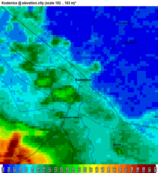
Below is the Elevation map of Kozienice, which displays elevation range with different colors. Scale of the first map is from 102 to 163 m (335 to 535 ft) with average elevation of 113.9 meters (=374 ft) [note 1]
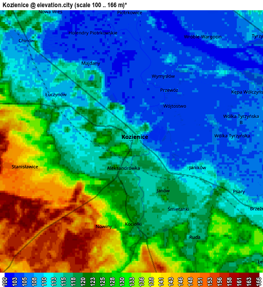
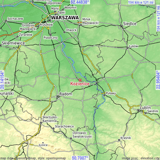
These maps also provides idea of topography and contour of this city, they are displayed at different zoom levels. More info about maps, scale and edge coordinates you can find below images.
| \ | Map #1 | Map #2 | Topo.Map |
| Scale [m] | 102..163 m | 100..166 m | × |
| Scale [ft] | 335..535 ft | 328..545 ft | × |
| Average | 113.9 m = 374 ft | 119.6 m = 392 ft | × |
| Width | 6.07 km = 3.8 mi | 12.14 km = 7.5 mi | 194.3 km = 120.7 mi |
| Height | 6.07 km = 3.8 mi | 12.14 km = 7.5 mi | 194.3 km = 120.7 mi |
| ↑Max Latitude | 51.610239° | 51.637521° | 52.44838° |
| Latitude at center | 51.58294° | 51.58294° | 51.58294° |
| ↓Min Latitude | 51.555625° | 51.528294° | 50.7007° |
| ← Min Longitude | 21.503845° | 21.459899° | 20.14154° |
| Longitude center | 21.54779° | 21.54779° | 21.54779° |
| →Max Longitude | 21.591735° | 21.635681° | 22.95404° |
Nearby cities:
Cities around Kozienice sort by population:
• Pionki elevation 145 m
13.7 km,  209°
209°
• Dęblin 115 m
20.9 km,  97°
97°
• Łaskarzew 131 m
23.2 km,  7°
7°
• Jedlnia-Letnisko 157 m
22.4 km,  220°
220°
• Garbatka-Letnisko 153 m
11.9 km,  158°
158°
• Sobolew 159 m
18.9 km,  25°
25°
• Maciejowice 105 m
12.2 km,  1°
1°
• Stężyca 113 m
15.4 km,  90°
90°
• Policzna 161 m
15.2 km, 158°
• Ryczywół 105 m
14.8 km,  324°
324°
• Podebłocie 148 m
15 km,  64°
64°
• Trojanów 143 m
21.9 km, 56°
Multilingual:
 En español:
Kozienice elevación 113 m.
 En France:
Kozienice élévation 113 m.
 Auf Deutsch:
Koschnitz höhe über dem Meeresspiegel ist 113 m.

Sources and notes:
- [note 1] Map square and city borders are not equal. Map elevation data is calculated only from area inside that square.
- [src 1] Elevation data from geonames database provided with same terms of usage.
- [src 2] The elevation map of Kozienice is generated using elevation data from NASA's 3 arcsec (90m) resolution SRTM data.
- [src 3] Base (background) map © OpenStreetMap contributors tiles are generated by Geofabrik and OpenTopoMap.
Copyright & License:
This Kozienice Elevation Map is licensed under CC BY-SA. You may reuse any part from this page, if you give a proper credit by linking to this URL:
 More info on terms of use page.