Kozubszczyzna elevation
Kozubszczyzna (Lublin, Powiat lubelski), Poland elevation is 220 meters and Kozubszczyzna elevation in feet is 722 ft above sea level [src 1]. Kozubszczyzna is a seat of a third-order administrative division (feature code) with elevation that is 29 meters (95 ft) bigger than average city elevation in Poland.
Below is the Elevation map of Kozubszczyzna, which displays elevation range with different colors. Scale of the first map is from 201 to 249 m (659 to 817 ft) with average elevation of 226.6 meters (=743 ft) [note 1]
These maps also provides idea of topography and contour of this city, they are displayed at different zoom levels. More info about maps, scale and edge coordinates you can find below images.
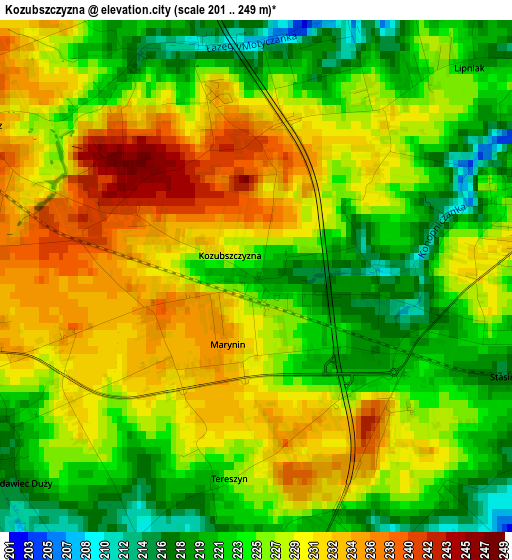
| \ | Map #1 | Topo.Map |
| Scale [m] | 201..249 m | × |
| Scale [ft] | 659..817 ft | × |
| Average | 226.6 m = 743 ft | × |
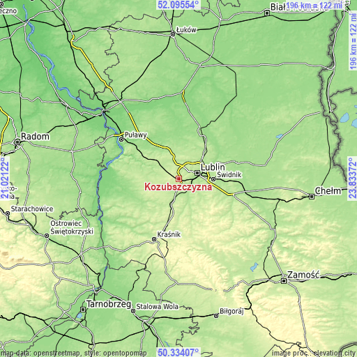
| Width | 6.12 km = 3.8 mi | 195.9 km = 121.7 mi |
| Height | 6.12 km = 3.8 mi | 195.8 km = 121.7 mi |
| ↑Max Latitude | 51.250744° | 52.09554° |
| Latitude at center | 51.22323° | 51.22323° |
| ↓Min Latitude | 51.195699° | 50.33407° |
| ← Min Longitude | 22.383525° | 21.02122° |
| Longitude center | 22.42747° | 22.42747° |
| →Max Longitude | 22.471415° | 23.83372° |
Nearby cities:
Cities around Kozubszczyzna sort by population:
• Lublin elevation 183 m
10.1 km,  72°
72°
• Świdnik 203 m
18.7 km,  91°
91°
• Bełżyce 212 m
11.6 km,  241°
241°
• Nałęczów 179 m
16.3 km,  295°
295°
• Niedrzwica Duża 194 m
12.4 km,  192°
192°
• Garbów 188 m
16.2 km,  335°
335°
• Jabłonna 212 m
18.9 km,  142°
142°
• Wojciechów 194 m
12.7 km,  276°
276°
• Jastków 208 m
9 km,  3°
3°
• Strzyżowice 199 m
19.5 km,  177°
177°
• Borzechów 200 m
17.6 km,  214°
214°
• Jakubowice Murowane 170 m
15.3 km, 70°
Multilingual:
 En español:
Kozubszczyzna elevación 220 m.
 En France:
Kozubszczyzna élévation 220 m.
 Auf Deutsch:
Kozubszczyzna höhe über dem Meeresspiegel ist 220 m.

Sources and notes:
- [note 1] Map square and city borders are not equal. Map elevation data is calculated only from area inside that square.
- [src 1] Elevation data from geonames database provided with same terms of usage.
- [src 2] The elevation map of Kozubszczyzna is generated using elevation data from NASA's 3 arcsec (90m) resolution SRTM data.
- [src 3] Base (background) map © OpenStreetMap contributors tiles are generated by Geofabrik and OpenTopoMap.
Copyright & License:
This Kozubszczyzna Elevation Map is licensed under CC BY-SA. You may reuse any part from this page, if you give a proper credit by linking to this URL:
 More info on terms of use page.