Łęczna elevation
Łęczna (Lublin, Powiat łęczyński), Poland elevation is 172 meters and Łęczna elevation in feet is 564 ft above sea level [src 1]. Łęczna is a seat of a second-order administrative division (feature code) with elevation that is 19 meters (62 ft) smaller than average city elevation in Poland.
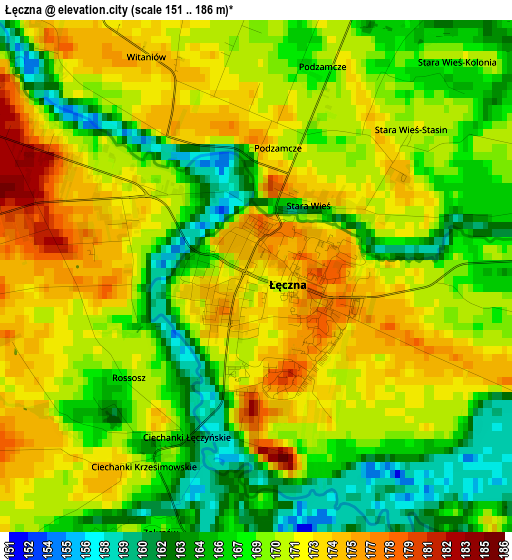
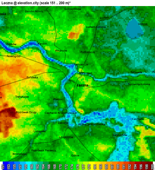
Below is the Elevation map of Łęczna, which displays elevation range with different colors. Scale of the first map is from 151 to 186 m (495 to 610 ft) with average elevation of 169.5 meters (=556 ft) [note 1]
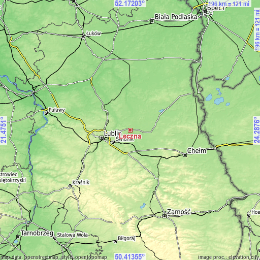
These maps also provides idea of topography and contour of this city, they are displayed at different zoom levels. More info about maps, scale and edge coordinates you can find below images.
| \ | Map #1 | Map #2 | Topo.Map |
| Scale [m] | 151..186 m | 151..200 m | × |
| Scale [ft] | 495..610 ft | 495..656 ft | × |
| Average | 169.5 m = 556 ft | 171.1 m = 561 ft | × |
| Width | 6.11 km = 3.8 mi | 12.22 km = 7.6 mi | 195.5 km = 121.5 mi |
| Height | 6.11 km = 3.8 mi | 12.22 km = 7.6 mi | 195.5 km = 121.5 mi |
| ↑Max Latitude | 51.328678° | 51.356129° | 52.17203° |
| Latitude at center | 51.30121° | 51.30121° | 51.30121° |
| ↓Min Latitude | 51.273726° | 51.246226° | 50.41355° |
| ← Min Longitude | 22.837405° | 22.793459° | 21.4751° |
| Longitude center | 22.88135° | 22.88135° | 22.88135° |
| →Max Longitude | 22.925295° | 22.969241° | 24.2876° |
Nearby cities:
Cities around Łęczna sort by population:
• Świdnik elevation 203 m
15.8 km,  234°
234°
• Ludwin 169 m
5.3 km,  18°
18°
• Niemce 184 m
18.1 km,  291°
291°
• Trawniki 175 m
20.1 km,  156°
156°
• Milejów 168 m
8.2 km, 158°
• Piaski 189 m
18.2 km,  187°
187°
• Cyców 171 m
18.1 km,  90°
90°
• Mełgiew 180 m
10.8 km,  218°
218°
• Puchaczów 167 m
6.5 km,  80°
80°
• Spiczyn 166 m
9.9 km,  296°
296°
• Uścimów Stary 160 m
19.4 km, 15°
• Jakubowice Murowane 170 m
17.5 km,  258°
258°
Multilingual:
 En español:
Łęczna elevación 172 m.
 En France:
Łęczna élévation 172 m.


Sources and notes:
- [note 1] Map square and city borders are not equal. Map elevation data is calculated only from area inside that square.
- [src 1] Elevation data from geonames database provided with same terms of usage.
- [src 2] The elevation map of Łęczna is generated using elevation data from NASA's 3 arcsec (90m) resolution SRTM data.
- [src 3] Base (background) map © OpenStreetMap contributors tiles are generated by Geofabrik and OpenTopoMap.
Copyright & License:
This Łęczna Elevation Map is licensed under CC BY-SA. You may reuse any part from this page, if you give a proper credit by linking to this URL:
 More info on terms of use page.