Lubartów elevation
Lubartów (Lublin, Powiat lubartowski), Poland elevation is 159 meters and Lubartów elevation in feet is 522 ft above sea level [src 1]. Lubartów is a seat of a second-order administrative division (feature code) with elevation that is 32 meters (105 ft) smaller than average city elevation in Poland.
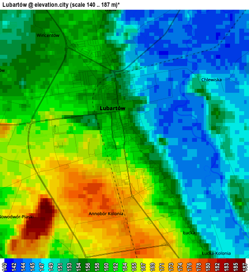
Below is the Elevation map of Lubartów, which displays elevation range with different colors. Scale of the first map is from 140 to 187 m (459 to 614 ft) with average elevation of 157.3 meters (=516 ft) [note 1]
These maps also provides idea of topography and contour of this city, they are displayed at different zoom levels. More info about maps, scale and edge coordinates you can find below images.
| \ | Map #1 | Map #2 | Topo.Map |
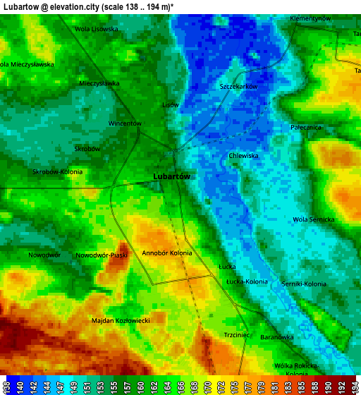
| Scale [m] | 140..187 m | 138..194 m | × |
| Scale [ft] | 459..614 ft | 453..636 ft | × |
| Average | 157.3 m = 516 ft | 159.6 m = 524 ft | × |
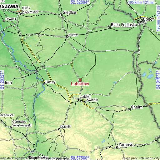
| Width | 6.09 km = 3.8 mi | 12.18 km = 7.6 mi | 194.8 km = 121 mi |
| Height | 6.09 km = 3.8 mi | 12.18 km = 7.6 mi | 194.8 km = 121 mi |
| ↑Max Latitude | 51.487632° | 51.514988° | 52.32804° |
| Latitude at center | 51.46026° | 51.46026° | 51.46026° |
| ↓Min Latitude | 51.432871° | 51.405466° | 50.57566° |
| ← Min Longitude | 22.565575° | 22.521629° | 21.20327° |
| Longitude center | 22.60952° | 22.60952° | 22.60952° |
| →Max Longitude | 22.653465° | 22.697411° | 24.01577° |
Nearby cities:
Cities around Lubartów sort by population:
• Niemce elevation 184 m
11.2 km,  169°
169°
• Ostrów Lubelski 150 m
17.3 km,  77°
77°
• Kamionka 149 m
10.2 km,  277°
277°
• Wola Sernicka 156 m
5.3 km,  102°
102°
• Firlej 147 m
13 km,  327°
327°
• Niedźwiada 161 m
10.9 km,  31°
31°
• Abramów 162 m
20.4 km,  268°
268°
• Jastków 208 m
21.2 km,  214°
214°
• Spiczyn 166 m
16.6 km,  142°
142°
• Serniki 150 m
4.3 km,  127°
127°
• Ostrówek 143 m
13.5 km,  0°
0°
• Jakubowice Murowane 170 m
21.2 km,  175°
175°
Multilingual:
 En español:
Lubartów elevación 159 m.
 En France:
Lubartów élévation 159 m.
 Auf Deutsch:
Lubartów höhe über dem Meeresspiegel ist 159 m.

Sources and notes:
- [note 1] Map square and city borders are not equal. Map elevation data is calculated only from area inside that square.
- [src 1] Elevation data from geonames database provided with same terms of usage.
- [src 2] The elevation map of Lubartów is generated using elevation data from NASA's 3 arcsec (90m) resolution SRTM data.
- [src 3] Base (background) map © OpenStreetMap contributors tiles are generated by Geofabrik and OpenTopoMap.
Copyright & License:
This Lubartów Elevation Map is licensed under CC BY-SA. You may reuse any part from this page, if you give a proper credit by linking to this URL:
 More info on terms of use page.