Praga Północ elevation
Praga Północ (Mazovia, Warszawa), Poland elevation is 85 meters and Praga Północ elevation in feet is 279 ft above sea level [src 1]. Praga Północ is a populated place (feature code) with elevation that is 106 meters (348 ft) smaller than average city elevation in Poland.
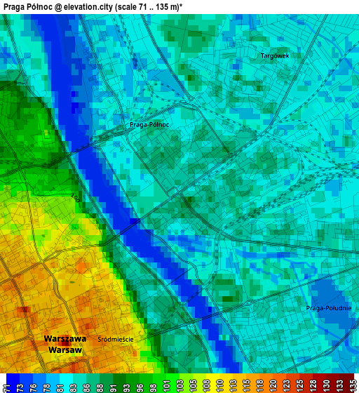
Below is the Elevation map of Praga Północ, which displays elevation range with different colors. Scale of the first map is from 71 to 135 m (233 to 443 ft) with average elevation of 88 meters (=289 ft) [note 1]
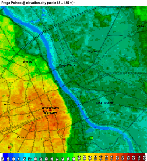
These maps also provides idea of topography and contour of this city, they are displayed at different zoom levels. More info about maps, scale and edge coordinates you can find below images.
| \ | Map #1 | Map #2 | Topo.Map |
| Scale [m] | 71..135 m | 63..135 m | × |
| Scale [ft] | 233..443 ft | 207..443 ft | × |
| Average | 88 m = 289 ft | 90.1 m = 296 ft | × |
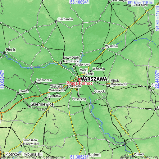
| Width | 5.98 km = 3.7 mi | 11.96 km = 7.4 mi | 191.4 km = 118.9 mi |
| Height | 5.98 km = 3.7 mi | 11.96 km = 7.4 mi | 191.4 km = 118.9 mi |
| ↑Max Latitude | 52.281323° | 52.3082° | 53.10694° |
| Latitude at center | 52.25443° | 52.25443° | 52.25443° |
| ↓Min Latitude | 52.22752° | 52.200595° | 51.38521° |
| ← Min Longitude | 20.990775° | 20.946829° | 19.62847° |
| Longitude center | 21.03472° | 21.03472° | 21.03472° |
| →Max Longitude | 21.078665° | 21.122611° | 22.44097° |
Nearby cities:
Cities around Praga Północ sort by population:
• Warsaw elevation 113 m
3.2 km,  209°
209°
• Mokotów 83 m
6.8 km,  179°
179°
• Praga Południe 81 m
3.6 km,  108°
108°
• Wola 114 m
3.5 km,  243°
243°
• Bielany 98 m
8 km,  301°
301°
• Śródmieście 116 m
3.1 km,  203°
203°
• Targówek 84 m
4.3 km,  12°
12°
• Bemowo 108 m
8.6 km,  270°
270°
• Ochota 118 m
5 km,  222°
222°
• Białołeka 80 m
8.6 km,  330°
330°
• Żoliborz 94 m
3.7 km, 296°
• Ząbki 83 m
6.4 km,  48°
48°
Multilingual:
 En español:
Praga Północ elevación 85 m.
 En France:
Praga Północ élévation 85 m.
 Auf Deutsch:
Praga Północ höhe über dem Meeresspiegel ist 85 m.

Sources and notes:
- [note 1] Map square and city borders are not equal. Map elevation data is calculated only from area inside that square.
- [src 1] Elevation data from geonames database provided with same terms of usage.
- [src 2] The elevation map of Praga Północ is generated using elevation data from NASA's 3 arcsec (90m) resolution SRTM data.
- [src 3] Base (background) map © OpenStreetMap contributors tiles are generated by Geofabrik and OpenTopoMap.
Copyright & License:
This Praga Północ Elevation Map is licensed under CC BY-SA. You may reuse any part from this page, if you give a proper credit by linking to this URL:
 More info on terms of use page.