Andrychów elevation
Andrychów (Lesser Poland, Powiat wadowicki), Poland elevation is 327 meters and Andrychów elevation in feet is 1073 ft above sea level [src 1]. Andrychów is a seat of a third-order administrative division (feature code) with elevation that is 136 meters (446 ft) bigger than average city elevation in Poland.
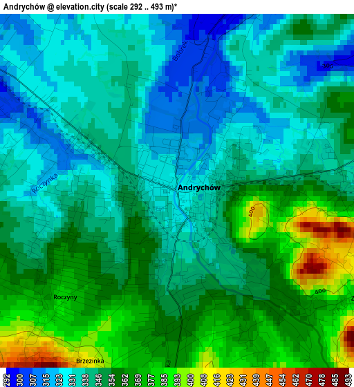
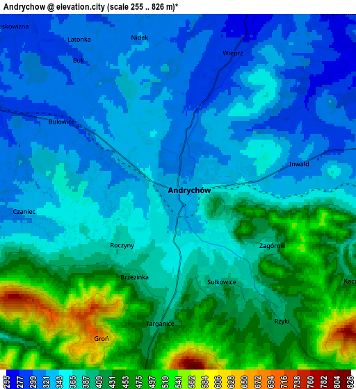
Below is the Elevation map of Andrychów, which displays elevation range with different colors. Scale of the first map is from 292 to 493 m (958 to 1617 ft) with average elevation of 348.7 meters (=1144 ft) [note 1]
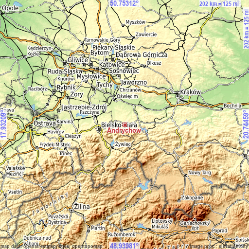
These maps also provides idea of topography and contour of this city, they are displayed at different zoom levels. More info about maps, scale and edge coordinates you can find below images.
| \ | Map #1 | Map #2 | Topo.Map |
| Scale [m] | 292..493 m | 255..826 m | × |
| Scale [ft] | 958..1617 ft | 837..2710 ft | × |
| Average | 348.7 m = 1144 ft | 381 m = 1250 ft | × |
| Width | 6.3 km = 3.9 mi | 12.6 km = 7.8 mi | 201.6 km = 125.3 mi |
| Height | 6.3 km = 3.9 mi | 12.6 km = 7.8 mi | 201.6 km = 125.3 mi |
| ↑Max Latitude | 49.883294° | 49.911602° | 50.75312° |
| Latitude at center | 49.85497° | 49.85497° | 49.85497° |
| ↓Min Latitude | 49.826629° | 49.798272° | 48.93981° |
| ← Min Longitude | 19.294395° | 19.250449° | 17.93209° |
| Longitude center | 19.33834° | 19.33834° | 19.33834° |
| →Max Longitude | 19.382285° | 19.426231° | 20.74459° |
Nearby cities:
Cities around Andrychów sort by population:
• Czaniec elevation 320 m
6.1 km,  265°
265°
• Wieprz 289 m
4.2 km,  18°
18°
• Sułkowice 417 m
4.3 km,  158°
158°
• Bulowice 299 m
4.3 km,  303°
303°
• Targanice 419 m
5.6 km,  190°
190°
• Roczyny 345 m
1.6 km, 265°
• Inwałd 319 m
4 km,  76°
76°
• Rzyki 419 m
6.4 km,  139°
139°
• Frydrychowice 259 m
8 km,  46°
46°
• Witkowice 300 m
7.2 km,  324°
324°
• Zagórnik 377 m
3.5 km,  124°
124°
• Nidek 310 m
5.6 km,  349°
349°
Multilingual:
 En español:
Andrychów elevación 327 m.
 En France:
Andrychów élévation 327 m.
 Auf Deutsch:
Andrychów höhe über dem Meeresspiegel ist 327 m.

Sources and notes:
- [note 1] Map square and city borders are not equal. Map elevation data is calculated only from area inside that square.
- [src 1] Elevation data from geonames database provided with same terms of usage.
- [src 2] The elevation map of Andrychów is generated using elevation data from NASA's 3 arcsec (90m) resolution SRTM data.
- [src 3] Base (background) map © OpenStreetMap contributors tiles are generated by Geofabrik and OpenTopoMap.
Copyright & License:
This Andrychów Elevation Map is licensed under CC BY-SA. You may reuse any part from this page, if you give a proper credit by linking to this URL:
 More info on terms of use page.