Bestwinka elevation
Bestwinka (Silesia, Powiat bielski), Poland elevation is 246 meters and Bestwinka elevation in feet is 807 ft above sea level [src 1]. Bestwinka is a populated place (feature code) with elevation that is 55 meters (180 ft) bigger than average city elevation in Poland.
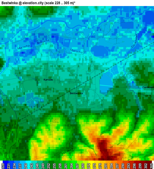
Below is the Elevation map of Bestwinka, which displays elevation range with different colors. Scale of the first map is from 228 to 305 m (748 to 1001 ft) with average elevation of 250.2 meters (=821 ft) [note 1]
These maps also provides idea of topography and contour of this city, they are displayed at different zoom levels. More info about maps, scale and edge coordinates you can find below images.
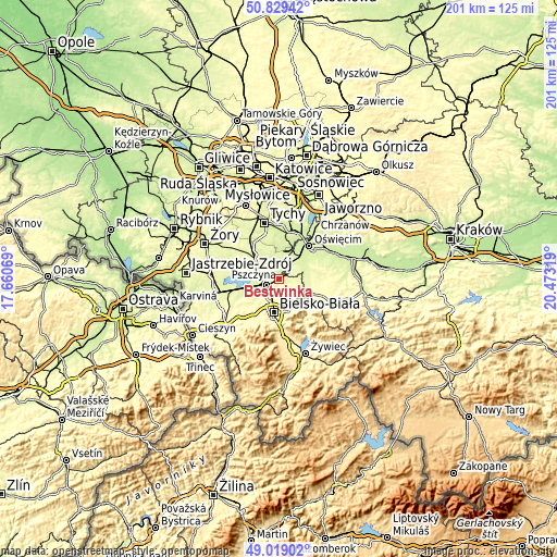
| \ | Map #1 | Topo.Map |
| Scale [m] | 228..305 m | × |
| Scale [ft] | 748..1001 ft | × |
| Average | 250.2 m = 821 ft | × |
| Width | 6.29 km = 3.9 mi | 201.3 km = 125.1 mi |
| Height | 6.29 km = 3.9 mi | 201.3 km = 125.1 mi |
| ↑Max Latitude | 49.960999° | 50.82942° |
| Latitude at center | 49.93272° | 49.93272° |
| ↓Min Latitude | 49.904425° | 49.01902° |
| ← Min Longitude | 19.022995° | 17.66069° |
| Longitude center | 19.06694° | 19.06694° |
| →Max Longitude | 19.110885° | 20.47319° |
Nearby cities:
Cities around Bestwinka sort by population:
• Czechowice-Dziedzice elevation 259 m
4.9 km,  244°
244°
• Brzeszcze 252 m
8.2 km,  47°
47°
• Goczałkowice Zdrój 250 m
7.1 km,  280°
280°
• Pisarzowice 295 m
7.8 km,  134°
134°
• Bestwina 262 m
4 km,  189°
189°
• Kaniów 240 m
1.6 km,  315°
315°
• Wilamowice 284 m
6.4 km,  105°
105°
• Góra 242 m
5.9 km,  27°
27°
• Janowice 315 m
5.6 km,  160°
160°
• Miedźna 250 m
5.7 km,  346°
346°
• Gilowice 243 m
7.2 km,  16°
16°
• Frydek 248 m
7.1 km,  3°
3°
Multilingual:
 En español:
Bestwinka elevación 246 m.
 En France:
Bestwinka élévation 246 m.
 Auf Deutsch:
Bestwinka höhe über dem Meeresspiegel ist 246 m.

Sources and notes:
- [note 1] Map square and city borders are not equal. Map elevation data is calculated only from area inside that square.
- [src 1] Elevation data from geonames database provided with same terms of usage.
- [src 2] The elevation map of Bestwinka is generated using elevation data from NASA's 3 arcsec (90m) resolution SRTM data.
- [src 3] Base (background) map © OpenStreetMap contributors tiles are generated by Geofabrik and OpenTopoMap.
Copyright & License:
This Bestwinka Elevation Map is licensed under CC BY-SA. You may reuse any part from this page, if you give a proper credit by linking to this URL:
 More info on terms of use page.