Blizanów elevation
Blizanów (Greater Poland, Powiat kaliski), Poland elevation is 113 meters and Blizanów elevation in feet is 371 ft above sea level [src 1]. Blizanów is a seat of a third-order administrative division (feature code) with elevation that is 78 meters (256 ft) smaller than average city elevation in Poland.
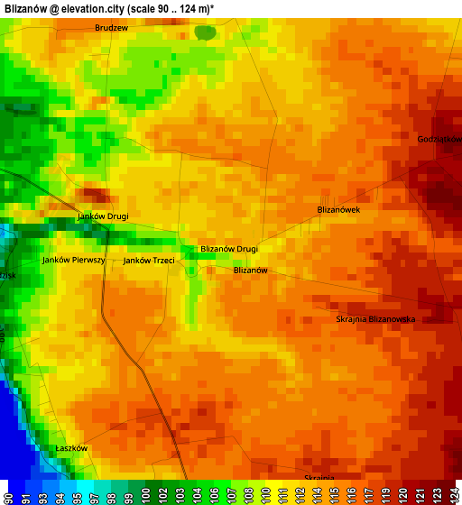
Below is the Elevation map of Blizanów, which displays elevation range with different colors. Scale of the first map is from 90 to 124 m (295 to 407 ft) with average elevation of 113.1 meters (=371 ft) [note 1]
These maps also provides idea of topography and contour of this city, they are displayed at different zoom levels. More info about maps, scale and edge coordinates you can find below images.
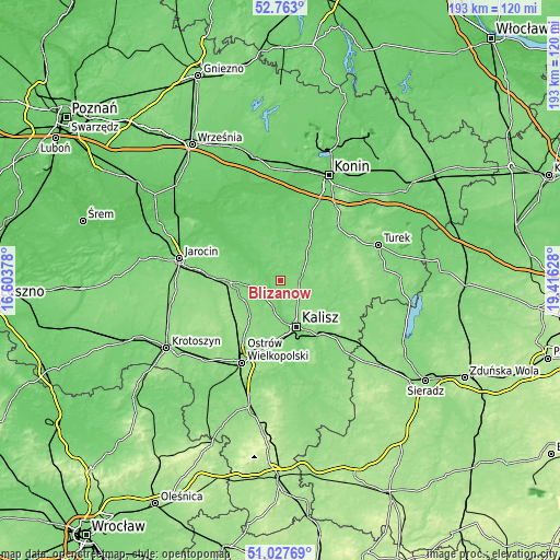
| \ | Map #1 | Topo.Map |
| Scale [m] | 90..124 m | × |
| Scale [ft] | 295..407 ft | × |
| Average | 113.1 m = 371 ft | × |
| Width | 6.03 km = 3.7 mi | 192.9 km = 119.9 mi |
| Height | 6.03 km = 3.7 mi | 192.9 km = 119.9 mi |
| ↑Max Latitude | 51.930825° | 52.763° |
| Latitude at center | 51.90372° | 51.90372° |
| ↓Min Latitude | 51.876598° | 51.02769° |
| ← Min Longitude | 17.966085° | 16.60378° |
| Longitude center | 18.01003° | 18.01003° |
| →Max Longitude | 18.053975° | 19.41628° |
Nearby cities:
Cities around Blizanów sort by population:
• Kalisz elevation 109 m
16.8 km,  160°
160°
• Pleszew 130 m
15.4 km,  266°
266°
• Nowe Skalmierzyce 140 m
21.5 km,  183°
183°
• Rychwał 105 m
21.5 km,  29°
29°
• Gołuchów 113 m
8 km,  222°
222°
• Chocz 92 m
12.6 km,  310°
310°
• Stawiszyn 120 m
7.1 km,  77°
77°
• Grodziec 105 m
15.4 km,  12°
12°
• Żelazków 124 m
12.5 km,  116°
116°
• Broniszewice 96 m
15 km,  297°
297°
• Czermin 118 m
18.6 km,  286°
286°
• Gizałki 86 m
22.6 km, 313°
Multilingual:
 En español:
Blizanów elevación 113 m.
 En France:
Blizanów élévation 113 m.
 Auf Deutsch:
Blizanów höhe über dem Meeresspiegel ist 113 m.

Sources and notes:
- [note 1] Map square and city borders are not equal. Map elevation data is calculated only from area inside that square.
- [src 1] Elevation data from geonames database provided with same terms of usage.
- [src 2] The elevation map of Blizanów is generated using elevation data from NASA's 3 arcsec (90m) resolution SRTM data.
- [src 3] Base (background) map © OpenStreetMap contributors tiles are generated by Geofabrik and OpenTopoMap.
Copyright & License:
This Blizanów Elevation Map is licensed under CC BY-SA. You may reuse any part from this page, if you give a proper credit by linking to this URL:
 More info on terms of use page.