Dzięgielów elevation
Dzięgielów (Silesia, Powiat cieszyński), Poland elevation is 324 meters and Dzięgielów elevation in feet is 1063 ft above sea level [src 1]. Dzięgielów is a populated place (feature code) with elevation that is 133 meters (436 ft) bigger than average city elevation in Poland.
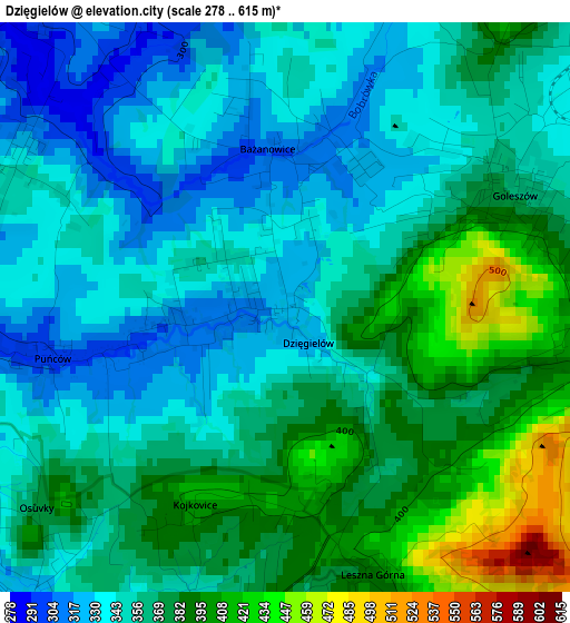
Below is the Elevation map of Dzięgielów, which displays elevation range with different colors. Scale of the first map is from 278 to 615 m (912 to 2018 ft) with average elevation of 362 meters (=1188 ft) [note 1]
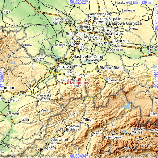
These maps also provides idea of topography and contour of this city, they are displayed at different zoom levels. More info about maps, scale and edge coordinates you can find below images.
| \ | Map #1 | Topo.Map |
| Scale [m] | 278..615 m | × |
| Scale [ft] | 912..2018 ft | × |
| Average | 362 m = 1188 ft | × |
| Width | 6.32 km = 3.9 mi | 202.2 km = 125.6 mi |
| Height | 6.32 km = 3.9 mi | 202.2 km = 125.6 mi |
| ↑Max Latitude | 49.750992° | 50.62322° |
| Latitude at center | 49.72259° | 49.72259° |
| ↓Min Latitude | 49.694172° | 48.80494° |
| ← Min Longitude | 18.660965° | 17.29866° |
| Longitude center | 18.70491° | 18.70491° |
| →Max Longitude | 18.748855° | 20.11116° |
Nearby cities:
Cities around Dzięgielów sort by population:
• Cieszyn elevation 273 m
6.1 km,  301°
301°
• Ustroń 355 m
7 km,  90°
90°
• Skoczów 293 m
10.5 km,  34°
34°
• Goleszów 368 m
2.7 km,  57°
57°
• Górki Wielkie 314 m
11.1 km, 55°
• Pogwizdów 269 m
11.7 km,  320°
320°
• Hażlach 282 m
10.1 km,  337°
337°
• Dębowiec 283 m
10.2 km,  6°
6°
• Cisownica 380 m
4.1 km, 89°
• Puńców 293 m
3.1 km,  261°
261°
• Zamarski 378 m
7.1 km, 339°
• Bażanowice 303 m
1.7 km,  356°
356°
Multilingual:
 En español:
Dzięgielów elevación 324 m.
 En France:
Dzięgielów élévation 324 m.
 Auf Deutsch:
Dzięgielów höhe über dem Meeresspiegel ist 324 m.

Sources and notes:
- [note 1] Map square and city borders are not equal. Map elevation data is calculated only from area inside that square.
- [src 1] Elevation data from geonames database provided with same terms of usage.
- [src 2] The elevation map of Dzięgielów is generated using elevation data from NASA's 3 arcsec (90m) resolution SRTM data.
- [src 3] Base (background) map © OpenStreetMap contributors tiles are generated by Geofabrik and OpenTopoMap.
Copyright & License:
This Dzięgielów Elevation Map is licensed under CC BY-SA. You may reuse any part from this page, if you give a proper credit by linking to this URL:
 More info on terms of use page.