Kępno elevation
Kępno (Greater Poland, Powiat kępiński), Poland elevation is 171 meters and Kępno elevation in feet is 561 ft above sea level [src 1]. Kępno is a seat of a second-order administrative division (feature code) with elevation that is 20 meters (66 ft) smaller than average city elevation in Poland.
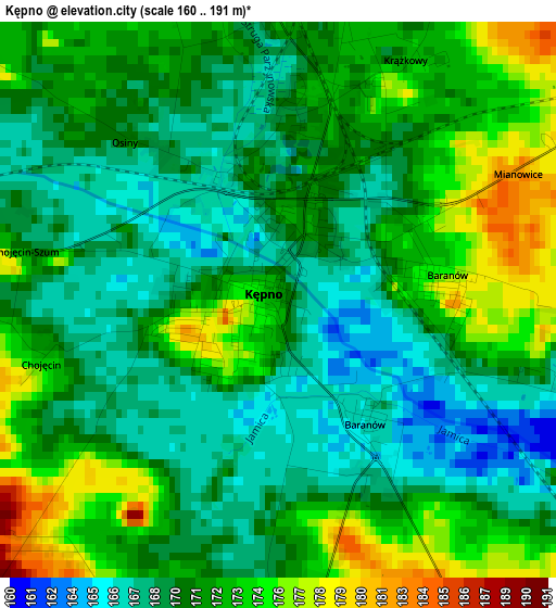
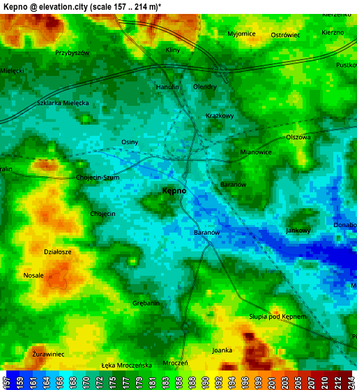
Below is the Elevation map of Kępno, which displays elevation range with different colors. Scale of the first map is from 160 to 191 m (525 to 627 ft) with average elevation of 170.9 meters (=561 ft) [note 1]
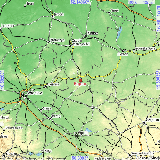
These maps also provides idea of topography and contour of this city, they are displayed at different zoom levels. More info about maps, scale and edge coordinates you can find below images.
| \ | Map #1 | Map #2 | Topo.Map |
| Scale [m] | 160..191 m | 157..214 m | × |
| Scale [ft] | 525..627 ft | 515..702 ft | × |
| Average | 170.9 m = 561 ft | 178.1 m = 584 ft | × |
| Width | 6.11 km = 3.8 mi | 12.23 km = 7.6 mi | 195.6 km = 121.5 mi |
| Height | 6.11 km = 3.8 mi | 12.23 km = 7.6 mi | 195.6 km = 121.5 mi |
| ↑Max Latitude | 51.305881° | 51.333346° | 52.14966° |
| Latitude at center | 51.2784° | 51.2784° | 51.2784° |
| ↓Min Latitude | 51.250902° | 51.223388° | 50.3903° |
| ← Min Longitude | 17.945135° | 17.901189° | 16.58283° |
| Longitude center | 17.98908° | 17.98908° | 17.98908° |
| →Max Longitude | 18.033025° | 18.076971° | 19.39533° |
Nearby cities:
Cities around Kępno sort by population:
• Ostrzeszów elevation 201 m
16.9 km,  346°
346°
• Wieruszów 154 m
11.7 km,  81°
81°
• Bralin 181 m
6 km,  277°
277°
• Doruchów 154 m
16.6 km,  21°
21°
• Kobyla Góra 201 m
15.4 km,  316°
316°
• Bolesławiec 165 m
16.6 km,  122°
122°
• Baranów 165 m
2 km,  146°
146°
• Słupia pod Kępnem 188 m
5.7 km,  139°
139°
• Opatów 167 m
13 km, 122°
• Trzcinica 183 m
12.4 km,  175°
175°
• Perzów 177 m
12.5 km,  268°
268°
• Łęka Opatowska 170 m
11 km,  131°
131°
Multilingual:
 En español:
Kępno elevación 171 m.
 En France:
Kępno élévation 171 m.
 Auf Deutsch:
Kępno, Kempen in Posen höhe über dem Meeresspiegel ist 171 m.

Sources and notes:
- [note 1] Map square and city borders are not equal. Map elevation data is calculated only from area inside that square.
- [src 1] Elevation data from geonames database provided with same terms of usage.
- [src 2] The elevation map of Kępno is generated using elevation data from NASA's 3 arcsec (90m) resolution SRTM data.
- [src 3] Base (background) map © OpenStreetMap contributors tiles are generated by Geofabrik and OpenTopoMap.
Copyright & License:
This Kępno Elevation Map is licensed under CC BY-SA. You may reuse any part from this page, if you give a proper credit by linking to this URL:
 More info on terms of use page.