Knurów elevation
Knurów (Silesia, Powiat gliwicki), Poland elevation is 236 meters and Knurów elevation in feet is 774 ft above sea level [src 1]. Knurów is a seat of a third-order administrative division (feature code) with elevation that is 45 meters (148 ft) bigger than average city elevation in Poland.
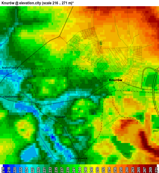
Below is the Elevation map of Knurów, which displays elevation range with different colors. Scale of the first map is from 216 to 271 m (709 to 889 ft) with average elevation of 242.7 meters (=796 ft) [note 1]
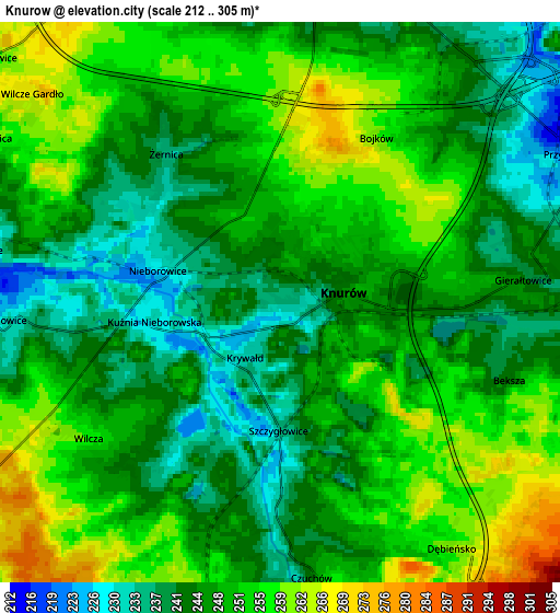
These maps also provides idea of topography and contour of this city, they are displayed at different zoom levels. More info about maps, scale and edge coordinates you can find below images.
| \ | Map #1 | Map #2 | Topo.Map |
| Scale [m] | 216..271 m | 212..305 m | × |
| Scale [ft] | 709..889 ft | 696..1001 ft | × |
| Average | 242.7 m = 796 ft | 248.3 m = 815 ft | × |
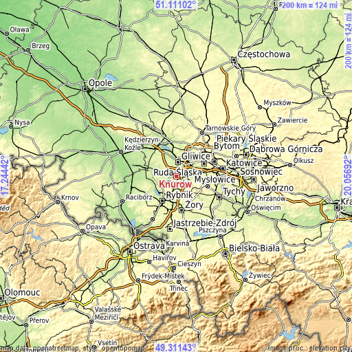
| Width | 6.25 km = 3.9 mi | 12.51 km = 7.8 mi | 200.1 km = 124.3 mi |
| Height | 6.25 km = 3.9 mi | 12.51 km = 7.8 mi | 200.1 km = 124.3 mi |
| ↑Max Latitude | 50.24782° | 50.275913° | 51.11102° |
| Latitude at center | 50.21971° | 50.21971° | 50.21971° |
| ↓Min Latitude | 50.191584° | 50.16344° | 49.31143° |
| ← Min Longitude | 18.606725° | 18.562779° | 17.24442° |
| Longitude center | 18.65067° | 18.65067° | 18.65067° |
| →Max Longitude | 18.694615° | 18.738561° | 20.05692° |
Nearby cities:
Cities around Knurów sort by population:
• Gliwice elevation 219 m
8.9 km,  12°
12°
• Czerwionka-Leszczyny 253 m
8 km,  166°
166°
• Ornontowice 252 m
7.9 km,  111°
111°
• Gierałtowice 242 m
5.9 km,  84°
84°
• Żernica 236 m
4 km,  321°
321°
• Przyszowice 217 m
7.5 km,  64°
64°
• Pilchowice 225 m
6.4 km,  266°
266°
• Książenice 280 m
8 km,  207°
207°
• Paniówki 234 m
9.4 km, 82°
• Stanowice 266 m
10 km, 171°
• Wilcza 249 m
5.1 km,  228°
228°
• Sośnicowice 244 m
10.4 km,  304°
304°
Multilingual:
 En español:
Knurów elevación 236 m.
 En France:
Knurów élévation 236 m.


Sources and notes:
- [note 1] Map square and city borders are not equal. Map elevation data is calculated only from area inside that square.
- [src 1] Elevation data from geonames database provided with same terms of usage.
- [src 2] The elevation map of Knurów is generated using elevation data from NASA's 3 arcsec (90m) resolution SRTM data.
- [src 3] Base (background) map © OpenStreetMap contributors tiles are generated by Geofabrik and OpenTopoMap.
Copyright & License:
This Knurów Elevation Map is licensed under CC BY-SA. You may reuse any part from this page, if you give a proper credit by linking to this URL:
 More info on terms of use page.