Legnica elevation
Legnica (Lower Silesia), Poland elevation is 121 meters and Legnica elevation in feet is 397 ft above sea level [src 1]. Legnica is a seat of a third-order administrative division (feature code) with elevation that is 70 meters (230 ft) smaller than average city elevation in Poland.
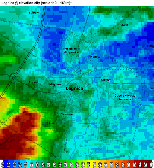
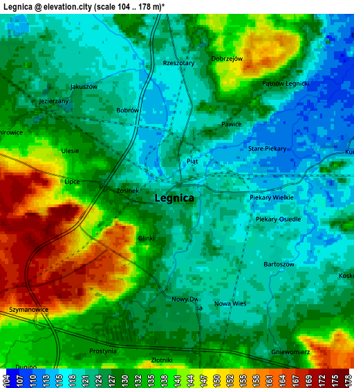
Below is the Elevation map of Legnica, which displays elevation range with different colors. Scale of the first map is from 110 to 169 m (361 to 554 ft) with average elevation of 124.8 meters (=409 ft) [note 1]
These maps also provides idea of topography and contour of this city, they are displayed at different zoom levels. More info about maps, scale and edge coordinates you can find below images.
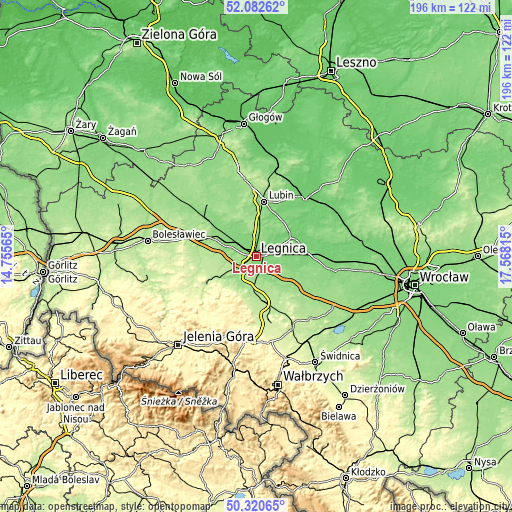
| \ | Map #1 | Map #2 | Topo.Map |
| Scale [m] | 110..169 m | 104..178 m | × |
| Scale [ft] | 361..554 ft | 341..584 ft | × |
| Average | 124.8 m = 409 ft | 129.6 m = 425 ft | × |
| Width | 6.12 km = 3.8 mi | 12.24 km = 7.6 mi | 195.9 km = 121.7 mi |
| Height | 6.12 km = 3.8 mi | 12.24 km = 7.6 mi | 195.9 km = 121.7 mi |
| ↑Max Latitude | 51.237582° | 51.265088° | 52.08262° |
| Latitude at center | 51.21006° | 51.21006° | 51.21006° |
| ↓Min Latitude | 51.182521° | 51.154967° | 50.32065° |
| ← Min Longitude | 16.117955° | 16.074009° | 14.75565° |
| Longitude center | 16.1619° | 16.1619° | 16.1619° |
| →Max Longitude | 16.205845° | 16.249791° | 17.56815° |
Nearby cities:
Cities around Legnica sort by population:
• Lubin elevation 128 m
21.4 km,  7°
7°
• Jawor 206 m
17.8 km,  172°
172°
• Złotoryja 211 m
19.3 km,  241°
241°
• Chojnów 153 m
17.2 km,  294°
294°
• Prochowice 101 m
15.8 km,  63°
63°
• Wilków 274 m
20.9 km,  231°
231°
• Miłkowice 125 m
8.1 km,  309°
309°
• Zagrodno 182 m
20.8 km,  264°
264°
• Paszowice 229 m
22.2 km,  181°
181°
• Legnickie Pole 170 m
9.2 km,  142°
142°
• Osiek 123 m
18.2 km,  15°
15°
• Kunice 112 m
6.2 km,  77°
77°
Multilingual:
 En español:
Legnica elevación 121 m.
 En France:
Legnica élévation 121 m.


Sources and notes:
- [note 1] Map square and city borders are not equal. Map elevation data is calculated only from area inside that square.
- [src 1] Elevation data from geonames database provided with same terms of usage.
- [src 2] The elevation map of Legnica is generated using elevation data from NASA's 3 arcsec (90m) resolution SRTM data.
- [src 3] Base (background) map © OpenStreetMap contributors tiles are generated by Geofabrik and OpenTopoMap.
Copyright & License:
This Legnica Elevation Map is licensed under CC BY-SA. You may reuse any part from this page, if you give a proper credit by linking to this URL:
 More info on terms of use page.